 |
|
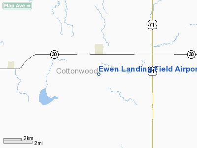
Ewen Landing Field Airport |
Location & QuickFacts
| FAA Information Effective: | 2008-09-25 |
| Airport Identifier: | 81MN |
| Airport Status: | Operational |
| Longitude/Latitude: | 095-11-43.9750W/44-01-49.8450N
-95.195549/44.030513 (Estimated) |
| Elevation: | 1483 ft / 452.02 m (Estimated) |
| Land: | 0 acres |
| From nearest city: | 2 nautical miles S of Jeffers, MN |
| Location: | Cottonwood County, MN |
| Magnetic Variation: | 05E (1985) |
Owner & Manager
| Ownership: | Privately owned |
| Owner: | Warren Ewen |
| Address: | Rr 1 Box 125
Jeffers, MN 56145 |
| Phone number: | 507-628-4697 |
| Manager: | Warren Ewen |
| Address: | Rr 1 Box 125
Jeffers, MN 56145 |
Airport Operations and Facilities
| Airport Use: | Private |
| Segmented Circle: | No |
| Control Tower: | No |
| Sectional chart: | Omaha |
| Region: | AGL - Great Lakes |
| Boundary ARTCC: | ZMP - Minneapolis |
| Tie-in FSS: | PNM - Princeton |
| FSS on Airport: | No |
| FSS Toll Free: | 1-800-WX-BRIEF |
Runway Information
Runway 17/35
| Dimension: | 2300 x 80 ft / 701.0 x 24.4 m |
| Surface: | TURF, |
| |
Runway 17 |
Runway 35 |
| Traffic Pattern: | Left | Left |
|
Radio Navigation Aids
| ID |
Type |
Name |
Ch |
Freq |
Var |
Dist |
| MWM | NDB | Windom | | 203.00 | 03E | 8.2 nm |
| MJQ | NDB | Jackson | | 353.00 | 04E | 24.8 nm |
| JYG | NDB | St James | | 260.00 | 04E | 27.9 nm |
| PUF | NDB | Puff | | 345.00 | 04E | 45.4 nm |
| ISB | NDB | Sibley | | 269.00 | 05E | 46.6 nm |
| ULM | NDB/DME | New Ulm | 050X | 272.00 | 04E | 34.7 nm |
| PQN | NDB/DME | Pipestone | 028X | 284.00 | 06E | 47.7 nm |
| EST | VOR | Estherville | | 110.40 | 07E | 42.2 nm |
| RWF | VOR/DME | Redwood Falls | 080X | 113.30 | 07E | 26.4 nm |
| OTG | VOR/DME | Worthington | 043X | 110.60 | 08E | 28.5 nm |
| MML | VOR/DME | Marshall | 047X | 111.00 | 05E | 36.9 nm |
| FRM | VOR/DME | Fairmont | 039X | 110.20 | 07E | 40.7 nm |
Images and information placed above are from
http://www.airport-data.com/airport/81MN/
We thank them for the data!
| General Info
|
| Country |
United States
|
| State |
MINNESOTA
|
| FAA ID |
81MN
|
| Latitude |
44-01-49.845N
|
| Longitude |
095-11-43.975W
|
| Elevation |
1483 feet
|
| Near City |
JEFFERS
|
We don't guarantee the information is fresh and accurate. The data may
be wrong or outdated.
For more up-to-date information please refer to other sources.
|
|


