 |
|
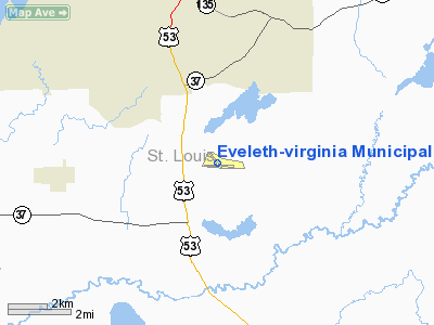
Eveleth - Virginia Municipal Airport |
Location & QuickFacts
| FAA Information Effective: | 2008-09-25 |
| Airport Identifier: | EVM |
| Airport Status: | Operational |
| Longitude/Latitude: | 092-29-54.4900W/47-25-30.2800N
-92.498469/47.425078 (Estimated) |
| Elevation: | 1378 ft / 420.01 m (Surveyed) |
| Land: | 433 acres |
| From nearest city: | 3 nautical miles SE of Eveleth, MN |
| Location: | St Louis County, MN |
| Magnetic Variation: | 00E (2005) |
Owner & Manager
| Ownership: | Publicly owned |
| Owner: | Eveleth & Virginia Cities
CITY OF VIRGINIA, CITY CLERK, 327 FIRST ST. S, VA, MN 55792, PHONE 218-748-7500. |
| Address: | 413 Pierce St., Box 401
Eveleth, MN 55734 |
| Phone number: | 218-744-2501 |
| Manager: | Gary Ulman |
| Address: | 4280 Miller Trunk Rd.
Eveleth, MN 55734 |
| Phone number: | 218-744-6175 |
Airport Operations and Facilities
| Airport Use: | Open to public |
| Wind indicator: | Yes |
| Segmented Circle: | No |
| Control Tower: | No |
| Lighting Schedule: | DUSK-DAWN
ACTVT MIRL RYS 09/27 AND 14/32; REIL RY 27; PAPI RYS 09 AND 27 - CTAF. |
| Beacon Color: | Clear-Green (lighted land airport) |
| Landing fee charge: | No |
| Sectional chart: | Green Bay |
| Region: | AGL - Great Lakes |
| Boundary ARTCC: | ZMP - Minneapolis |
| Tie-in FSS: | PNM - Princeton |
| FSS on Airport: | No |
| FSS Toll Free: | 1-800-WX-BRIEF |
| NOTAMs Facility: | EVM (NOTAM-d service avaliable) |
| Federal Agreements: | NGY3 |
Airport Communications
| CTAF: | 122.700 |
| Unicom: | 122.700 |
Airport Services
| Fuel available: | 100LLA
FOR FUEL AFTER HOURS CALL 218-258-3639 OR 218-741-1828. |
| Airframe Repair: | MINOR |
| Power Plant Repair: | MINOR |
| Bottled Oxygen: | NONE |
| Bulk Oxygen: | NONE |
Runway Information
Runway 05/23
| Dimension: | 2685 x 110 ft / 818.4 x 33.5 m |
| Surface: | TURF, Good Condition |
| |
Runway 05 |
Runway 23 |
| Traffic Pattern: | Left | Left |
| Displaced threshold: | 0.00 ft | 885.00 ft |
| Obstruction: | 54 ft trees, 1080.0 ft from runway, 150 ft right of centerline, 20:1 slope to clear | 42 ft trees, 165.0 ft from runway, 130 ft right of centerline, 3:1 slope to clear
APCH RATIO 20:1 TO DSPLCD THLD. |
|
Runway 09/27
| Dimension: | 4215 x 100 ft / 1284.7 x 30.5 m |
| Surface: | ASPH, Good Condition |
| Weight Limit: | Single wheel: 12000 lbs. |
| Edge Lights: | Medium |
| |
Runway 09 |
Runway 27 |
| Longitude: | 092-30-15.9800W | 092-29-14.8540W |
| Latitude: | 47-25-26.2500N | 47-25-23.1490N |
| Elevation: | 1376.00 ft | 1369.00 ft |
| Alignment: | 94 | 127 |
| Traffic Pattern: | Left | Left |
| Markings: | Non-precision instrument, Good Condition | Non-precision instrument, Good Condition |
| Crossing Height: | 30.00 ft | 40.00 ft |
| VASI: | 4-light PAPI on right side | 4-light PAPI on left side |
| Visual Glide Angle: | 3.00° | 3.00° |
| Runway End Identifier: | | Yes |
| Obstruction: | 84 ft trees, 1600.0 ft from runway, 240 ft right of centerline, 16:1 slope to clear | 64 ft trees, 2550.0 ft from runway, 80 ft right of centerline, 36:1 slope to clear |
|
Runway 14/32
| Dimension: | 2506 x 100 ft / 763.8 x 30.5 m |
| Surface: | ASPH, Good Condition |
| Weight Limit: | Single wheel: 25000 lbs.
Dual wheel: 43000 lbs. |
| Edge Lights: | Medium |
| |
Runway 14 |
Runway 32 |
| Longitude: | 092-30-09.0100W | 092-29-45.2370W |
| Latitude: | 47-25-42.6000N | 47-25-23.8580N |
| Elevation: | 1378.00 ft | 1369.00 ft |
| Alignment: | 127 | 127 |
| Traffic Pattern: | Left | Left |
| Markings: | Basic, Good Condition | Basic, Good Condition |
| Obstruction: | 51 ft trees, 850.0 ft from runway, 180 ft left of centerline, 12:1 slope to clear | 17 ft road, 201.0 ft from runway, 120 ft left of centerline
+17'ROAD 200'FM RWY END 120'L. |
|
Radio Navigation Aids
| ID |
Type |
Name |
Ch |
Freq |
Var |
Dist |
| CQM | NDB | Cook | | 233.00 | 01E | 25.1 nm |
| DL | NDB | Pykla | | 379.00 | 02E | 35.3 nm |
| TWM | NDB | Two Harbors | | 243.00 | 01E | 38.1 nm |
| ORB | NDB | Orr | | 341.00 | 02E | 38.6 nm |
| COQ | NDB | Cloquet | | 335.00 | 03E | 43.8 nm |
| BFW | NDB | Silver Bay | | 350.00 | 00E | 45.4 nm |
| SUW | NDB | Bong | | 260.00 | 01E | 47.0 nm |
| LKI | TACAN | Lakeside | 011X | | 05E | 37.1 nm |
| EVM | VOR/DME | Eveleth | 019X | 108.20 | 01E | 0.2 nm |
| HIB | VOR/DME | Hibbing | 045X | 110.80 | 02E | 11.2 nm |
| ELO | VOR/DME | Ely | 033X | 109.60 | 00E | 36.1 nm |
| GPZ | VOR/DME | Grand Rapids | 051X | 111.40 | 06E | 43.3 nm |
| DLH | VORTAC | Duluth | 073X | 112.60 | 05E | 39.3 nm |
Remarks
Images and information placed above are from
http://www.airport-data.com/airport/EVM/
We thank them for the data!
| General Info
|
| Country |
United States
|
| State |
MINNESOTA
|
| FAA ID |
EVM
|
| Latitude |
47-25-30.280N
|
| Longitude |
092-29-54.490W
|
| Elevation |
1378 feet
|
| Near City |
EVELETH
|
We don't guarantee the information is fresh and accurate. The data may
be wrong or outdated.
For more up-to-date information please refer to other sources.
|
|


