 |
|
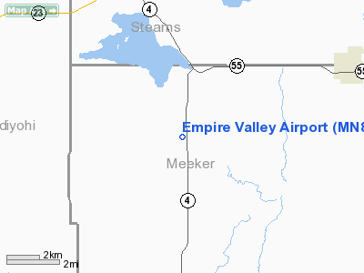
Location & QuickFacts
| FAA Information Effective: | 2008-09-25 |
| Airport Identifier: | MN88 |
| Airport Status: | Operational |
| Longitude/Latitude: | 094-40-31.0000W/45-17-12.8680N
-94.675278/45.286908 (Estimated) |
| Elevation: | 1160 ft / 353.57 m (Estimated) |
| Land: | 0 acres |
| From nearest city: | 7 nautical miles NW of Paynesville, MN |
| Location: | Meeker County, MN |
| Magnetic Variation: | 04E (1985) |
Owner & Manager
| Ownership: | Privately owned |
| Owner: | Alfred Melchert |
| Address: | Route 2
Paynesville, MN 56362 |
| Manager: | Alfred Melchert |
| Address: | Route 2
Paynesville, MN 56362 |
| Phone number: | 612-276-8674 |
Airport Operations and Facilities
| Airport Use: | Private |
| Segmented Circle: | No |
| Control Tower: | No |
| Sectional chart: | Twin Cities |
| Region: | AGL - Great Lakes |
| Boundary ARTCC: | ZMP - Minneapolis |
| Tie-in FSS: | PNM - Princeton |
| FSS on Airport: | No |
| FSS Toll Free: | 1-800-WX-BRIEF |
Runway Information
Runway E/W
| Dimension: | 2000 x 150 ft / 609.6 x 45.7 m |
| Surface: | TURF, |
| |
Runway E |
Runway W |
| Traffic Pattern: | Left | Left |
|
Runway N/S
| Dimension: | 2300 x 150 ft / 701.0 x 45.7 m |
| Surface: | TURF, |
| |
Runway N |
Runway S |
| Traffic Pattern: | Left | Left |
|
Radio Navigation Aids
| ID |
Type |
Name |
Ch |
Freq |
Var |
Dist |
| HCD | NDB | Hutchinson | | 209.00 | 04E | 28.7 nm |
| GHW | NDB | Glenwood | | 346.00 | 03E | 34.6 nm |
| EE | NDB | Tamie | | 374.00 | 04E | 40.3 nm |
| GYL | NDB | Glencoe | | 407.00 | 03E | 40.3 nm |
| BBB | NDB | Benson | | 239.00 | 05E | 41.3 nm |
| LXL | NDB | Little Falls | | 359.00 | 03E | 42.3 nm |
| PNM | NDB | Princeton | | 368.00 | 03E | 48.0 nm |
| XCR | NDB | Ripley | | 404.00 | 03E | 49.6 nm |
| ILL | VOR/DME | Willmar | 084X | 113.70 | 04E | 20.3 nm |
| BDH | VOR/DME | Willmar | 84X | 113.70 | 04E | 21.7 nm |
| STC | VOR/DME | St Cloud | 058X | 112.10 | 03E | 30.4 nm |
| AXN | VOR/DME | Alexandria | 075X | 112.80 | 07E | 46.7 nm |
| MVE | VOR/DME | Montevideo | 053X | 111.60 | 05E | 47.8 nm |
| DWN | VORTAC | Darwin | 027X | 109.00 | 07E | 15.2 nm |
Images and information placed above are from
http://www.airport-data.com/airport/MN88/
We thank them for the data!
| General Info
|
| Country |
United States
|
| State |
MINNESOTA
|
| FAA ID |
MN88
|
| Latitude |
45-17-12.868N
|
| Longitude |
094-40-31.000W
|
| Elevation |
1160 feet
|
| Near City |
PAYNESVILLE
|
We don't guarantee the information is fresh and accurate. The data may
be wrong or outdated.
For more up-to-date information please refer to other sources.
|
|


