 |
|
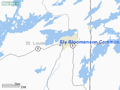
Ely Bloomenson Community Hospital Heliport |
Location & QuickFacts
| FAA Information Effective: | 2008-09-25 |
| Airport Identifier: | 0MN7 |
| Airport Status: | Operational |
| Longitude/Latitude: | 091-52-22.7070W/47-53-56.8140N
-91.872974/47.899115 (Estimated) |
| Elevation: | 1450 ft / 441.96 m (Estimated) |
| Land: | 0 acres |
| From nearest city: | 0 nautical miles W of Ely, MN |
| Location: | St Louis County, MN |
| Magnetic Variation: | 01E (1990) |
Owner & Manager
| Ownership: | Privately owned |
| Owner: | Ely Bloomenson Comm Hosp & Nh |
| Address: | 328 W. Conan Street
Ely, MN 55731 |
| Phone number: | 218-365-3271 |
| Manager: | Larry Ravenberg |
| Address: | 328 W Conan St
Ely, MN 55731 |
| Phone number: | 218-365-6130 |
Airport Operations and Facilities
| Airport Use: | Private
MEDICAL USE. |
| Wind indicator: | Yes |
| Segmented Circle: | No |
| Control Tower: | No |
| Lighting Schedule: | DUSK-DAWN
FOR PERIMETER LGTS CALL 218-365-3271. |
| Beacon Color: | Clear-Green-Yellow (heliport) |
| Sectional chart: | Green Bay |
| Region: | AGL - Great Lakes |
| Boundary ARTCC: | ZMP - Minneapolis |
| Tie-in FSS: | PNM - Princeton |
| FSS on Airport: | No |
| FSS Toll Free: | 1-800-WX-BRIEF |
Runway Information
Helipad H1
| Dimension: | 120 x 100 ft / 36.6 x 30.5 m |
| Surface: | ASPH, |
| |
Runway H1 |
Runway |
| Traffic Pattern: | Left | Left |
|
Radio Navigation Aids
| ID |
Type |
Name |
Ch |
Freq |
Var |
Dist |
| SCG | NDB | Scott | | 385.00 | 02E | 32.5 nm |
| CQM | NDB | Cook | | 233.00 | 01E | 33.3 nm |
| ORB | NDB | Orr | | 341.00 | 02E | 40.4 nm |
| BFW | NDB | Silver Bay | | 350.00 | 00E | 43.2 nm |
| ELO | VOR/DME | Ely | 033X | 109.60 | 00E | 5.0 nm |
| EVM | VOR/DME | Eveleth | 019X | 108.20 | 01E | 38.3 nm |
| HIB | VOR/DME | Hibbing | 045X | 110.80 | 02E | 49.2 nm |
Remarks
- PRVDD APCH/DEP OPS 180-197 DEGS AND 325-345 DEGS; 45' TREES 200'N AND 50'TREE N BE REMOVED; TKOF/LDG AREA MKD; WIND INDICATOR MAINTAINED; UNAUTHORIZED PERSONS RESTRAINED FROM ACCESS.
Images and information placed above are from
http://www.airport-data.com/airport/0MN7/
We thank them for the data!
| General Info
|
| Country |
United States
|
| State |
MINNESOTA
|
| FAA ID |
0MN7
|
| Latitude |
47-53-56.814N
|
| Longitude |
091-52-22.707W
|
| Elevation |
1450 feet
|
| Near City |
ELY
|
We don't guarantee the information is fresh and accurate. The data may
be wrong or outdated.
For more up-to-date information please refer to other sources.
|
|


