|
|
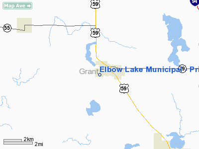
Elbow Lake Municipal - Pride Of The Prairie Airport |
|
 |
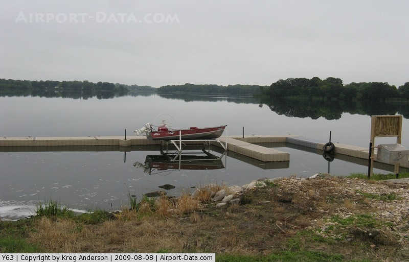
(Click on the photo to enlarge) |
|
 |
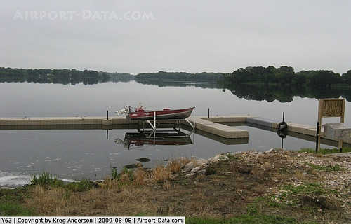
(Click on the photo to enlarge) |
Location & QuickFacts
| FAA Information Effective: | 2008-09-25 |
| Airport Identifier: | Y63 |
| Airport Status: | Operational |
| Longitude/Latitude: | 095-59-31.1950W/45-59-09.8560N
-95.991999/45.986071 (Estimated) |
| Elevation: | 1205 ft / 367.28 m (Estimated) |
| Land: | 87 acres |
| From nearest city: | 1 nautical miles SW of Elbow Lake, MN |
| Location: | Grant County, MN |
| Magnetic Variation: | 05E (1985) |
Owner & Manager
| Ownership: | Publicly owned |
| Owner: | City Of Elbow Lake |
| Address: | C/o City Clerk, P.o. Box 1079
Elbow Lake, MN 56531 |
| Phone number: | 218-685-4483 |
| Manager: | Joe Larue |
| Address: | 218 Seventh Se
Elbow Lake, MN 56531 |
| Phone number: | 218-685-6594 |
Airport Operations and Facilities
| Airport Use: | Open to public |
| Wind indicator: | Yes |
| Segmented Circle: | No |
| Control Tower: | No |
| Lighting Schedule: | DUSK-DAWN
MIRL RY 14/32 PRESET ON LOW INTST; TO INCR INTST & ACTVT REIL RYS 14 & 32 & PAPI RYS 14 & 32 - CTAF. |
| Beacon Color: | Clear-Green (lighted land airport) |
| Landing fee charge: | No |
| Sectional chart: | Twin Cities |
| Region: | AGL - Great Lakes |
| Boundary ARTCC: | ZMP - Minneapolis |
| Tie-in FSS: | PNM - Princeton |
| FSS on Airport: | No |
| FSS Toll Free: | 1-800-WX-BRIEF |
| NOTAMs Facility: | Y63 (NOTAM-d service avaliable) |
| Federal Agreements: | N |
Airport Communications
Airport Services
| Fuel available: | 100LL
SELF SVC FUEL WITH CREDIT CARD. |
| Airframe Repair: | MAJOR |
| Power Plant Repair: | MAJOR |
| Bottled Oxygen: | NONE |
| Bulk Oxygen: | NONE |
Runway Information
Runway 14/32
| Dimension: | 3400 x 60 ft / 1036.3 x 18.3 m |
| Surface: | ASPH, Good Condition |
| Edge Lights: | Medium |
| |
Runway 14 |
Runway 32 |
| Longitude: | 095-59-46.0700W | 095-59-15.4400W |
| Latitude: | 45-59-18.4000N | 45-58-52.5000N |
| Elevation: | 1203.00 ft | 1203.00 ft |
| Traffic Pattern: | Left | Left |
| Markings: | Non-precision instrument, Good Condition | Non-precision instrument, Good Condition |
| Crossing Height: | 25.00 ft | 25.00 ft |
| VASI: | 4-light PAPI on left side | 4-light PAPI on left side |
| Visual Glide Angle: | 3.00° | 3.00° |
| Runway End Identifier: | Yes | Yes |
| Centerline Lights: | No | No |
| Touchdown Lights: | No | No |
| Obstruction: | , 50:1 slope to clear | 3 ft gnd, 201.0 ft from runway, 70 ft right of centerline
GND +3, 150-200 FM END, 125-70 R. |
|
Radio Navigation Aids
| ID |
Type |
Name |
Ch |
Freq |
Var |
Dist |
| ETH | NDB | Wheaton | | 326.00 | 05E | 26.2 nm |
| BWP | NDB | Breckenridge-wahpeton | | 233.00 | 05E | 29.9 nm |
| EE | NDB | Tamie | | 374.00 | 04E | 31.0 nm |
| GHW | NDB | Glenwood | | 346.00 | 03E | 34.9 nm |
| BBB | NDB | Benson | | 239.00 | 05E | 42.1 nm |
| VVV | NDB | Ortonville | | 332.00 | 05E | 44.9 nm |
| AQP | NDB | Appleton | | 356.00 | 05E | 45.5 nm |
| FFM | VOR/DME | Fergus Falls | 041X | 110.40 | 05E | 19.5 nm |
| MOX | VOR/DME | Morris | 033X | 109.60 | 05E | 25.3 nm |
| AXN | VOR/DME | Alexandria | 075X | 112.80 | 07E | 31.8 nm |
Remarks
- ULTRALIGHTS ON & INVOF ARPT.
Images and information placed above are from
http://www.airport-data.com/airport/Y63/
We thank them for the data!
| General Info
|
| Country |
United States
|
| State |
MINNESOTA
|
| FAA ID |
Y63
|
| Latitude |
45-59-09.856N
|
| Longitude |
095-59-31.195W
|
| Elevation |
1205 feet
|
| Near City |
ELBOW LAKE
|
We don't guarantee the information is fresh and accurate. The data may
be wrong or outdated.
For more up-to-date information please refer to other sources.
|
|