 |
|
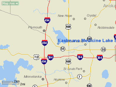
Eastmans Medicine Lake Seaplane Base |
Location & QuickFacts
| FAA Information Effective: | 2008-09-25 |
| Airport Identifier: | 22MN |
| Airport Status: | Operational |
| Longitude/Latitude: | 093-25-33.8290W/44-59-40.8700N
-93.426064/44.994686 (Estimated) |
| Elevation: | 820 ft / 249.94 m (Estimated) |
| Land: | 0 acres |
| From nearest city: | 0 nautical miles N of Plymouth, MN |
| Location: | Hennepin County, MN |
| Magnetic Variation: | 03E (1985) |
Owner & Manager
| Ownership: | Privately owned |
| Owner: | William Eastman |
| Address: | 1441 W Medicine Lake Dr
Minneapolis, MN 55441 |
| Phone number: | 612-559-0909 |
| Manager: | William W Eastman |
| Address: | 1441 W Medicine Lake Dr
Minneapolis, MN 55441 |
| Phone number: | 612-559-0909 |
Airport Operations and Facilities
| Airport Use: | Private
PERSONAL USE. |
| Segmented Circle: | No |
| Control Tower: | No |
| Sectional chart: | Twin Cities |
| Region: | AGL - Great Lakes |
| Boundary ARTCC: | ZMP - Minneapolis |
| Tie-in FSS: | PNM - Princeton |
| FSS on Airport: | No |
| FSS Toll Free: | 1-800-WX-BRIEF |
Runway Information
Runway N/S
| Dimension: | 10000 x 5000 ft / 3048.0 x 1524.0 m |
| Surface: | WATER, |
| |
Runway N |
Runway S |
| Traffic Pattern: | Left | Left |
|
Radio Navigation Aids
| ID |
Type |
Name |
Ch |
Freq |
Var |
Dist |
| MS | NDB | Narco | | 266.00 | 02E | 17.5 nm |
| PPI | NDB | Hopey | | 400.00 | 03E | 21.8 nm |
| GYL | NDB | Glencoe | | 407.00 | 03E | 31.4 nm |
| CBG | NDB | Cambridge | | 350.00 | 03E | 34.5 nm |
| PNM | NDB | Princeton | | 368.00 | 03E | 35.1 nm |
| OEO | NDB | Osceola | | 233.00 | 01E | 36.6 nm |
| RNH | NDB | New Richmond | | 257.00 | 02E | 39.0 nm |
| HCD | NDB | Hutchinson | | 209.00 | 04E | 41.6 nm |
| ROS | NDB | Rush City | | 282.00 | 02E | 46.6 nm |
| AHH | NDB | Ameron | | 278.00 | 01E | 47.9 nm |
| MSP | VOR/DME | Minneapolis | 100X | 115.30 | 02E | 10.0 nm |
| FCM | VOR/DME | Flying Cloud | 055X | 111.80 | 06E | 10.2 nm |
| STC | VOR/DME | St Cloud | 058X | 112.10 | 03E | 42.7 nm |
| FOW | VOR/DME | Halfway | 049X | 111.20 | 02E | 47.6 nm |
| GEP | VORTAC | Gopher | 120X | 117.30 | 06E | 9.4 nm |
| FGT | VORTAC | Farmington | 104X | 115.70 | 06E | 24.2 nm |
| DWN | VORTAC | Darwin | 027X | 109.00 | 07E | 44.0 nm |
| MSP | VOT | Minneapolis St Paul | | 111.00 | | 11.2 nm |
| STP | VOT | St Paul | | 114.40 | | 15.9 nm |
Remarks
- GAS, PHONE, TRANSPORTATION AVAILABLE BY PRIOR ARRANGEMENT.
- INSUFFICIENT AIRSPACE AVAILABLE TO ESTABLISH COMPATIBLE TRAFFIC PATTERN OPERATIONS BETWEEN THIS ARPT & MEDICINE LAKE SPB.
Images and information placed above are from
http://www.airport-data.com/airport/22MN/
We thank them for the data!
| General Info
|
| Country |
United States
|
| State |
MINNESOTA
|
| FAA ID |
22MN
|
| Latitude |
44-59-40.870N
|
| Longitude |
093-25-33.829W
|
| Elevation |
820 feet
|
| Near City |
PLYMOUTH
|
We don't guarantee the information is fresh and accurate. The data may
be wrong or outdated.
For more up-to-date information please refer to other sources.
|
|


