 |
|
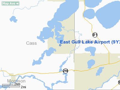
Location & QuickFacts
| FAA Information Effective: | 2008-09-25 |
| Airport Identifier: | 9Y2 |
| Airport Status: | Operational |
| Longitude/Latitude: | 094-21-43.0080W/46-22-59.8810N
-94.361947/46.383300 (Estimated) |
| Elevation: | 1236 ft / 376.73 m (Surveyed) |
| Land: | 7 acres |
| From nearest city: | 8 nautical miles NW of East Gull Lake, MN |
| Location: | Cass County, MN |
| Magnetic Variation: | 04E (1985) |
Owner & Manager
| Ownership: | Publicly owned |
| Owner: | City Of East Gull Lake |
| Address: | 10790 Squaw Point Rd
East Gull Lake, MN 56401 |
| Phone number: | 218-828-9279 |
| Manager: | Maureen K. Cirks |
| Address: | City Administrator, 10790 Squaw Point Rd
East Gull Lake, MN 56401 |
| Phone number: | 218-828-9279 |
Airport Operations and Facilities
| Airport Use: | Open to public |
| Wind indicator: | Yes |
| Segmented Circle: | No |
| Control Tower: | No |
| Landing fee charge: | No |
| Sectional chart: | Twin Cities |
| Region: | AGL - Great Lakes |
| Boundary ARTCC: | ZMP - Minneapolis |
| Tie-in FSS: | PNM - Princeton |
| FSS on Airport: | No |
| FSS Toll Free: | 1-800-WX-BRIEF |
| NOTAMs Facility: | PNM (NOTAM-d service avaliable) |
Airport Communications
Airport Services
Runway Information
Runway 13/31
| Dimension: | 2618 x 160 ft / 798.0 x 48.8 m |
| Surface: | TURF, Good Condition |
| |
Runway 13 |
Runway 31 |
| Longitude: | 094-22-37.5000W | 094-22-12.5200W |
| Latitude: | 46-23-11.4900N | 46-22-52.2700N |
| Elevation: | 1230.00 ft | 1230.00 ft |
| Traffic Pattern: | Left | Left |
| Markings: | Nonstandard,
RY 13/31 NSTD MKGS; MKD WITH YELLOW CONES. | , |
| Runway End Identifier: | No | No |
| Centerline Lights: | No | No |
| Touchdown Lights: | No | No |
| Obstruction: | 27 ft tree, 550.0 ft from runway, 80 ft left of centerline, 20:1 slope to clear | 44 ft trees, 1000.0 ft from runway, 22:1 slope to clear |
|
Radio Navigation Aids
| ID |
Type |
Name |
Ch |
Freq |
Var |
Dist |
| XCR | NDB | Ripley | | 404.00 | 03E | 18.3 nm |
| SAZ | NDB | Staples | | 257.00 | 04E | 18.4 nm |
| PWC | NDB | Pine River | | 330.00 | 03E | 20.7 nm |
| LXL | NDB | Little Falls | | 359.00 | 03E | 26.1 nm |
| AIT | NDB | Aitkin | | 397.00 | 03E | 30.1 nm |
| PK | NDB | Spida | | 269.00 | 04E | 37.1 nm |
| XVG | NDB | Longville | | 392.00 | 04E | 37.3 nm |
| RYM | TACAN | Camp Ripley | 048X | | 03E | 17.6 nm |
| PKD | VOR/DME | Park Rapids | 043X | 110.60 | 04E | 42.6 nm |
| AXN | VOR/DME | Alexandria | 075X | 112.80 | 07E | 44.3 nm |
| BRD | VORTAC | Brainerd | 116X | 116.90 | 03E | 14.1 nm |
Remarks
- ARPT CLSD WINTERS.
- WATCH FOR VEHICLES & PEDESTRIANS CROSSING RY.
- LOW SPOT 100-200 FT NORTH OF AER 31 THLD.
Images and information placed above are from
http://www.airport-data.com/airport/9Y2/
We thank them for the data!
| General Info
|
| Country |
United States
|
| State |
MINNESOTA
|
| FAA ID |
9Y2
|
| Latitude |
46-22-59.881N
|
| Longitude |
094-21-43.008W
|
| Elevation |
1236 feet
|
| Near City |
EAST GULL LAKE
|
We don't guarantee the information is fresh and accurate. The data may
be wrong or outdated.
For more up-to-date information please refer to other sources.
|
|


