 |
|
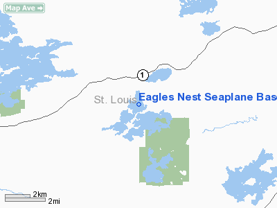
Eagles Nest Seaplane Base |
Location & QuickFacts
| FAA Information Effective: | 2008-09-25 |
| Airport Identifier: | 7MN2 |
| Airport Status: | Operational |
| Longitude/Latitude: | 092-05-58.9340W/47-49-42.6570N
-92.099704/47.828516 (Estimated) |
| Elevation: | 1490 ft / 454.15 m (Estimated) |
| Land: | 0 acres |
| From nearest city: | 10 nautical miles E of Tower, MN |
| Location: | St Louis County, MN |
| Magnetic Variation: | 00E (2000) |
Owner & Manager
| Ownership: | Privately owned |
| Owner: | Lee & Irene Van Deusen |
| Address: | Box 357
Tower, MN 55790 |
| Phone number: | 218-753-2331 |
| Manager: | Lee & Irene Van Deusen |
| Address: | Box 357
Tower, MN 55790 |
| Phone number: | 218-753-2331 |
Airport Operations and Facilities
| Airport Use: | Private |
| Wind indicator: | Yes |
| Segmented Circle: | No |
| Control Tower: | No |
| Sectional chart: | Green Bay |
| Region: | AGL - Great Lakes |
| Boundary ARTCC: | ZMP - Minneapolis |
| Tie-in FSS: | PNM - Princeton |
| FSS Toll Free: | 1-800-WX-BRIEF |
Runway Information
Runway 08W/26W
| Dimension: | 3000 x 400 ft / 914.4 x 121.9 m |
| Surface: | WATER, |
| |
Runway 08W |
Runway 26W |
| Traffic Pattern: | Left | Left |
|
Runway 17W/35W
| Dimension: | 5000 x 600 ft / 1524.0 x 182.9 m |
| Surface: | WATER, |
| |
Runway 17W |
Runway 35W |
| Traffic Pattern: | Left | Left |
|
Radio Navigation Aids
| ID |
Type |
Name |
Ch |
Freq |
Var |
Dist |
| CQM | NDB | Cook | | 233.00 | 01E | 23.9 nm |
| SCG | NDB | Scott | | 385.00 | 02E | 30.0 nm |
| ORB | NDB | Orr | | 341.00 | 02E | 32.7 nm |
| BFW | NDB | Silver Bay | | 350.00 | 00E | 44.5 nm |
| TWM | NDB | Two Harbors | | 243.00 | 01E | 48.8 nm |
| ELO | VOR/DME | Ely | 033X | 109.60 | 00E | 10.9 nm |
| EVM | VOR/DME | Eveleth | 019X | 108.20 | 01E | 29.3 nm |
| HIB | VOR/DME | Hibbing | 045X | 110.80 | 02E | 40.1 nm |
Remarks
- 439 FT TOWER 3 MILES NW OF SEAPLANE BASE.
- PRVDD CLEAR 20:1 APCHS & REF FAR 91.115 RIGHT-OF-WAY RULES, WATER OPNS.
Images and information placed above are from
http://www.airport-data.com/airport/7MN2/
We thank them for the data!
| General Info
|
| Country |
United States
|
| State |
MINNESOTA
|
| FAA ID |
7MN2
|
| Latitude |
47-49-42.657N
|
| Longitude |
092-05-58.934W
|
| Elevation |
1490 feet
|
| Near City |
TOWER
|
We don't guarantee the information is fresh and accurate. The data may
be wrong or outdated.
For more up-to-date information please refer to other sources.
|
|


