 |
|
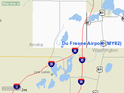
Location & QuickFacts
| FAA Information Effective: | 2008-09-25 |
| Airport Identifier: | MY82 |
| Airport Status: | Operational |
| Longitude/Latitude: | 093-04-28.7970W/45-12-46.8800N
-93.074666/45.213022 (Estimated) |
| Elevation: | 900 ft / 274.32 m (Estimated) |
| Land: | 0 acres |
| From nearest city: | 6 nautical miles SW of Forest Lake, MN |
| Location: | Anoka County, MN |
| Magnetic Variation: | 03E (1985) |
Owner & Manager
| Ownership: | Privately owned |
| Owner: | Roger Du Fresne |
| Address: | 13608 Rondeau Lake Drive
Forest Lake, MN 55025 |
| Phone number: | 612-464-6343 |
| Manager: | Roger Du Fresne |
| Address: | 13608 Rondeau Lake Drive
Forest Lake, MN 55025 |
| Phone number: | 612-464-6343 |
Airport Operations and Facilities
| Airport Use: | Private
PERSONAL USE. |
| Wind indicator: | Yes |
| Segmented Circle: | No |
| Control Tower: | No |
| Sectional chart: | Twin Cities |
| Region: | AGL - Great Lakes |
| Boundary ARTCC: | ZMP - Minneapolis |
| Tie-in FSS: | PNM - Princeton |
| FSS Toll Free: | 1-800-WX-BRIEF |
Runway Information
Runway 18/36
| Dimension: | 2000 x 60 ft / 609.6 x 18.3 m |
| Surface: | TURF, |
| |
Runway 18 |
Runway 36 |
| Traffic Pattern: | Left | Left |
|
Radio Navigation Aids
| ID |
Type |
Name |
Ch |
Freq |
Var |
Dist |
| OEO | NDB | Osceola | | 233.00 | 01E | 17.4 nm |
| PPI | NDB | Hopey | | 400.00 | 03E | 21.2 nm |
| CBG | NDB | Cambridge | | 350.00 | 03E | 22.2 nm |
| RNH | NDB | New Richmond | | 257.00 | 02E | 23.3 nm |
| MS | NDB | Narco | | 266.00 | 02E | 23.3 nm |
| ROS | NDB | Rush City | | 282.00 | 02E | 29.5 nm |
| AHH | NDB | Ameron | | 278.00 | 01E | 30.0 nm |
| PNM | NDB | Princeton | | 368.00 | 03E | 30.9 nm |
| JMR | NDB | Mora | | 327.00 | 03E | 41.5 nm |
| BXR | NDB | Big Doctor | | 203.00 | 02E | 47.2 nm |
| UBE | NDB | Cumberland | | 375.00 | 01E | 49.7 nm |
| MSP | VOR/DME | Minneapolis | 100X | 115.30 | 02E | 20.2 nm |
| FCM | VOR/DME | Flying Cloud | 055X | 111.80 | 06E | 28.4 nm |
| STC | VOR/DME | St Cloud | 058X | 112.10 | 03E | 46.2 nm |
| RZN | VOR/DME | Siren | 031X | 109.40 | 02E | 46.9 nm |
| GEP | VORTAC | Gopher | 120X | 117.30 | 06E | 13.3 nm |
| FGT | VORTAC | Farmington | 104X | 115.70 | 06E | 35.3 nm |
| STP | VOT | St Paul | | 114.40 | | 16.4 nm |
| MSP | VOT | Minneapolis St Paul | | 111.00 | | 20.6 nm |
Remarks
- NO CNTRLN STRIPE RY 10/28.
Images and information placed above are from
http://www.airport-data.com/airport/MY82/
We thank them for the data!
| General Info
|
| Country |
United States
|
| State |
MINNESOTA
|
| FAA ID |
MY82
|
| Latitude |
45-12-46.880N
|
| Longitude |
093-04-28.797W
|
| Elevation |
900 feet
|
| Near City |
FOREST LAKE
|
We don't guarantee the information is fresh and accurate. The data may
be wrong or outdated.
For more up-to-date information please refer to other sources.
|
|


