 |
|
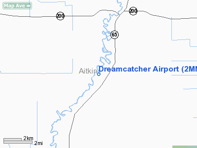
Location & QuickFacts
| FAA Information Effective: | 2008-09-25 |
| Airport Identifier: | 2MN2 |
| Airport Status: | Operational |
| Longitude/Latitude: | 093-17-52.5800W/46-56-25.3000N
-93.297939/46.940361 (Estimated) |
| Elevation: | 1250 ft / 381.00 m (Estimated) |
| Land: | 8 acres |
| From nearest city: | 4 nautical miles SW of Jacobson, MN |
| Location: | Aitkin County, MN |
| Magnetic Variation: | 02E (1995) |
Owner & Manager
| Ownership: | Privately owned |
| Owner: | Kent V. Carlson |
| Address: | 21356 640th Lane
Jacobson, MN 55752 |
| Phone number: | 218-752-6647 |
| Manager: | Kent V. Carlson |
| Address: | 21356 640th Lane
Jacobson, MN 55752 |
| Phone number: | 218-752-6647 |
Airport Operations and Facilities
| Airport Use: | Private |
| Wind indicator: | Yes |
| Segmented Circle: | No |
| Control Tower: | No |
| Sectional chart: | Twin Cities |
| Region: | AGL - Great Lakes |
| Boundary ARTCC: | ZMP - Minneapolis |
| Tie-in FSS: | PNM - Princeton |
| FSS on Airport: | No |
| FSS Toll Free: | 1-800-WX-BRIEF |
Runway Information
Runway 09/27
| Dimension: | 1700 x 60 ft / 518.2 x 18.3 m |
| Surface: | TURF, |
| |
Runway 09 |
Runway 27 |
| Traffic Pattern: | Left | Left |
| Obstruction: | 30 ft bldg, 150.0 ft from runway | 30 ft trees, 150.0 ft from runway |
|
Radio Navigation Aids
| ID |
Type |
Name |
Ch |
Freq |
Var |
Dist |
| AIT | NDB | Aitkin | | 397.00 | 03E | 28.3 nm |
| COQ | NDB | Cloquet | | 335.00 | 03E | 35.8 nm |
| XVG | NDB | Longville | | 392.00 | 04E | 37.4 nm |
| MZH | NDB | Moose Lake | | 362.00 | 02E | 37.5 nm |
| DL | NDB | Pykla | | 379.00 | 02E | 39.1 nm |
| PWC | NDB | Pine River | | 330.00 | 03E | 46.5 nm |
| LKI | TACAN | Lakeside | 011X | | 05E | 46.1 nm |
| GPZ | VOR/DME | Grand Rapids | 051X | 111.40 | 06E | 15.5 nm |
| HIB | VOR/DME | Hibbing | 045X | 110.80 | 02E | 32.6 nm |
| EVM | VOR/DME | Eveleth | 019X | 108.20 | 01E | 43.6 nm |
| DLH | VORTAC | Duluth | 073X | 112.60 | 05E | 45.8 nm |
| BRD | VORTAC | Brainerd | 116X | 116.90 | 03E | 46.6 nm |
Remarks
- PRVDD OBSTNS REMOVED/LOWERED TO PROVIDE CLEAR 20:1 APCH; AREA 125 FT EITHER SIDE OF RY & 200 FT OFF RY ENDS CLEAR; RSA IS CLEAR.
Images and information placed above are from
http://www.airport-data.com/airport/2MN2/
We thank them for the data!
| General Info
|
| Country |
United States
|
| State |
MINNESOTA
|
| FAA ID |
2MN2
|
| Latitude |
46-56-25.300N
|
| Longitude |
093-17-52.580W
|
| Elevation |
1250 feet
|
| Near City |
JACOBSON
|
We don't guarantee the information is fresh and accurate. The data may
be wrong or outdated.
For more up-to-date information please refer to other sources.
|
|


