 |
|
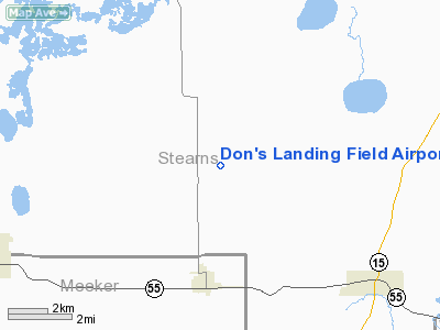
Don's Landing Field Airport |
Location & QuickFacts
| FAA Information Effective: | 2008-09-25 |
| Airport Identifier: | 32MN |
| Airport Status: | Operational |
| Longitude/Latitude: | 094-23-57.9740W/45-22-02.8700N
-94.399437/45.367464 (Estimated) |
| Elevation: | 1140 ft / 347.47 m (Estimated) |
| Land: | 3 acres |
| From nearest city: | 3 nautical miles NE of Watkins, MN |
| Location: | Stearns County, MN |
| Magnetic Variation: | 04E (1985) |
Owner & Manager
| Ownership: | Privately owned |
| Owner: | Donald J. Erpelding |
| Address: | 16714 143 Rd Ave
Watkins, MN 55389 |
| Phone number: | 612-764-9303 |
| Manager: | Donald J. Erpelding |
| Address: | 16714 143 Rd Ave
Watkins, MN 55389 |
| Phone number: | 612-764-9303 |
Airport Operations and Facilities
| Airport Use: | Private
PERSONAL USE. |
| Wind indicator: | No |
| Segmented Circle: | No |
| Control Tower: | No |
| Landing fee charge: | No |
| Sectional chart: | Green Bay |
| Region: | AGL - Great Lakes |
| Boundary ARTCC: | ZMP - Minneapolis |
| Tie-in FSS: | PNM - Princeton |
| FSS on Airport: | No |
| FSS Toll Free: | 1-800-WX-BRIEF |
Runway Information
Runway E/W
| Dimension: | 2100 x 200 ft / 640.1 x 61.0 m |
| Surface: | TURF, |
| |
Runway E |
Runway W |
| Traffic Pattern: | Left | Left |
|
Radio Navigation Aids
| ID |
Type |
Name |
Ch |
Freq |
Var |
Dist |
| HCD | NDB | Hutchinson | | 209.00 | 04E | 30.7 nm |
| LXL | NDB | Little Falls | | 359.00 | 03E | 35.1 nm |
| PNM | NDB | Princeton | | 368.00 | 03E | 35.4 nm |
| GYL | NDB | Glencoe | | 407.00 | 03E | 38.8 nm |
| GHW | NDB | Glenwood | | 346.00 | 03E | 42.1 nm |
| XCR | NDB | Ripley | | 404.00 | 03E | 42.8 nm |
| EE | NDB | Tamie | | 374.00 | 04E | 45.9 nm |
| CBG | NDB | Cambridge | | 350.00 | 03E | 49.3 nm |
| RYM | TACAN | Camp Ripley | 048X | | 03E | 43.5 nm |
| STC | VOR/DME | St Cloud | 058X | 112.10 | 03E | 18.1 nm |
| ILL | VOR/DME | Willmar | 084X | 113.70 | 04E | 32.9 nm |
| BDH | VOR/DME | Willmar | 84X | 113.70 | 04E | 34.3 nm |
| AXN | VOR/DME | Alexandria | 075X | 112.80 | 07E | 49.9 nm |
| DWN | VORTAC | Darwin | 027X | 109.00 | 07E | 17.0 nm |
| GEP | VORTAC | Gopher | 120X | 117.30 | 06E | 45.4 nm |
Remarks
- FILED FOR RECORD PURPOSES ONLY.
Images and information placed above are from
http://www.airport-data.com/airport/32MN/
We thank them for the data!
| General Info
|
| Country |
United States
|
| State |
MINNESOTA
|
| FAA ID |
32MN
|
| Latitude |
45-22-02.870N
|
| Longitude |
094-23-57.974W
|
| Elevation |
1140 feet
|
| Near City |
WATKINS
|
We don't guarantee the information is fresh and accurate. The data may
be wrong or outdated.
For more up-to-date information please refer to other sources.
|
|


