|
|
|
 |
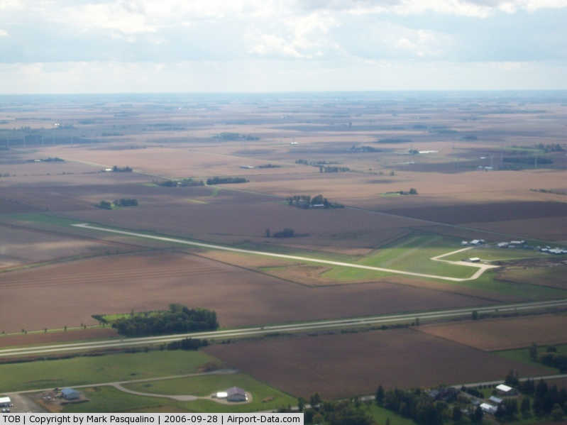
(Click on the photo to enlarge) |
|
 |
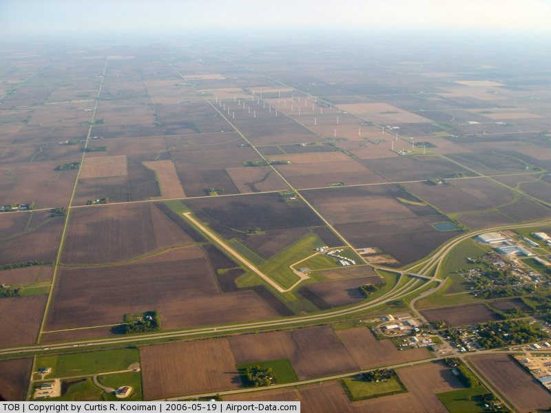
(Click on the photo to enlarge) |
Location & QuickFacts
| FAA Information Effective: | 2008-09-25 |
| Airport Identifier: | TOB |
| Airport Status: | Operational |
| Longitude/Latitude: | 092-49-53.4000W/44-01-04.9000N
-92.831500/44.018028 (Estimated) |
| Elevation: | 1305 ft / 397.76 m (Estimated) |
| Land: | 165 acres |
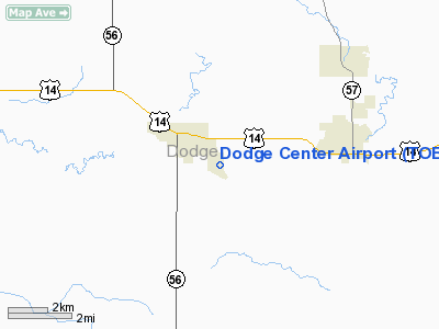
| From nearest city: | 1 nautical miles SE of Dodge Center, MN |
| Location: | Dodge County, MN |
| Magnetic Variation: | 02E (2000) |
Owner & Manager
| Ownership: | Publicly owned |
| Owner: | City Of Dodge Center |
| Address: | 23 West Main St, P. O. Box 430
Dodge Center, MN 55927 |
| Phone number: | 507-374-2575 |
| Manager: | Wayne Trom |
| Address: | 806 Airport Rd. S.
Dodge Center, MN 55927 |
| Phone number: | 507-374-6245 |
Airport Operations and Facilities
| Airport Use: | Open to public |
| Wind indicator: | Yes |
| Segmented Circle: | No |
| Control Tower: | No |
| Lighting Schedule: | DUSK-DAWN
MIRL RY 16/34 PRESET LOW INTST; INCR INTST & ACTVT REIL & PAPI RYS 16 & 34 - CTAF. |
| Beacon Color: | Clear-Green (lighted land airport) |
| Landing fee charge: | No |
| Sectional chart: | Green Bay |
| Region: | AGL - Great Lakes |
| Boundary ARTCC: | ZMP - Minneapolis |
| Tie-in FSS: | PNM - Princeton |
| FSS on Airport: | No |
| FSS Toll Free: | 1-800-WX-BRIEF |
| NOTAMs Facility: | TOB (NOTAM-d service avaliable) |
| Federal Agreements: | NY1 |
Airport Communications
Airport Services
| Fuel available: | 100LL
SELF SERVE FUEL AVBL 24 HRS WITH CREDIT CARD. |
| Airframe Repair: | MAJOR |
| Power Plant Repair: | MAJOR |
Runway Information
Runway 04/22
| Dimension: | 2390 x 200 ft / 728.5 x 61.0 m |
| Surface: | TURF, Good Condition |
| |
Runway 04 |
Runway 22 |
| Longitude: | 092-50-12.7900W | 092-49-50.0500W |
| Latitude: | 44-01-01.7600N | 44-01-18.7300N |
| Alignment: | 44 | 127 |
| Traffic Pattern: | Left | Left |
| Markings: | None,
RY 04/22 MARKED WITH YELLOW CONES. | None, |
| Runway End Identifier: | No | No |
| Centerline Lights: | No | No |
| Touchdown Lights: | No | No |
| Obstruction: | 22 ft road, 730.0 ft from runway, 33:1 slope to clear | 90 ft trees, 1800.0 ft from runway, 115 ft left of centerline, 20:1 slope to clear |
|
Runway 16/34
| Dimension: | 4500 x 75 ft / 1371.6 x 22.9 m |
| Surface: | CONC, Good Condition |
| Edge Lights: | Medium |
| |
Runway 16 |
Runway 34 |
| Longitude: | 092-49-56.7600W | 092-49-41.4800W |
| Latitude: | 44-01-23.5400N | 44-00-40.4900N |
| Elevation: | 1295.00 ft | 1305.00 ft |
| Alignment: | 127 | 127 |
| Traffic Pattern: | Left | Left |
| Markings: | Non-precision instrument, Good Condition | Non-precision instrument, Good Condition |
| Crossing Height: | 28.00 ft | 40.00 ft |
| VASI: | 4-light PAPI on left side | 4-light PAPI on left side |
| Visual Glide Angle: | 3.00° | 3.00° |
| Runway End Identifier: | Yes | Yes |
| Obstruction: | 27 ft trees, 1215.0 ft from runway, 37:1 slope to clear | , 50:1 slope to clear |
|
Radio Navigation Aids
| ID |
Type |
Name |
Ch |
Freq |
Var |
Dist |
| ACQ | NDB | Waseca | | 371.00 | 02E | 31.3 nm |
| CJJ | NDB | Cresco | | 293.00 | 02E | 49.6 nm |
| MS | NDB | Narco | | 266.00 | 02E | 49.8 nm |
| RST | VOR/DME | Rochester | 057X | 112.00 | 05E | 17.4 nm |
| FOW | VOR/DME | Halfway | 049X | 111.20 | 02E | 25.8 nm |
| JAY | VOR/DME | Austin | 019X | 108.20 | 03E | 26.8 nm |
| AEL | VOR/DME | Albert Lea | 035X | 109.80 | 05E | 30.9 nm |
| MKT | VOR/DME | Mankato | 045X | 110.80 | 07E | 48.2 nm |
| ONA | VOR/DME | Winona | 051X | 111.40 | 01E | 48.8 nm |
| FGT | VORTAC | Farmington | 104X | 115.70 | 06E | 39.8 nm |
Remarks
- ULTRALIGHT TRAFFIC ON & INVOF ARPT.
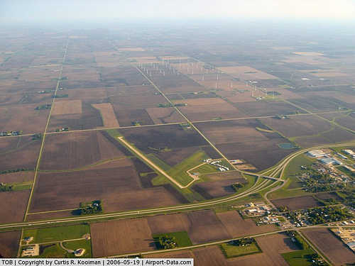
- WINDMILLS 1.5 MILES SW OF AIRPORT.
Images and information placed above are from
http://www.airport-data.com/airport/TOB/
We thank them for the data!
| General Info
|
| Country |
United States
|
| State |
MINNESOTA
|
| FAA ID |
TOB
|
| Latitude |
44-01-04.800N
|
| Longitude |
092-49-53.400W
|
| Elevation |
1305 feet
|
| Near City |
DODGE CENTER
|
We don't guarantee the information is fresh and accurate. The data may
be wrong or outdated.
For more up-to-date information please refer to other sources.
|
|