|
|
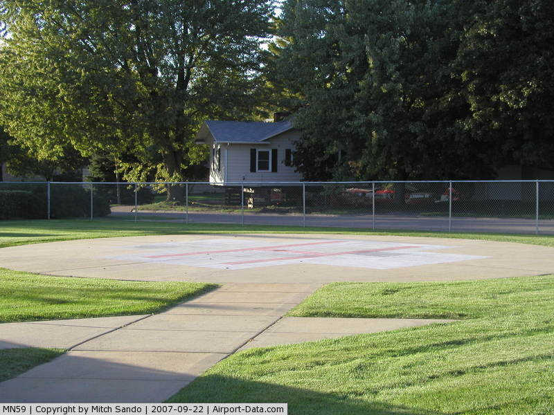
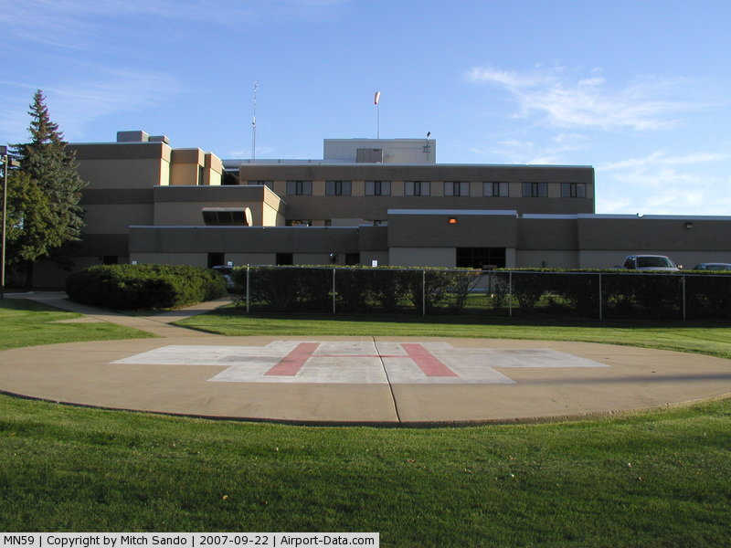
District One Hospital Heliport |
|
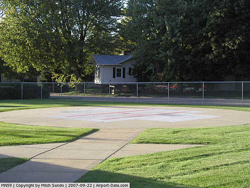 |
(Click on the photo to enlarge) |
|
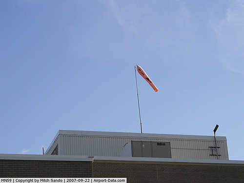 |
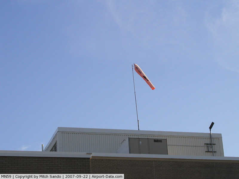
(Click on the photo to enlarge) |
|
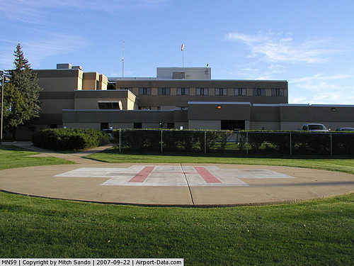 |
(Click on the photo to enlarge) |
Location & QuickFacts
| FAA Information Effective: | 2008-09-25 |
| Airport Identifier: | MN59 |
| Airport Status: | Operational |
| Longitude/Latitude: | 093-15-28.7750W/44-17-21.8690N
-93.257993/44.289408 (Estimated) |
| Elevation: | 1065 ft / 324.61 m (Estimated) |
| Land: | 0 acres |
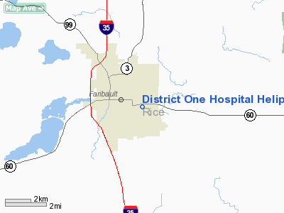
| From nearest city: | 1 nautical miles S of Faribault, MN |
| Location: | Rice County, MN |
| Magnetic Variation: | 03E (1990) |
Owner & Manager
| Ownership: | Publicly owned |
| Owner: | District One Hospital |
| Address: | 200 State Ave
Faribault, MN 55021 |
| Phone number: | 507-334-6451 |
| Manager: | Timothy O Johnson |
| Address: | 200 State Ave
Faribault, MN 55021 |
| Phone number: | 507-332-4784 |
Airport Operations and Facilities
| Airport Use: | Private
MEDICAL USE. |
| Wind indicator: | Yes |
| Segmented Circle: | No |
| Control Tower: | No |
| Lighting Schedule: | DUSK-DAWN |
| Beacon Color: | Clear-Green-Yellow (heliport) |
| Sectional chart: | Omaha |
| Region: | AGL - Great Lakes |
| Boundary ARTCC: | ZMP - Minneapolis |
| Tie-in FSS: | PNM - Princeton |
| FSS on Airport: | No |
| FSS Toll Free: | 1-800-WX-BRIEF |
Runway Information
Helipad H1
| Dimension: | 44 x 44 ft / 13.4 x 13.4 m |
| Surface: | CONC, |
| |
Runway H1 |
Runway |
| Traffic Pattern: | Left | Left |
|
Radio Navigation Aids
| ID |
Type |
Name |
Ch |
Freq |
Var |
Dist |
| ACQ | NDB | Waseca | | 371.00 | 02E | 18.3 nm |
| MS | NDB | Narco | | 266.00 | 02E | 33.0 nm |
| PPI | NDB | Hopey | | 400.00 | 03E | 37.6 nm |
| GYL | NDB | Glencoe | | 407.00 | 03E | 45.4 nm |
| FOW | VOR/DME | Halfway | 049X | 111.20 | 02E | 7.0 nm |
| MKT | VOR/DME | Mankato | 045X | 110.80 | 07E | 28.5 nm |
| FCM | VOR/DME | Flying Cloud | 055X | 111.80 | 06E | 33.3 nm |
| MSP | VOR/DME | Minneapolis | 100X | 115.30 | 02E | 36.5 nm |
| AEL | VOR/DME | Albert Lea | 035X | 109.80 | 05E | 36.8 nm |
| RST | VOR/DME | Rochester | 057X | 112.00 | 05E | 41.8 nm |
| JAY | VOR/DME | Austin | 019X | 108.20 | 03E | 45.3 nm |
| FGT | VORTAC | Farmington | 104X | 115.70 | 06E | 20.8 nm |
| MSP | VOT | Minneapolis St Paul | | 111.00 | | 35.8 nm |
| STP | VOT | St Paul | | 114.40 | | 40.1 nm |
Remarks
- PRVDD ALL APCH/DEP OPNS 280-290 DEGS AND 080-090 DEGS AND 30 FT POLE 90 DEGS FROM HELIPAD REMOVED & WIRES 270 DEGS FROM HELIPAD MARKED. TKOF/LNDG AREA MKD; NON-OBSTRUCTING WIND INDICATOR MAINTAINED; ALL TRAFFIC INBND/OUTBND MONITORED BY TWO-WAY RADIO COM BTWN PILOT & HOSPITAL.
Images and information placed above are from
http://www.airport-data.com/airport/MN59/
We thank them for the data!
| General Info
|
| Country |
United States
|
| State |
MINNESOTA
|
| FAA ID |
MN59
|
| Latitude |
44-17-21.869N
|
| Longitude |
093-15-28.775W
|
| Elevation |
1065 feet
|
| Near City |
FARIBAULT
|
We don't guarantee the information is fresh and accurate. The data may
be wrong or outdated.
For more up-to-date information please refer to other sources.
|
|