 |
|
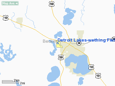
Detroit Lakes - Wething Field Airport |
Location & QuickFacts
| FAA Information Effective: | 2008-09-25 |
| Airport Identifier: | DTL |
| Airport Status: | Operational |
| Longitude/Latitude: | 095-53-08.1000W/46-49-30.6000N
-95.885583/46.825167 (Estimated) |
| Elevation: | 1397 ft / 425.81 m (Surveyed) |
| Land: | 288 acres |
| From nearest city: | 2 nautical miles W of Detroit Lakes, MN |
| Location: | Becker County, MN |
| Magnetic Variation: | 05E (1995) |
Owner & Manager
| Ownership: | Publicly owned |
| Owner: | City Of Detroit Lakes
OWNED ALSO BY BECKER COUNTY. |
| Address: | 1025 Roosevelt Ave, Box 647
Detroit Lakes, MN 56501 |
| Phone number: | 218-847-5658 |
| Manager: | Perry Ochsner |
| Address: | 24813 Us Hwy 10 W
Detroit Lakes, MN 56502 |
| Phone number: | 218-847-3233 |
Airport Operations and Facilities
| Airport Use: | Open to public |
| Wind indicator: | Yes |
| Segmented Circle: | Yes |
| Control Tower: | No |
| Lighting Schedule: | DUSK-DAWN
ACTVT MIRL RY 13/31 & REIL RYS 13, 31 & VASI RYS 13 & 31 - CTAF. |
| Beacon Color: | Clear-Green (lighted land airport) |
| Landing fee charge: | No |
| Sectional chart: | Twin Cities |
| Region: | AGL - Great Lakes |
| Traffic Pattern Alt: | 800 ft |
| Boundary ARTCC: | ZMP - Minneapolis |
| Tie-in FSS: | PNM - Princeton |
| FSS on Airport: | No |
| FSS Toll Free: | 1-800-WX-BRIEF |
| NOTAMs Facility: | DTL (NOTAM-d service avaliable) |
| Federal Agreements: | NGY |
Airport Communications
| CTAF: | 122.800 |
| Unicom: | 122.800 |
Airport Services
| Fuel available: | 100LLA
SELF SERVICE AVAIL 24 HRS. |
| Airframe Repair: | MAJOR |
| Power Plant Repair: | MAJOR |
| Bottled Oxygen: | NONE |
| Bulk Oxygen: | NONE |
Runway Information
Runway 13/31
| Dimension: | 4500 x 75 ft / 1371.6 x 22.9 m |
| Surface: | ASPH, Good Condition |
| Weight Limit: | Single wheel: 23000 lbs.
Dual wheel: 42000 lbs. |
| Edge Lights: | Medium |
| |
Runway 13 |
Runway 31 |
| Longitude: | 095-53-22.6798W | 095-52-40.9960W |
| Latitude: | 46-49-46.4724N | 46-49-12.5022N |
| Elevation: | 1397.00 ft | 1362.00 ft |
| Alignment: | 127 | 127 |
| Traffic Pattern: | Left | Left |
| Markings: | Non-precision instrument, Good Condition | Non-precision instrument, Good Condition |
| Crossing Height: | 45.00 ft | 35.00 ft |
| VASI: | 4-box on left side | 4-box on left side |
| Runway End Identifier: | Yes
& 31 OMNIDIRECTIONAL REIL. | Yes |
| Centerline Lights: | No | No |
| Touchdown Lights: | No | No |
| Obstruction: | 2 ft road, 200.0 ft from runway, 250 ft left of centerline
+5 FT FENCE 5 FT FM RY END 250 FT R. | 48 ft trees, 1650.0 ft from runway, 30:1 slope to clear |
|
Runway 17/35
| Dimension: | 1880 x 250 ft / 573.0 x 76.2 m |
| Surface: | TURF, Good Condition |
| |
Runway 17 |
Runway 35 |
| Longitude: | 095-53-23.1200W | 095-53-23.1800W |
| Latitude: | 46-49-42.6300N | 46-49-24.0700N |
| Alignment: | 127 | 0 |
| Traffic Pattern: | Left | Left |
| Markings: | None,
RY 17/35 MKD WITH CONES. | None, |
| Runway End Identifier: | No | No |
| Centerline Lights: | No | No |
| Touchdown Lights: | No | No |
| Obstruction: | , 50:1 slope to clear | 43 ft trees, 700.0 ft from runway, 190 ft left of centerline, 16:1 slope to clear |
|
Radio Navigation Aids
| ID |
Type |
Name |
Ch |
Freq |
Var |
Dist |
| PK | NDB | Spida | | 269.00 | 04E | 37.4 nm |
| AA | NDB | Kenie | | 365.00 | 06E | 39.7 nm |
| BWP | NDB | Breckenridge-wahpeton | | 233.00 | 05E | 45.8 nm |
| FSE | NDB | Fosston | | 224.00 | 05E | 46.2 nm |
| PKD | VOR/DME | Park Rapids | 043X | 110.60 | 04E | 33.8 nm |
| FFM | VOR/DME | Fergus Falls | 041X | 110.40 | 05E | 34.1 nm |
| FAR | VORTAC | Fargo | 109X | 116.20 | 09E | 40.0 nm |
Remarks
- RWY 17/35 CLSD WINTER MONTHS.
- ULTRALIGHTS ON & INVOF ARPT.
Images and information placed above are from
http://www.airport-data.com/airport/DTL/
We thank them for the data!
| General Info
|
| Country |
United States
|
| State |
MINNESOTA
|
| FAA ID |
DTL
|
| Latitude |
46-49-30.751N
|
| Longitude |
095-53-08.475W
|
| Elevation |
1396 feet
|
| Near City |
DETROIT LAKES
|
We don't guarantee the information is fresh and accurate. The data may
be wrong or outdated.
For more up-to-date information please refer to other sources.
|
|


