 |
|
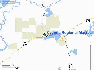
Cuyuna Regional Medical Center Heliport |
Location & QuickFacts
| FAA Information Effective: | 2008-09-25 |
| Airport Identifier: | 1MN7 |
| Airport Status: | Operational |
| Longitude/Latitude: | 093-56-36.9380W/46-28-55.8640N
-93.943594/46.482184 (Estimated) |
| Elevation: | 1255 ft / 382.52 m (Estimated) |
| Land: | 0 acres |
| From nearest city: | 0 nautical miles N of Crosby, MN |
| Location: | Crow Wing County, MN |
| Magnetic Variation: | 03E (1995) |
Owner & Manager
| Ownership: | Privately owned |
| Owner: | Cuyuna Regional Medical Cntr |
| Address: |
Crosby, MN 56441 |
| Phone number: | 218-546-5147 |
| Manager: | Tom Reek |
| Address: | Cuyuna Regional Medical Cntr
Crosby, MN 56441 |
| Phone number: | 218-546-5147 |
Airport Operations and Facilities
| Airport Use: | Private
MEDICAL USE. |
| Wind indicator: | Yes |
| Segmented Circle: | No |
| Control Tower: | No |
| Lighting Schedule: | PHONE REQ
FOR PERIMETER LGTS CALL 218-546-5147 OR 612-291-2701. |
| Sectional chart: | Twin Cities |
| Region: | AGL - Great Lakes |
| Boundary ARTCC: | ZMP - Minneapolis |
| Tie-in FSS: | PNM - Princeton |
| FSS on Airport: | No |
| FSS Toll Free: | 1-800-WX-BRIEF |
Runway Information
Helipad H1
| Dimension: | 55 x 55 ft / 16.8 x 16.8 m |
| Surface: | CONC, |
| |
Runway H1 |
Runway |
| Traffic Pattern: | Left | Left |
|
Radio Navigation Aids
| ID |
Type |
Name |
Ch |
Freq |
Var |
Dist |
| AIT | NDB | Aitkin | | 397.00 | 03E | 11.8 nm |
| PWC | NDB | Pine River | | 330.00 | 03E | 23.4 nm |
| XCR | NDB | Ripley | | 404.00 | 03E | 29.4 nm |
| XVG | NDB | Longville | | 392.00 | 04E | 32.6 nm |
| LXL | NDB | Little Falls | | 359.00 | 03E | 36.0 nm |
| SAZ | NDB | Staples | | 257.00 | 04E | 36.2 nm |
| JMR | NDB | Mora | | 327.00 | 03E | 45.3 nm |
| MZH | NDB | Moose Lake | | 362.00 | 02E | 47.3 nm |
| PK | NDB | Spida | | 269.00 | 04E | 47.5 nm |
| RYM | TACAN | Camp Ripley | 048X | | 03E | 29.1 nm |
| GPZ | VOR/DME | Grand Rapids | 051X | 111.40 | 06E | 45.0 nm |
| BRD | VORTAC | Brainerd | 116X | 116.90 | 03E | 8.7 nm |
Remarks
- SEE AIRSPACE LETTER DATED 01/11/94.
Images and information placed above are from
http://www.airport-data.com/airport/1MN7/
We thank them for the data!
| General Info
|
| Country |
United States
|
| State |
MINNESOTA
|
| FAA ID |
1MN7
|
| Latitude |
46-28-55.864N
|
| Longitude |
093-56-36.938W
|
| Elevation |
1255 feet
|
| Near City |
CROSBY
|
We don't guarantee the information is fresh and accurate. The data may
be wrong or outdated.
For more up-to-date information please refer to other sources.
|
|


