|
|
Coordinates: 45°03′43″N 093°21′14″W / 45.06194°N 93.35389°W / 45.06194; -93.35389
| Crystal Airport |
| IATA: MIC – ICAO: KMIC – FAA LID: MIC |
| Summary |
| Airport type |
Public |
| Owner |
Metropolitan Airports Commission |
| Serves |
Minneapolis, Minnesota |
| Location |
Crystal, Minnesota |
| Elevation AMSL |
869 ft / 265 m |
| Runways |
| Direction |
Length |
Surface |
| ft |
m |
| 14L/32R |
3,263 |
995 |
Asphalt |
| 14R/32L |
3,266 |
995 |
Asphalt |
| 6L/24R |
2,499 |
762 |
Asphalt |
| 6R/24L |
2,122 |
647 |
Turf |
| Statistics (2004) |
| Aircraft operations |
187,859 |
| Based aircraft |
263 |
| Source: Federal Aviation Administration |
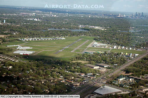
Crystal Airport (IATA: MIC, ICAO: KMIC, FAA LID: MIC) is a public airport named after the city of Crystal in Hennepin County, Minnesota, United States. Most of the airport is in the city of Crystal. Portions north of 62nd Avenue are in Brooklyn Park, and the north east corner of the airport is in Brooklyn Center. It is eight miles (13 km) northwest of the central business district of Minneapolis and is owned by the Metropolitan Airports Commission.
The airport opened in 1946 as a privately owned public use airport. In 1948 the Metropolitan Airports Commission purchased the airport. Additional land purchases were made in 1951 and 1954.
Facilities and aircraft
Crystal Airport covers an area of 436 acres (176 ha) which contains four runways:
- Runway 14L/32R: 3,263 x 75 ft (995 x 23 m), Surface: Asphalt
- Runway 14R/32L: 3,266 x 75 ft (995 x 23 m), Surface: Asphalt
- Runway 6L/24R: 2,499 x 75 ft (762 x 23 m), Surface: Asphalt
- Runway 6R/24L: 2,122 x 202 ft (647 x 62 m), Surface: Turf
For the 12-month period ending August 31, 2004, the airport had 187,859 aircraft operations, an average of 514 per day: 95% general aviation, 4% air taxi and <1% military. There are 263 aircraft based at this airport: 91% single engine, 6% multi-engine, 2% helicopter and 1% jet.
The above content comes from Wikipedia and is published under free licenses – click here to read more.

|
 |
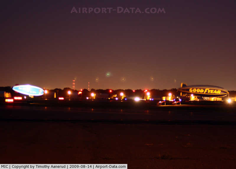
(Click on the photo to enlarge) |
|
 |
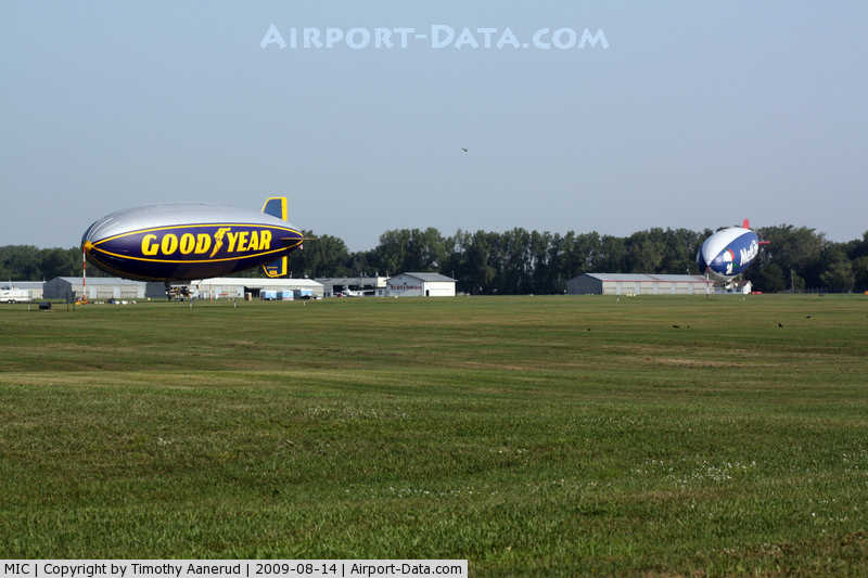
(Click on the photo to enlarge) |
|
 |
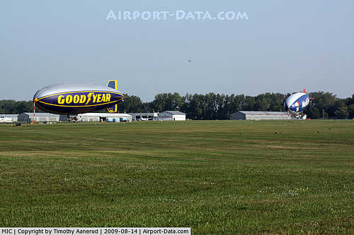
(Click on the photo to enlarge) |
|
 |
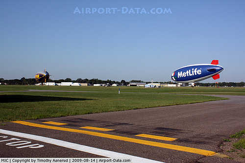
(Click on the photo to enlarge) |
Location & QuickFacts
| FAA Information Effective: | 2008-09-25 |
| Airport Identifier: | MIC |
| Airport Status: | Operational |
| Longitude/Latitude: | 093-21-14.1750W/45-03-43.1500N
-93.353938/45.061986 (Estimated) |
| Elevation: | 869 ft / 264.87 m (Surveyed) |
| Land: | 436 acres |
| From nearest city: | 8 nautical miles NW of Minneapolis, MN |
| Location: | Hennepin County, MN |
| Magnetic Variation: | 02E (2000) |
Owner & Manager
| Ownership: | Publicly owned |
| Owner: | Metropolitan Airport Cmsn |
| Address: | 6040 28th Avs S
Minneapolis, MN 55450 |
| Phone number: | 612-726-8100 |
| Manager: | Jeff Nawrocki
BERNARD SWANSON, MAINT SUPSVR 763-537-4096. |
| Address: | 6040 28th Ave S
Minneapolis, MN 55450 |
| Phone number: | 763-537-2058 |
Airport Operations and Facilities
| Airport Use: | Open to public |
| Wind indicator: | Yes |
| Segmented Circle: | No |
| Control Tower: | Yes |
| Lighting Schedule: | DUSK-DAWN
WHEN ATCT CLSD ACTVT MIRL RYS 14L/32R; 06L/24R; REIL RYS 14L/32R - CTAF. |
| Beacon Color: | Clear-Green (lighted land airport) |
| Landing fee charge: | No |
| Sectional chart: | Twin Cities |
| Region: | AGL - Great Lakes |
| Traffic Pattern Alt: | 1000 ft |
| Boundary ARTCC: | ZMP - Minneapolis |
| Tie-in FSS: | PNM - Princeton |
| FSS on Airport: | No |
| FSS Toll Free: | 1-800-WX-BRIEF |
| NOTAMs Facility: | MIC (NOTAM-d service avaliable) |
| Federal Agreements: | NGY |
Airport Communications
| CTAF: | 120.700 |
| Unicom: | 122.950 |
Airport Services
| Fuel available: | 100LLA
FUEL AVAIL 24 HRS WITH CREDIT CARD. |
| Airframe Repair: | MAJOR |
| Power Plant Repair: | MAJOR |
Runway Information
Runway 06L/24R
| Dimension: | 2499 x 75 ft / 761.7 x 22.9 m
500 FT STOPWAY ADDED TO EACH END; NOT AVBL FOR TKOFS. |
| Surface: | ASPH, Good Condition
TURF RY ROUGH CONDITION. CLSD NOV THRU APR. |
| Weight Limit: | Single wheel: 12500 lbs.
Dual wheel: 25000 lbs. |
| Edge Lights: | Medium |
| |
Runway 06L |
Runway 24R |
| Longitude: | 093-21-31.5680W | 093-21-03.6810W |
| Latitude: | 45-03-40.7940N | 45-03-55.5710N |
| Elevation: | 869.00 ft | 867.00 ft |
| Alignment: | 53 | 127 |
| Traffic Pattern: | Left | Left |
| Markings: | Basic, Good Condition | Basic, Good Condition |
| Crossing Height: | 27.00 ft | 29.00 ft |
| Displaced threshold: | 390.00 ft | 389.00 ft |
| VASI: | 4-box on left side | 4-box on left side |
| Visual Glide Angle: | 4.00° | 3.50° |
| Runway End Identifier: | No | No |
| Centerline Lights: | No | No |
| Touchdown Lights: | No | No |
| Obstruction: | 54 ft tree, 1100.0 ft from runway, 141 ft left of centerline, 16:1 slope to clear
23:1 TO DSPLCD THLD. | 54 ft tree, 740.0 ft from runway, 75 ft left of centerline, 10:1 slope to clear
17:1 TO DSPLCD THLD. |
|
Runway 06R/24L
| Dimension: | 2122 x 202 ft / 646.8 x 61.6 m
500 FT STOPWAY ADDED TO EACH END; NOT AVBL FOR TKOFS. |
| Surface: | TURF, Fair Condition
TURF RY ROUGH CONDITION. CLSD NOV THRU APR. |
| |
Runway 06R |
Runway 24L |
| Longitude: | 093-21-27.7160W | 093-21-03.9720W |
| Latitude: | 45-03-39.1590N | 45-03-51.6940N |
| Elevation: | 869.00 ft | 868.00 ft |
| Alignment: | 53 | 127 |
| Traffic Pattern: | Left | Left |
| Markings: | None,
RY 06R/24L MKD WITH YELLOW CONES. | None, |
| Runway End Identifier: | No | No |
| Centerline Lights: | No | No |
| Touchdown Lights: | No | No |
| Obstruction: | 65 ft tree, 1300.0 ft from runway, 100 ft right of centerline, 20:1 slope to clear | 42 ft tree, 700.0 ft from runway, 190 ft left of centerline, 16:1 slope to clear |
|
Runway 14L/32R
| Dimension: | 3263 x 75 ft / 994.6 x 22.9 m
500 FT STOPWAY ADDED TO EACH END; NOT AVBL FOR TKOFS. |
| Surface: | ASPH, Good Condition
TURF RY ROUGH CONDITION. CLSD NOV THRU APR. |
| Weight Limit: | Single wheel: 13000 lbs.
Dual wheel: 25000 lbs. |
| Edge Lights: | Medium |
| |
Runway 14L |
Runway 32R |
| Longitude: | 093-21-24.8280W | 093-20-56.4690W |
| Latitude: | 45-03-53.9760N | 45-03-28.7920N |
| Elevation: | 868.00 ft | 866.00 ft |
| Alignment: | 127 | 127 |
| Traffic Pattern: | Left | Left |
| Markings: | Non-precision instrument, Good Condition | Non-precision instrument, Good Condition |
| Crossing Height: | 27.00 ft | 34.00 ft |
| VASI: | 4-box on left side | 4-box on left side |
| Visual Glide Angle: | 4.00° | 3.50° |
| Runway End Identifier: | Yes | Yes |
| Centerline Lights: | No | No |
| Touchdown Lights: | No | No |
| Obstruction: | 95 ft tree, 2100.0 ft from runway, 20:1 slope to clear | 52 ft trees, 1100.0 ft from runway, 300 ft right of centerline, 17:1 slope to clear |
|
Runway 14R/32L
| Dimension: | 3266 x 75 ft / 995.5 x 22.9 m
500 FT STOPWAY ADDED TO EACH END; NOT AVBL FOR TKOFS. |
| Surface: | ASPH, Good Condition
TURF RY ROUGH CONDITION. CLSD NOV THRU APR. |
| Weight Limit: | Single wheel: 13000 lbs.
Dual wheel: 25000 lbs. |
| |
Runway 14R |
Runway 32L |
| Longitude: | 093-21-28.1570W | 093-20-59.7880W |
| Latitude: | 45-03-52.1830N | 45-03-26.9790N |
| Elevation: | 868.00 ft | 866.00 ft |
| Alignment: | 127 | 127 |
| Traffic Pattern: | Left | Left |
| Markings: | Basic, Good Condition | Basic, Good Condition |
| Runway End Identifier: | No | No |
| Centerline Lights: | No | No |
| Touchdown Lights: | No | No |
| Obstruction: | 58 ft tree, 1500.0 ft from runway, 22:1 slope to clear | 39 ft tree, 413.0 ft from runway, 130 ft left of centerline, 5:1 slope to clear |
|
Radio Navigation Aids
| ID |
Type |
Name |
Ch |
Freq |
Var |
Dist |
| MS | NDB | Narco | | 266.00 | 02E | 18.1 nm |
| PPI | NDB | Hopey | | 400.00 | 03E | 20.9 nm |
| CBG | NDB | Cambridge | | 350.00 | 03E | 30.0 nm |
| OEO | NDB | Osceola | | 233.00 | 01E | 31.9 nm |
| PNM | NDB | Princeton | | 368.00 | 03E | 32.1 nm |
| RNH | NDB | New Richmond | | 257.00 | 02E | 35.2 nm |
| GYL | NDB | Glencoe | | 407.00 | 03E | 36.0 nm |
| ROS | NDB | Rush City | | 282.00 | 02E | 41.7 nm |
| AHH | NDB | Ameron | | 278.00 | 01E | 43.7 nm |
| HCD | NDB | Hutchinson | | 209.00 | 04E | 45.5 nm |
| JMR | NDB | Mora | | 327.00 | 03E | 49.9 nm |
| MSP | VOR/DME | Minneapolis | 100X | 115.30 | 02E | 11.1 nm |
| FCM | VOR/DME | Flying Cloud | 055X | 111.80 | 06E | 14.9 nm |
| STC | VOR/DME | St Cloud | 058X | 112.10 | 03E | 41.8 nm |
| GEP | VORTAC | Gopher | 120X | 117.30 | 06E | 5.1 nm |
| FGT | VORTAC | Farmington | 104X | 115.70 | 06E | 26.9 nm |
| DWN | VORTAC | Darwin | 027X | 109.00 | 07E | 46.7 nm |
| MSP | VOT | Minneapolis St Paul | | 111.00 | | 12.2 nm |
| STP | VOT | St Paul | | 114.40 | | 14.5 nm |
Remarks
- WHEN TAXIING INVOF RY 32L RUNUP PAD VIS FM ATCT OBSCURED BY BLDG.
- DEER & WATERFOWL ON & INVOF ARPT.
- ULTRALIGHT OPNS PROHIBITED.
- RY 14R/32L CLSD TO FIXED WING ACFT 1/2 HR AFT SS TO 1/2 HR PRIOR TO SR.
- WHEN ATCT CLSD SNOW REMOVAL OPERATORS MONITOR 120.7.
Images and information placed above are from
http://www.airport-data.com/airport/MIC/
We thank them for the data!
| General Info
|
| Country |
United States
|
| State |
MINNESOTA
|
| FAA ID |
MIC
|
| Latitude |
45-03-43.150N
|
| Longitude |
093-21-14.175W
|
| Elevation |
869 feet
|
| Near City |
MINNEAPOLIS
|
We don't guarantee the information is fresh and accurate. The data may
be wrong or outdated.
For more up-to-date information please refer to other sources.
|
|