 |
|
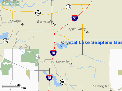
Crystal Lake Seaplane Base |
Location & QuickFacts
| FAA Information Effective: | 2008-09-25 |
| Airport Identifier: | MN09 |
| Airport Status: | Operational |
| Longitude/Latitude: | 093-16-00.7980W/44-43-19.8720N
-93.266888/44.722187 (Estimated) |
| Elevation: | 935 ft / 284.99 m (Estimated) |
| Land: | 0 acres |
| From nearest city: | 3 nautical miles W of Apple Valley, MN |
| Location: | Dakota County, MN |
| Magnetic Variation: | 03E (1985) |
Owner & Manager
| Ownership: | Privately owned |
| Owner: | Thomas E. Lejeune |
| Address: | 8330 W. 220th St.
Lakeville, MN 55044 |
| Phone number: | 612-469-5521 |
| Manager: | Thomas E. Lejeune |
| Address: | 8330 W. 220th St
Lakeville, MN 55044 |
| Phone number: | 612-469-5521 |
Airport Operations and Facilities
| Airport Use: | Private |
| Wind indicator: | No |
| Segmented Circle: | No |
| Control Tower: | No |
| Landing fee charge: | No |
| Sectional chart: | Twin Cities |
| Region: | AGL - Great Lakes |
| Boundary ARTCC: | ZMP - Minneapolis |
| Tie-in FSS: | PNM - Princeton |
| FSS on Airport: | No |
| FSS Toll Free: | 1-800-WX-BRIEF |
Airport Services
| Airframe Repair: | NONE |
| Power Plant Repair: | NONE |
Runway Information
Runway 02/20
| Dimension: | 6000 x 500 ft / 1828.8 x 152.4 m |
| Surface: | WATER, |
| |
Runway 02 |
Runway 20 |
| Traffic Pattern: | Right | Right |
|
Runway 09/27
| Dimension: | 12000 x 1000 ft / 3657.6 x 304.8 m |
| Surface: | WATER, |
| |
Runway 09 |
Runway 27 |
| Traffic Pattern: | Left | Right |
|
Radio Navigation Aids
| ID |
Type |
Name |
Ch |
Freq |
Var |
Dist |
| MS | NDB | Narco | | 266.00 | 02E | 9.7 nm |
| PPI | NDB | Hopey | | 400.00 | 03E | 16.6 nm |
| GYL | NDB | Glencoe | | 407.00 | 03E | 35.0 nm |
| RNH | NDB | New Richmond | | 257.00 | 02E | 40.3 nm |
| ACQ | NDB | Waseca | | 371.00 | 02E | 41.1 nm |
| OEO | NDB | Osceola | | 233.00 | 01E | 43.1 nm |
| HCD | NDB | Hutchinson | | 209.00 | 04E | 48.3 nm |
| FCM | VOR/DME | Flying Cloud | 055X | 111.80 | 06E | 10.2 nm |
| MSP | VOR/DME | Minneapolis | 100X | 115.30 | 02E | 10.6 nm |
| FOW | VOR/DME | Halfway | 049X | 111.20 | 02E | 31.4 nm |
| MKT | VOR/DME | Mankato | 045X | 110.80 | 07E | 41.0 nm |
| FGT | VORTAC | Farmington | 104X | 115.70 | 06E | 6.6 nm |
| GEP | VORTAC | Gopher | 120X | 117.30 | 06E | 25.9 nm |
| MSP | VOT | Minneapolis St Paul | | 111.00 | | 10.0 nm |
| STP | VOT | St Paul | | 114.40 | | 15.8 nm |
Remarks
- RIGHT TURN/EAST DPTRS/-NE/SW-LNDG/TKOF-WILL BE WEST OF LNDG AREA.
Images and information placed above are from
http://www.airport-data.com/airport/MN09/
We thank them for the data!
| General Info
|
| Country |
United States
|
| State |
MINNESOTA
|
| FAA ID |
MN09
|
| Latitude |
44-43-19.872N
|
| Longitude |
093-16-00.798W
|
| Elevation |
935 feet
|
| Near City |
APPLE VALLEY
|
We don't guarantee the information is fresh and accurate. The data may
be wrong or outdated.
For more up-to-date information please refer to other sources.
|
|


