 |
|
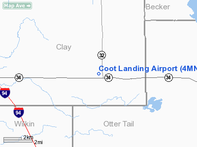
Location & QuickFacts
| FAA Information Effective: | 2008-09-25 |
| Airport Identifier: | 4MN2 |
| Airport Status: | Operational |
| Longitude/Latitude: | 096-14-30.3260W/46-39-49.8510N
-96.241757/46.663847 (Estimated) |
| Elevation: | 1325 ft / 403.86 m (Estimated) |
| Land: | 15 acres |
| From nearest city: | 8 nautical miles E of Barnsville, MN |
| Location: | Aitkin County, MN |
| Magnetic Variation: | () |
Owner & Manager
| Ownership: | Privately owned |
| Owner: | John Ohnstad |
| Address: | 13714 Deer Pt Road
Audubon, MN 56511 |
| Phone number: | 218-439-6896 |
| Manager: | John Ohnstad |
| Address: | 13714 Deer Pt Road
Audubon, MN 56511 |
| Phone number: | 218-439-6896 |
Airport Operations and Facilities
| Airport Use: | Private |
| Segmented Circle: | No |
| Control Tower: | No |
| Sectional chart: | Twin Cities |
| Region: | AGL - Great Lakes |
| Boundary ARTCC: | ZMP - Minneapolis |
| Tie-in FSS: | PNM - Princeton |
| FSS Toll Free: | 1-800-WX-BRIEF |
Runway Information
Runway 07/25
| Dimension: | 1800 x 75 ft / 548.6 x 22.9 m |
| Surface: | TURF, |
| |
Runway 07 |
Runway 25 |
| Traffic Pattern: | Left | Left |
|
Radio Navigation Aids
| ID |
Type |
Name |
Ch |
Freq |
Var |
Dist |
| BWP | NDB | Breckenridge-wahpeton | | 233.00 | 05E | 29.3 nm |
| AA | NDB | Kenie | | 365.00 | 06E | 31.4 nm |
| DTL | VOR/DME | Detroit Lakes | 049X | 111.20 | 05E | 17.5 nm |
| FFM | VOR/DME | Fergus Falls | 041X | 110.40 | 05E | 22.8 nm |
| FAR | VORTAC | Fargo | 109X | 116.20 | 09E | 25.7 nm |
Remarks
- 1245 FT TOWER 1 MILE NE.
- PRVDD CLEAR 20:1 APCHS, CLEAR OBSTL FREE ZONE, AND CLEAR RY SAFETY AREA.
Images and information placed above are from
http://www.airport-data.com/airport/4MN2/
We thank them for the data!
We don't guarantee the information is fresh and accurate. The data may
be wrong or outdated.
For more up-to-date information please refer to other sources.
|
|


