 |
|
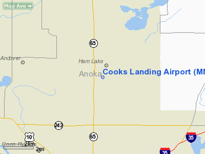
Location & QuickFacts
| FAA Information Effective: | 2008-09-25 |
| Airport Identifier: | MN87 |
| Airport Status: | Operational |
| Longitude/Latitude: | 093-13-18.0000W/45-14-37.0000N
-93.221667/45.243611 (Estimated) |
| Elevation: | 895 ft / 272.80 m (Estimated) |
| Land: | 0 acres |
| From nearest city: | 5 nautical miles S of Ham Lake, MN |
| Location: | Anoka County, MN |
| Magnetic Variation: | 03E (1995) |
Owner & Manager
| Ownership: | Privately owned |
| Owner: | Charles S. Cook |
| Address: | 1845 149th Ave
Ham Lake, MN 55304 |
| Phone number: | 612-434-8744 |
| Manager: | Charles S. Cook |
| Address: | 1845 149th Ave
Ham Lake, MN 55304 |
| Phone number: | 612-757-7568 |
Airport Operations and Facilities
| Airport Use: | Private |
| Wind indicator: | Yes |
| Segmented Circle: | No |
| Control Tower: | No |
| Sectional chart: | Twin Cities |
| Region: | AGL - Great Lakes |
| Boundary ARTCC: | ZMP - Minneapolis |
| Tie-in FSS: | PNM - Princeton |
| FSS Toll Free: | 1-800-WX-BRIEF |
Runway Information
Runway 18/36
| Dimension: | 1070 x 120 ft / 326.1 x 36.6 m |
| Surface: | TURF, |
| |
Runway 18 |
Runway 36 |
| Traffic Pattern: | Left | Left |
| Displaced threshold: | 0.00 ft | 500.00 ft
RY 36 DSPLCD THLD MKD WITH WHITE HORSE FENCING. |
| Obstruction: | | 25 ft pline, 500.0 ft from runway |
|
Radio Navigation Aids
| ID |
Type |
Name |
Ch |
Freq |
Var |
Dist |
| CBG | NDB | Cambridge | | 350.00 | 03E | 18.9 nm |
| OEO | NDB | Osceola | | 233.00 | 01E | 22.9 nm |
| PPI | NDB | Hopey | | 400.00 | 03E | 25.2 nm |
| PNM | NDB | Princeton | | 368.00 | 03E | 25.3 nm |
| MS | NDB | Narco | | 266.00 | 02E | 25.7 nm |
| ROS | NDB | Rush City | | 282.00 | 02E | 29.5 nm |
| RNH | NDB | New Richmond | | 257.00 | 02E | 29.7 nm |
| AHH | NDB | Ameron | | 278.00 | 01E | 36.0 nm |
| JMR | NDB | Mora | | 327.00 | 03E | 38.9 nm |
| GYL | NDB | Glencoe | | 407.00 | 03E | 46.8 nm |
| MSP | VOR/DME | Minneapolis | 100X | 115.30 | 02E | 20.9 nm |
| FCM | VOR/DME | Flying Cloud | 055X | 111.80 | 06E | 27.0 nm |
| STC | VOR/DME | St Cloud | 058X | 112.10 | 03E | 39.8 nm |
| RZN | VOR/DME | Siren | 031X | 109.40 | 02E | 49.7 nm |
| GEP | VORTAC | Gopher | 120X | 117.30 | 06E | 8.7 nm |
| FGT | VORTAC | Farmington | 104X | 115.70 | 06E | 36.9 nm |
| STP | VOT | St Paul | | 114.40 | | 19.5 nm |
| MSP | VOT | Minneapolis St Paul | | 111.00 | | 21.6 nm |
Remarks
- PRVDD CLEAR 20:1 APCH SLOPE,OBSTACLE FREE ZONE & CLEAR RY SAFETY AREA.
Images and information placed above are from
http://www.airport-data.com/airport/MN87/
We thank them for the data!
| General Info
|
| Country |
United States
|
| State |
MINNESOTA
|
| FAA ID |
MN87
|
| Latitude |
45-14-37.000N
|
| Longitude |
093-13-18.000W
|
| Elevation |
895 feet
|
| Near City |
HAM LAKE
|
We don't guarantee the information is fresh and accurate. The data may
be wrong or outdated.
For more up-to-date information please refer to other sources.
|
|


