 |
|
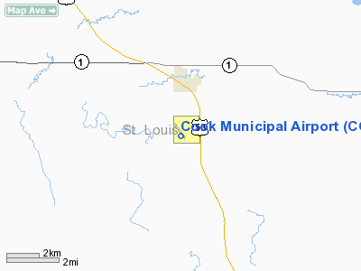
Location & QuickFacts
| FAA Information Effective: | 2008-09-25 |
| Airport Identifier: | CQM |
| Airport Status: | Operational |
| Longitude/Latitude: | 092-41-26.3060W/47-49-18.4950N
-92.690641/47.821804 (Estimated) |
| Elevation: | 1327 ft / 404.47 m (Surveyed) |
| Land: | 280 acres |
| From nearest city: | 2 nautical miles S of Cook, MN |
| Location: | St Louis County, MN |
| Magnetic Variation: | 01E (1995) |
Owner & Manager
| Ownership: | Publicly owned |
| Owner: | City Of Cook |
| Address: | Po Box 155
Cook, MN 55723 |
| Phone number: | 218-666-2200 |
| Manager: | Tom Woock |
| Address: | Po Box 155, City Hall
Cook, MN 55723 |
| Phone number: | 218-666-2909 |
Airport Operations and Facilities
| Airport Use: | Open to public |
| Wind indicator: | Yes |
| Segmented Circle: | No |
| Control Tower: | No |
| Lighting Schedule: | DUSK-DAWN
MIRL RY 13/31 PRESET LOW INTST; TO INCR INTST ACTVT - CTAF. |
| Beacon Color: | Clear-Green (lighted land airport) |
| Landing fee charge: | No |
| Sectional chart: | Green Bay |
| Region: | AGL - Great Lakes |
| Boundary ARTCC: | ZMP - Minneapolis |
| Tie-in FSS: | PNM - Princeton |
| FSS on Airport: | No |
| FSS Toll Free: | 1-800-WX-BRIEF |
| NOTAMs Facility: | CQM (NOTAM-d service avaliable) |
Airport Communications
Airport Services
| Fuel available: | 100LLA
SELF SERVICE FUEL AVAIL 24 HRS. |
Runway Information
Runway 07/25
| Dimension: | 1570 x 120 ft / 478.5 x 36.6 m |
| Surface: | TURF, |
| |
Runway 07 |
Runway 25 |
| Longitude: | 092-41-45.8400W | 092-41-24.6159W |
| Latitude: | 47-49-14.7600N | 47-49-20.7386N |
| Alignment: | 67 | 127 |
| Traffic Pattern: | Left | Left |
|
Runway 13/31
| Dimension: | 3200 x 75 ft / 975.4 x 22.9 m |
| Surface: | ASPH, Good Condition |
| Edge Lights: | Medium
RY 31 HAS VISUAL LGTG ON NPI RY. |
| |
Runway 13 |
Runway 31 |
| Longitude: | 092-41-37.9300W | 092-41-05.9300W |
| Latitude: | 47-49-30.4100N | 47-49-07.3100N |
| Elevation: | 1327.00 ft | 1317.00 ft |
| Alignment: | 127 | 127 |
| Traffic Pattern: | Left | Left |
| Markings: | Non-precision instrument, Good Condition | Non-precision instrument, Good Condition |
| Obstruction: | 17 ft trees, 300.0 ft from runway, 250 ft left of centerline, 5:1 slope to clear
RWY 13, TREES +55, 1100 FM END, 180R, 16:1. | 24 ft trees, 400.0 ft from runway, 250 ft left of centerline, 8:1 slope to clear |
|
Radio Navigation Aids
| ID |
Type |
Name |
Ch |
Freq |
Var |
Dist |
| ORB | NDB | Orr | | 341.00 | 02E | 13.7 nm |
| SCG | NDB | Scott | | 385.00 | 02E | 27.7 nm |
| FOZ | NDB | Bigfork | | 345.00 | 02E | 39.0 nm |
| IN | NDB | Raize | | 353.00 | 06E | 46.1 nm |
| EVM | VOR/DME | Eveleth | 019X | 108.20 | 01E | 25.2 nm |
| HIB | VOR/DME | Hibbing | 045X | 110.80 | 02E | 31.3 nm |
| ELO | VOR/DME | Ely | 033X | 109.60 | 00E | 34.7 nm |
Remarks
Images and information placed above are from
http://www.airport-data.com/airport/CQM/
We thank them for the data!
| General Info
|
| Country |
United States
|
| State |
MINNESOTA
|
| FAA ID |
CQM
|
| Latitude |
47-49-18.908N
|
| Longitude |
092-41-21.931W
|
| Elevation |
1327 feet
|
| Near City |
COOK
|
We don't guarantee the information is fresh and accurate. The data may
be wrong or outdated.
For more up-to-date information please refer to other sources.
|
|


