 |
|
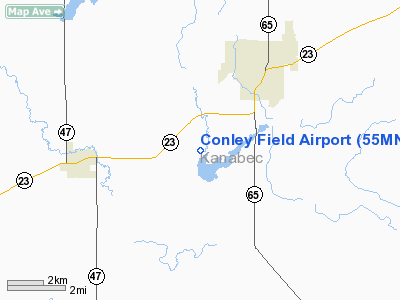
Location & QuickFacts
| FAA Information Effective: | 2008-09-25 |
| Airport Identifier: | 55MN |
| Airport Status: | Operational |
| Longitude/Latitude: | 093-20-07.8140W/45-50-06.8550N
-93.335504/45.835238 (Estimated) |
| Elevation: | 1004 ft / 306.02 m (Estimated) |
| Land: | 0 acres |
| From nearest city: | 3 nautical miles SW of Mora, MN |
| Location: | Kanabec County, MN |
| Magnetic Variation: | 03E (1985) |
Owner & Manager
| Ownership: | Privately owned |
| Owner: | Marie L. Conley |
| Address: | Rt 2
Moramn 55051 |
| Phone number: | 612-679-2410 |
| Manager: | Larry O. Jones |
| Address: | Rt 5 Box 146
Mora, MN 55051 |
| Phone number: | 612-679-5980 |
Airport Operations and Facilities
| Airport Use: | Private |
| Wind indicator: | Yes |
| Segmented Circle: | No |
| Control Tower: | No |
| Sectional chart: | Twin Cities |
| Region: | AGL - Great Lakes |
| Boundary ARTCC: | ZMP - Minneapolis |
| Tie-in FSS: | PNM - Princeton |
| FSS on Airport: | No |
| FSS Toll Free: | 1-800-WX-BRIEF |
Runway Information
Runway N/S
| Dimension: | 2600 x 70 ft / 792.5 x 21.3 m |
| Surface: | TURF, |
| |
Runway N |
Runway S |
| Traffic Pattern: | Left | Left |
|
Radio Navigation Aids
| ID |
Type |
Name |
Ch |
Freq |
Var |
Dist |
| JMR | NDB | Mora | | 327.00 | 03E | 4.4 nm |
| CBG | NDB | Cambridge | | 350.00 | 03E | 17.0 nm |
| ROS | NDB | Rush City | | 282.00 | 02E | 18.0 nm |
| PNM | NDB | Princeton | | 368.00 | 03E | 19.9 nm |
| BXR | NDB | Big Doctor | | 203.00 | 02E | 40.6 nm |
| MZH | NDB | Moose Lake | | 362.00 | 02E | 41.3 nm |
| OEO | NDB | Osceola | | 233.00 | 01E | 41.7 nm |
| LXL | NDB | Little Falls | | 359.00 | 03E | 42.7 nm |
| XCR | NDB | Ripley | | 404.00 | 03E | 44.6 nm |
| AIT | NDB | Aitkin | | 397.00 | 03E | 45.1 nm |
| RYM | TACAN | Camp Ripley | 048X | | 03E | 45.3 nm |
| STC | VOR/DME | St Cloud | 058X | 112.10 | 03E | 34.9 nm |
| RZN | VOR/DME | Siren | 031X | 109.40 | 02E | 40.3 nm |
| GEP | VORTAC | Gopher | 120X | 117.30 | 06E | 41.5 nm |
| BRD | VORTAC | Brainerd | 116X | 116.90 | 03E | 42.2 nm |
Remarks
- FILED FOR RECORD PURPOSES ONLY.
Images and information placed above are from
http://www.airport-data.com/airport/55MN/
We thank them for the data!
| General Info
|
| Country |
United States
|
| State |
MINNESOTA
|
| FAA ID |
55MN
|
| Latitude |
45-50-06.855N
|
| Longitude |
093-20-07.814W
|
| Elevation |
1004 feet
|
| Near City |
MORA
|
We don't guarantee the information is fresh and accurate. The data may
be wrong or outdated.
For more up-to-date information please refer to other sources.
|
|


