 |
|
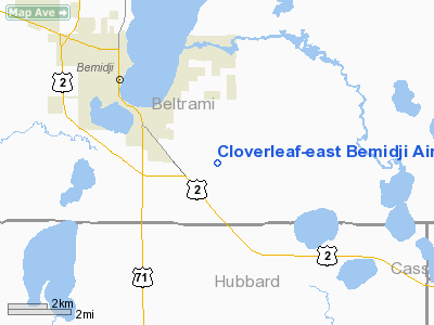
Cloverleaf-East Bemidji Airport |
Location & QuickFacts
| FAA Information Effective: | 2008-09-25 |
| Airport Identifier: | MY54 |
| Airport Status: | Operational |
| Longitude/Latitude: | 094-48-43.9840W/47-26-17.8290N
-94.812218/47.438286 (Estimated) |
| Elevation: | 1445 ft / 440.44 m (Estimated) |
| Land: | 0 acres |
| From nearest city: | 2 nautical miles SE of Bemidji, MN |
| Location: | Beltrami County, MN |
| Magnetic Variation: | 04E (1985) |
Owner & Manager
| Ownership: | Privately owned |
| Owner: | John C. Rowles |
| Address: | 2408 Tyler Ave., S.e.
Bemidji, MN 56601-8308 |
| Phone number: | 218-751-1634 |
| Manager: | John C. Rowles |
| Address: | 2408 Tyler Ave., S.e.
Bemidji, MN 56601-8308 |
| Phone number: | 218-751-1634 |
Airport Operations and Facilities
| Airport Use: | Private |
| Wind indicator: | Yes |
| Segmented Circle: | No |
| Control Tower: | No |
| Landing fee charge: | No |
| Sectional chart: | Twin Cities |
| Region: | AGL - Great Lakes |
| Boundary ARTCC: | ZMP - Minneapolis |
| Tie-in FSS: | PNM - Princeton |
| FSS on Airport: | No |
| FSS Toll Free: | 1-800-WX-BRIEF |
Runway Information
Runway 09/27
| Dimension: | 4200 x 100 ft / 1280.2 x 30.5 m |
| Surface: | TURF, |
| |
Runway 09 |
Runway 27 |
| Traffic Pattern: | Right | Left |
| Displaced threshold: | 800.00 ft | 0.00 ft |
|
Radio Navigation Aids
| ID |
Type |
Name |
Ch |
Freq |
Var |
Dist |
| XVG | NDB | Longville | | 392.00 | 04E | 36.4 nm |
| PK | NDB | Spida | | 269.00 | 04E | 36.9 nm |
| FSE | NDB | Fosston | | 224.00 | 05E | 39.9 nm |
| PWC | NDB | Pine River | | 330.00 | 03E | 46.2 nm |
| PKD | VOR/DME | Park Rapids | 043X | 110.60 | 04E | 34.1 nm |
| BJI | VORTAC | Bemidji | 023X | 108.60 | 04E | 12.0 nm |
Remarks
- RWY IS RELOCATED SOUTH TO CLEAR ROAD; HANGAR & BARN RELOCATED OUT OF RWY PRIMARY SURFACE.
Images and information placed above are from
http://www.airport-data.com/airport/MY54/
We thank them for the data!
| General Info
|
| Country |
United States
|
| State |
MINNESOTA
|
| FAA ID |
MY54
|
| Latitude |
47-26-17.829N
|
| Longitude |
094-48-43.984W
|
| Elevation |
1445 feet
|
| Near City |
BEMIDJI
|
We don't guarantee the information is fresh and accurate. The data may
be wrong or outdated.
For more up-to-date information please refer to other sources.
|
|


