 |
|
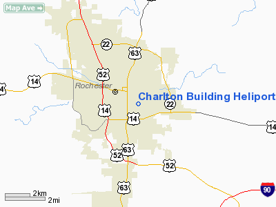
Charlton Building Heliport |
Location & QuickFacts
| FAA Information Effective: | 2008-09-25 |
| Airport Identifier: | MN56 |
| Airport Status: | Operational |
| Longitude/Latitude: | 092-27-06.6330W/44-01-05.8690N
-92.451842/44.018297 (Estimated) |
| Elevation: | 1086 ft / 331.01 m (Estimated) |
| Land: | 0 acres |
| From nearest city: | 0 nautical miles SW of Rochester, MN |
| Location: | Olmsted County, MN |
| Magnetic Variation: | 03E (1985) |
Owner & Manager
| Ownership: | Privately owned |
| Owner: | Mayo Foundation |
| Address: | 200 First Street Sw
Rochester, MN 55905 |
| Phone number: | 507-284-2511 |
| Manager: | Paul Drucker, Rn |
| Address: | 1216 Second Street Sw, Mary Bridge 10 Helipad
Rochester, MN 55902 |
| Phone number: | 507-255-5459 |
Airport Operations and Facilities
| Airport Use: | Private |
| Wind indicator: | Yes |
| Segmented Circle: | No |
| Control Tower: | No |
| Sectional chart: | Green Bay |
| Region: | AGL - Great Lakes |
| Boundary ARTCC: | ZMP - Minneapolis |
| Tie-in FSS: | PNM - Princeton |
| FSS on Airport: | No |
| FSS Toll Free: | 1-800-WX-BRIEF |
Runway Information
Helipad H1
| Dimension: | 50 x 22 ft / 15.2 x 6.7 m |
| Surface: | CONC, |
| |
Runway H1 |
Runway |
| Traffic Pattern: | Left | Left |
|
Radio Navigation Aids
| ID |
Type |
Name |
Ch |
Freq |
Var |
Dist |
| CJJ | NDB | Cresco | | 293.00 | 02E | 41.6 nm |
| ACQ | NDB | Waseca | | 371.00 | 02E | 47.7 nm |
| CHU | NDB | Caledonia | | 209.00 | 03E | 49.1 nm |
| RST | VOR/DME | Rochester | 057X | 112.00 | 05E | 15.5 nm |
| ONA | VOR/DME | Winona | 051X | 111.40 | 01E | 32.4 nm |
| JAY | VOR/DME | Austin | 019X | 108.20 | 03E | 33.4 nm |
| FOW | VOR/DME | Halfway | 049X | 111.20 | 02E | 41.2 nm |
| AEL | VOR/DME | Albert Lea | 035X | 109.80 | 05E | 44.7 nm |
| ODI | VORTAC | Nodine | 126X | 117.90 | 01E | 43.1 nm |
| FGT | VORTAC | Farmington | 104X | 115.70 | 06E | 48.4 nm |
Remarks
- APP/DEP OPNS FROM 200 DEGS CLOCKWISE TO 360 DEGS USING PAD AS THE CENTER OF A COMPASS ROSE. AREA IS MARKED; WIND INDICATOR IS MAINTAINED.
Images and information placed above are from
http://www.airport-data.com/airport/MN56/
We thank them for the data!
| General Info
|
| Country |
United States
|
| State |
MINNESOTA
|
| FAA ID |
MN56
|
| Latitude |
44-01-05.869N
|
| Longitude |
092-27-06.633W
|
| Elevation |
1086 feet
|
| Near City |
ROCHESTER
|
We don't guarantee the information is fresh and accurate. The data may
be wrong or outdated.
For more up-to-date information please refer to other sources.
|
|


