 |
|
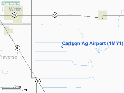
Location & QuickFacts
| FAA Information Effective: | 2008-09-25 |
| Airport Identifier: | 1MY1 |
| Airport Status: | Operational |
| Longitude/Latitude: | 096-11-40.0000W/45-59-07.0000N
-96.194444/45.985278 (Estimated) |
| Elevation: | 1033 ft / 314.86 m (Estimated) |
| Land: | 10 acres |
| From nearest city: | 5 nautical miles SW of Wendell, MN |
| Location: | Grant County, MN |
| Magnetic Variation: | () |
Owner & Manager
| Ownership: | Privately owned |
| Owner: | Lynn Carlson |
| Address: | 8441 Decker Ave
Northfield, MN 55057 |
| Phone number: | 507-645-6208 |
| Manager: | Lynn Carlson |
| Address: | 25445 300th Ave
Wendell, MN 56590 |
| Phone number: | 320-284-2415 |
Airport Operations and Facilities
| Airport Use: | Private |
| Control Tower: | No |
| Sectional chart: | Twin Cities |
| Region: | AGL - Great Lakes |
| Boundary ARTCC: | ZMP - Minneapolis |
| Tie-in FSS: | PNM - Princeton |
| FSS Toll Free: | 1-800-WX-BRIEF |
Runway Information
Runway 09/27
| Dimension: | 4500 x 60 ft / 1371.6 x 18.3 m |
| Surface: | ASPH-TURF,
W 2500 FT OF RY IS TURF AND E 2000 FT OF RY IS ASPH. |
| |
Runway 09 |
Runway 27 |
| Traffic Pattern: | Left | Right |
|
Radio Navigation Aids
| ID |
Type |
Name |
Ch |
Freq |
Var |
Dist |
| ETH | NDB | Wheaton | | 326.00 | 05E | 19.1 nm |
| BWP | NDB | Breckenridge-wahpeton | | 233.00 | 05E | 23.1 nm |
| EE | NDB | Tamie | | 374.00 | 04E | 39.0 nm |
| GHW | NDB | Glenwood | | 346.00 | 03E | 42.0 nm |
| VVV | NDB | Ortonville | | 332.00 | 05E | 42.2 nm |
| BBB | NDB | Benson | | 239.00 | 05E | 45.7 nm |
| AQP | NDB | Appleton | | 356.00 | 05E | 46.2 nm |
| FFM | VOR/DME | Fergus Falls | 041X | 110.40 | 05E | 18.3 nm |
| MOX | VOR/DME | Morris | 033X | 109.60 | 05E | 26.9 nm |
| AXN | VOR/DME | Alexandria | 075X | 112.80 | 07E | 40.2 nm |
Remarks
- PRVDD CLEAR 20:1 APCH; CLEAR RY SAFETY AREAS; CLEAR OBSTACLE FREE ZONE; AND FLY TFC PAT TO THE NORTH TO DECONFLICT WITH RICK'S FLD ARPT.
Images and information placed above are from
http://www.airport-data.com/airport/1MY1/
We thank them for the data!
| General Info
|
| Country |
United States
|
| State |
MINNESOTA
|
| FAA ID |
1MY1
|
| Latitude |
45.985278
45° 59' 07.00" N
|
| Longitude |
-96.194444
096° 11' 40.00" W
|
| Elevation |
1033 feet
315 meters
|
| Magnetic Variation |
003° E (01/06)
|
| Operating Agency |
PRIVATE
|
We don't guarantee the information is fresh and accurate. The data may
be wrong or outdated.
For more up-to-date information please refer to other sources.
|
|


