 |
|
Buffalo Municipal Airport |
| Buffalo Municipal Airport |
| IATA: none – ICAO: KCFE – FAA LID: CFE |
| Summary |
| Airport type |
Public |
| Owner |
City of Buffalo |
| Serves |
Buffalo, Minnesota |
| Elevation AMSL |
967 ft / 295 m |
| Coordinates |
45°09′33″N 093°50′36″W / 45.15917°N 93.84333°W / 45.15917; -93.84333 |
| Website |
www.KCFE.org |
| Runways |
| Direction |
Length |
Surface |
| ft |
m |
| 17/35 |
2,600 |
792 |
Asphalt |
| Statistics (2006) |
| Aircraft operations |
22,350 |
| Based aircraft |
54 |
| Source: Federal Aviation Administration |
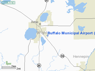
Buffalo Municipal Airport (ICAO: KCFE, FAA LID: CFE) is a city-owned, public-use airport located two miles (3 km) southeast of the central business district of Buffalo, a city in Wright County, Minnesota, United States.
Although most U.S. airports use the same three-letter location identifier for the FAA and IATA, Buffalo Municipal Airport is assigned CFE by the FAA but has no designation from the IATA (which assigned CFE to Clermont-Ferrand Auvergne Airport in Clermont-Ferrand, Auvergne, France).
Facilities and aircraft
Buffalo Municipal Airport covers an area of 57 acres (23 ha) and has one runway designated 17/35 with a 2,600 x 60 ft (792 x 18 m) asphalt surface. For the 12-month period ending August 31, 2006, the airport had 22,350 aircraft operations, an average of 61 per day: 98% general aviation, 1% air taxi and 1% military. At that time there were 54 aircraft based at this airport: 98% single-engine and 2% multi-engine.
The above content comes from Wikipedia and is published under free licenses – click here to read more.
Location & QuickFacts
| FAA Information Effective: | 2008-09-25 |
| Airport Identifier: | CFE |
| Airport Status: | Operational |
| Longitude/Latitude: | 093-50-35.8930W/45-09-32.5690N
-93.843304/45.159047 (Estimated) |
| Elevation: | 967 ft / 294.74 m (Surveyed) |
| Land: | 57 acres |
| From nearest city: | 2 nautical miles SE of Buffalo, MN |
| Location: | Wright County, MN |
| Magnetic Variation: | 05E (1980) |
Owner & Manager
| Ownership: | Publicly owned |
| Owner: | City Of Buffalo |
| Address: | 212 Central Ave
Buffalo, MN 55313 |
| Phone number: | 612-682-3322 |
| Manager: | Terry Marsh |
| Address: | 1309 Co Rd 134
Buffalo, MN 55313 |
| Phone number: | 612-682-5452 |
Airport Operations and Facilities
| Airport Use: | Open to public |
| Wind indicator: | Yes |
| Segmented Circle: | No |
| Control Tower: | No |
| Lighting Schedule: | DUSK-DAWN |
| Beacon Color: | Clear-Green (lighted land airport) |
| Landing fee charge: | No |
| Sectional chart: | Twin Cities |
| Region: | AGL - Great Lakes |
| Traffic Pattern Alt: | 830 ft |
| Boundary ARTCC: | ZMP - Minneapolis |
| Tie-in FSS: | PNM - Princeton |
| FSS on Airport: | No |
| FSS Toll Free: | 1-800-WX-BRIEF |
| NOTAMs Facility: | CFE (NOTAM-d service avaliable) |
| Federal Agreements: | NY1 |
Airport Communications
| CTAF: | 122.800 |
| Unicom: | 122.800 |
Airport Services
| Fuel available: | 100LL
FUEL AVAIL 24 HRS W CREDIT CARD. |
| Airframe Repair: | MAJOR |
| Power Plant Repair: | MAJOR |
| Bottled Oxygen: | NONE |
| Bulk Oxygen: | NONE |
Runway Information
Runway 17/35
| Dimension: | 2600 x 60 ft / 792.5 x 18.3 m |
| Surface: | ASPH, Good Condition |
| Edge Lights: | Low
RWY 17/35 NON STD LIGHTS: SPACING. |
| |
Runway 17 |
Runway 35 |
| Longitude: | 093-50-35.6630W | 093-50-36.1370W |
| Latitude: | 45-09-45.4060N | 45-09-19.7350N |
| Elevation: | 967.00 ft | 954.00 ft |
| Alignment: | 127 | 1 |
| Traffic Pattern: | Left | Left |
| Markings: | Non-precision instrument, Good Condition | Non-precision instrument, Good Condition |
| Runway End Identifier: | No | No |
| Centerline Lights: | No | No |
| Touchdown Lights: | No | No |
| Obstruction: | 72 ft pole, 1800.0 ft from runway, 260 ft left of centerline, 22:1 slope to clear | 8 ft trees, 300.0 ft from runway, 70 ft left of centerline, 12:1 slope to clear |
|
Radio Navigation Aids
| ID |
Type |
Name |
Ch |
Freq |
Var |
Dist |
| GYL | NDB | Glencoe | | 407.00 | 03E | 26.1 nm |
| PNM | NDB | Princeton | | 368.00 | 03E | 26.3 nm |
| HCD | NDB | Hutchinson | | 209.00 | 04E | 29.3 nm |
| CBG | NDB | Cambridge | | 350.00 | 03E | 34.3 nm |
| MS | NDB | Narco | | 266.00 | 02E | 37.7 nm |
| PPI | NDB | Hopey | | 400.00 | 03E | 42.0 nm |
| ROS | NDB | Rush City | | 282.00 | 02E | 49.5 nm |
| OEO | NDB | Osceola | | 233.00 | 01E | 49.7 nm |
| STC | VOR/DME | St Cloud | 058X | 112.10 | 03E | 25.2 nm |
| FCM | VOR/DME | Flying Cloud | 055X | 111.80 | 06E | 25.9 nm |
| MSP | VOR/DME | Minneapolis | 100X | 115.30 | 02E | 30.2 nm |
| GEP | VORTAC | Gopher | 120X | 117.30 | 06E | 19.9 nm |
| DWN | VORTAC | Darwin | 027X | 109.00 | 07E | 26.2 nm |
| FGT | VORTAC | Farmington | 104X | 115.70 | 06E | 42.4 nm |
| MSP | VOT | Minneapolis St Paul | | 111.00 | | 31.4 nm |
| STP | VOT | St Paul | | 114.40 | | 35.8 nm |
Remarks
- ULTRALIGHT TFC ON & INVOF ARPT.
- GCO AVBL ON FREQ 121.725 THRU MSP CD & FLT SVCS.
Images and information placed above are from
http://www.airport-data.com/airport/CFE/
We thank them for the data!
| General Info
|
| Country |
United States
|
| State |
MINNESOTA
|
| FAA ID |
CFE
|
| Latitude |
45-09-32.569N
|
| Longitude |
093-50-35.893W
|
| Elevation |
967 feet
|
| Near City |
BUFFALO
|
We don't guarantee the information is fresh and accurate. The data may
be wrong or outdated.
For more up-to-date information please refer to other sources.
|
|


