 |
|
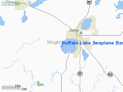
Buffalo Lake Seaplane Base |
Location & QuickFacts
| FAA Information Effective: | 2008-09-25 |
| Airport Identifier: | MN29 |
| Airport Status: | Operational |
| Longitude/Latitude: | 093-54-38.9020W/45-09-43.8700N
-93.910806/45.162186 (Estimated) |
| Elevation: | 915 ft / 278.89 m (Estimated) |
| Land: | 1500 acres |
| From nearest city: | 2 nautical miles SW of Buffalo, MN |
| Location: | Wright County, MN |
| Magnetic Variation: | 04E (1990) |
Owner & Manager
| Ownership: | Privately owned |
| Owner: | Don Kramer |
| Address: | 816 Barton Ave Nw
Buffalo, MN 55313 |
| Phone number: | 612-682-1544 |
| Manager: | Don Kramer |
| Address: | 816 Barton Ave Nw
Buffalo, MN 55313 |
| Phone number: | 612-682-1544 |
Airport Operations and Facilities
| Airport Use: | Private |
| Segmented Circle: | No |
| Control Tower: | No |
| Sectional chart: | Twin Cities |
| Region: | AGL - Great Lakes |
| Boundary ARTCC: | ZMP - Minneapolis |
| Tie-in FSS: | PNM - Princeton |
| FSS on Airport: | No |
| FSS Toll Free: | 1-800-WX-BRIEF |
Runway Information
Runway 09/27
| Dimension: | 4000 x 300 ft / 1219.2 x 91.4 m |
| Surface: | WATER, |
| |
Runway 09 |
Runway 27 |
| Traffic Pattern: | Left | Left |
|
Runway 18/36
| Dimension: | 4000 x 300 ft / 1219.2 x 91.4 m |
| Surface: | WATER, |
| |
Runway 18 |
Runway 36 |
| Traffic Pattern: | Left | Left |
|
Radio Navigation Aids
| ID |
Type |
Name |
Ch |
Freq |
Var |
Dist |
| GYL | NDB | Glencoe | | 407.00 | 03E | 25.2 nm |
| HCD | NDB | Hutchinson | | 209.00 | 04E | 27.2 nm |
| PNM | NDB | Princeton | | 368.00 | 03E | 27.4 nm |
| CBG | NDB | Cambridge | | 350.00 | 03E | 36.3 nm |
| MS | NDB | Narco | | 266.00 | 02E | 40.3 nm |
| PPI | NDB | Hopey | | 400.00 | 03E | 44.7 nm |
| STC | VOR/DME | St Cloud | 058X | 112.10 | 03E | 24.1 nm |
| FCM | VOR/DME | Flying Cloud | 055X | 111.80 | 06E | 28.0 nm |
| MSP | VOR/DME | Minneapolis | 100X | 115.30 | 02E | 32.8 nm |
| GEP | VORTAC | Gopher | 120X | 117.30 | 06E | 22.8 nm |
| DWN | VORTAC | Darwin | 027X | 109.00 | 07E | 23.5 nm |
| FGT | VORTAC | Farmington | 104X | 115.70 | 06E | 44.5 nm |
| MSP | VOT | Minneapolis St Paul | | 111.00 | | 34.0 nm |
| STP | VOT | St Paul | | 114.40 | | 38.5 nm |
Remarks
- PROVIDED A 20:1 APCH OVER OBSTRUCTIONS & REFERENCE FAR 91.115.
Images and information placed above are from
http://www.airport-data.com/airport/MN29/
We thank them for the data!
| General Info
|
| Country |
United States
|
| State |
MINNESOTA
|
| FAA ID |
MN29
|
| Latitude |
45-09-43.870N
|
| Longitude |
093-54-38.902W
|
| Elevation |
915 feet
|
| Near City |
BUFFALO
|
We don't guarantee the information is fresh and accurate. The data may
be wrong or outdated.
For more up-to-date information please refer to other sources.
|
|


