 |
|
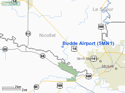
Location & QuickFacts
| FAA Information Effective: | 2008-09-25 |
| Airport Identifier: | 5MN1 |
| Airport Status: | Operational |
| Longitude/Latitude: | 094-06-47.8520W/44-12-01.8780N
-94.113292/44.200522 (Estimated) |
| Elevation: | 975 ft / 297.18 m (Estimated) |
| Land: | 0 acres |
| From nearest city: | 3 nautical miles NW of Mankato, MN |
| Location: | Nicollet County, MN |
| Magnetic Variation: | 04E (1985) |
Owner & Manager
| Ownership: | Privately owned |
| Owner: | Dean E. Budde |
| Address: | 42332- 520th Street
North Mankato, MN 56003 |
| Phone number: | 507-947-3714 |
| Manager: | Dean E. Budde |
| Address: | 42332- 520th Street
North Mankato, MN 56003 |
| Phone number: | 507-947-3714 |
Airport Operations and Facilities
| Airport Use: | Private |
| Wind indicator: | Yes |
| Segmented Circle: | No |
| Control Tower: | No |
| Landing fee charge: | No |
| Sectional chart: | Omaha |
| Region: | AGL - Great Lakes |
| Boundary ARTCC: | ZMP - Minneapolis |
| Tie-in FSS: | PNM - Princeton |
| FSS on Airport: | No |
| FSS Toll Free: | 1-800-WX-BRIEF |
Runway Information
Runway N/S
| Dimension: | 2228 x 50 ft / 679.1 x 15.2 m |
| Surface: | TURF, |
| |
Runway N |
Runway S |
| Traffic Pattern: | Left | Left |
|
Radio Navigation Aids
| ID |
Type |
Name |
Ch |
Freq |
Var |
Dist |
| JYG | NDB | St James | | 260.00 | 04E | 22.9 nm |
| ACQ | NDB | Waseca | | 371.00 | 02E | 25.4 nm |
| GYL | NDB | Glencoe | | 407.00 | 03E | 33.7 nm |
| SBU | NDB | Blue Earth | | 332.00 | 04E | 36.3 nm |
| HCD | NDB | Hutchinson | | 209.00 | 04E | 41.1 nm |
| MWM | NDB | Windom | | 203.00 | 03E | 46.4 nm |
| ULM | NDB/DME | New Ulm | 050X | 272.00 | 04E | 18.0 nm |
| MKT | VOR/DME | Mankato | 045X | 110.80 | 07E | 8.7 nm |
| FOW | VOR/DME | Halfway | 049X | 111.20 | 02E | 32.0 nm |
| FRM | VOR/DME | Fairmont | 039X | 110.20 | 07E | 35.9 nm |
| AEL | VOR/DME | Albert Lea | 035X | 109.80 | 05E | 44.8 nm |
| RWF | VOR/DME | Redwood Falls | 080X | 113.30 | 07E | 46.5 nm |
| FCM | VOR/DME | Flying Cloud | 055X | 111.80 | 06E | 46.9 nm |
| FGT | VORTAC | Farmington | 104X | 115.70 | 06E | 47.6 nm |
Images and information placed above are from
http://www.airport-data.com/airport/5MN1/
We thank them for the data!
| General Info
|
| Country |
United States
|
| State |
MINNESOTA
|
| FAA ID |
5MN1
|
| Latitude |
44-12-01.878N
|
| Longitude |
094-06-47.852W
|
| Elevation |
975 feet
|
| Near City |
MANKATO
|
We don't guarantee the information is fresh and accurate. The data may
be wrong or outdated.
For more up-to-date information please refer to other sources.
|
|


