 |
|
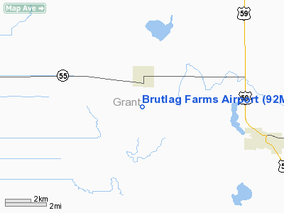
Location & QuickFacts
| FAA Information Effective: | 2008-09-25 |
| Airport Identifier: | 92MN |
| Airport Status: | Operational |
| Longitude/Latitude: | 096-06-06.2070W/46-00-51.8550N
-96.101724/46.014404 (Estimated) |
| Elevation: | 1127 ft / 343.51 m (Surveyed) |
| Land: | 0 acres |
| From nearest city: | 2 nautical miles S of Wendell, MN |
| Location: | Grant County, MN |
| Magnetic Variation: | 05E (1985) |
Owner & Manager
| Ownership: | Privately owned |
| Owner: | Paul Brutlag |
| Address: | Rt 1, Box 2
Wendell, MN 56590 |
| Phone number: | 218-458-2112 |
| Manager: | Paul Brutlag |
| Address: | Rt 1, Box 2
Wendell, MN 56590 |
| Phone number: | 218-458-2113 |
Airport Operations and Facilities
| Airport Use: | Private |
| Wind indicator: | No |
| Segmented Circle: | No |
| Control Tower: | No |
| Landing fee charge: | No |
| Sectional chart: | Twin Cities |
| Region: | AGL - Great Lakes |
| Boundary ARTCC: | ZMP - Minneapolis |
| Tie-in FSS: | PNM - Princeton |
| FSS on Airport: | No |
| FSS Toll Free: | 1-800-WX-BRIEF |
Airport Services
Runway Information
Runway 17/35
| Dimension: | 3100 x 60 ft / 944.9 x 18.3 m |
| Surface: | TURF, |
| |
Runway 17 |
Runway 35 |
| Traffic Pattern: | Left | Left |
|
Radio Navigation Aids
| ID |
Type |
Name |
Ch |
Freq |
Var |
Dist |
| ETH | NDB | Wheaton | | 326.00 | 05E | 23.2 nm |
| BWP | NDB | Breckenridge-wahpeton | | 233.00 | 05E | 25.1 nm |
| EE | NDB | Tamie | | 374.00 | 04E | 35.9 nm |
| GHW | NDB | Glenwood | | 346.00 | 03E | 39.6 nm |
| VVV | NDB | Ortonville | | 332.00 | 05E | 44.9 nm |
| BBB | NDB | Benson | | 239.00 | 05E | 45.5 nm |
| AQP | NDB | Appleton | | 356.00 | 05E | 47.4 nm |
| FFM | VOR/DME | Fergus Falls | 041X | 110.40 | 05E | 16.7 nm |
| MOX | VOR/DME | Morris | 033X | 109.60 | 05E | 27.5 nm |
| AXN | VOR/DME | Alexandria | 075X | 112.80 | 07E | 36.5 nm |
| DTL | VOR/DME | Detroit Lakes | 049X | 111.20 | 05E | 49.6 nm |
Images and information placed above are from
http://www.airport-data.com/airport/92MN/
We thank them for the data!
| General Info
|
| Country |
United States
|
| State |
MINNESOTA
|
| FAA ID |
92MN
|
| Latitude |
46-00-51.855N
|
| Longitude |
096-06-06.207W
|
| Elevation |
1127 feet
|
| Near City |
WENDELL
|
We don't guarantee the information is fresh and accurate. The data may
be wrong or outdated.
For more up-to-date information please refer to other sources.
|
|


