 |
|
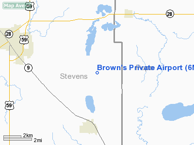
Location & QuickFacts
| FAA Information Effective: | 2008-09-25 |
| Airport Identifier: | 6MN2 |
| Airport Status: | Operational |
| Longitude/Latitude: | 095-47-00.4300W/45-33-13.9500N
-95.783453/45.553875 (Estimated) |
| Elevation: | 1175 ft / 358.14 m (Estimated) |
| Land: | 0 acres |
| From nearest city: | 3 nautical miles N of Hancock, MN |
| Location: | Stevens County, MN |
| Magnetic Variation: | 05E (1985) |
Owner & Manager
| Ownership: | Privately owned |
| Owner: | Marvin W. Brown |
| Address: | 24430 County Rd. 1
Hancock, MN 56244 |
| Phone number: | 320-392-5869 |
| Manager: | Mary Joe Brown |
| Address: | 24430 County Rd. 1
Hancock, MN 56244 |
| Phone number: | 320-392-5869 |
Airport Operations and Facilities
| Airport Use: | Private |
| Wind indicator: | Yes |
| Segmented Circle: | No |
| Control Tower: | No |
| Sectional chart: | Twin Cities |
| Region: | AGL - Great Lakes |
| Boundary ARTCC: | ZMP - Minneapolis |
| Tie-in FSS: | PNM - Princeton |
| FSS on Airport: | No |
| FSS Toll Free: | 1-800-WX-BRIEF |
Runway Information
Runway N/S
| Dimension: | 2100 x 100 ft / 640.1 x 30.5 m |
| Surface: | TURF, |
| |
Runway N |
Runway S |
| Traffic Pattern: | Left | Left |
|
Radio Navigation Aids
| ID |
Type |
Name |
Ch |
Freq |
Var |
Dist |
| BBB | NDB | Benson | | 239.00 | 05E | 14.7 nm |
| GHW | NDB | Glenwood | | 346.00 | 03E | 20.3 nm |
| AQP | NDB | Appleton | | 356.00 | 05E | 21.8 nm |
| EE | NDB | Tamie | | 374.00 | 04E | 24.6 nm |
| VVV | NDB | Ortonville | | 332.00 | 05E | 30.9 nm |
| ETH | NDB | Wheaton | | 326.00 | 05E | 34.9 nm |
| DXX | NDB | Dawson/madison | | 341.00 | 06E | 38.1 nm |
| MOX | VOR/DME | Morris | 033X | 109.60 | 05E | 7.9 nm |
| AXN | VOR/DME | Alexandria | 075X | 112.80 | 07E | 33.5 nm |
| MVE | VOR/DME | Montevideo | 053X | 111.60 | 05E | 35.1 nm |
| BDH | VOR/DME | Willmar | 84X | 113.70 | 04E | 38.2 nm |
| ILL | VOR/DME | Willmar | 084X | 113.70 | 04E | 39.3 nm |
| FFM | VOR/DME | Fergus Falls | 041X | 110.40 | 05E | 46.9 nm |
Remarks
- PILOT LOUNGE WITH RESTROOMS & PHONE EOR 28.
- TIE DOWNS AVAIL.
Images and information placed above are from
http://www.airport-data.com/airport/6MN2/
We thank them for the data!
| General Info
|
| Country |
United States
|
| State |
MINNESOTA
|
| FAA ID |
6MN2
|
| Latitude |
45-32-43.859N
|
| Longitude |
095-46-46.170W
|
| Elevation |
1175 feet
|
| Near City |
HANCOCK
|
We don't guarantee the information is fresh and accurate. The data may
be wrong or outdated.
For more up-to-date information please refer to other sources.
|
|


