 |
|
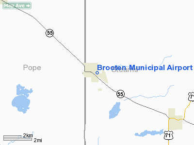
Brooten Municipal Airport |
Location & QuickFacts
| FAA Information Effective: | 2008-09-25 |
| Airport Identifier: | 6D1 |
| Airport Status: | Operational |
| Longitude/Latitude: | 095-06-46.0790W/45-29-59.8710N
-95.112800/45.499964 (Estimated) |
| Elevation: | 1305 ft / 397.76 m (Estimated) |
| Land: | 225 acres |
| From nearest city: | 1 nautical miles SE of Brooten, MN |
| Location: | Stearns County, MN |
| Magnetic Variation: | 05E (1985) |
Owner & Manager
| Ownership: | Publicly owned |
| Owner: | City Of Brooten |
| Address: | 120 Central Ave No, Po Box 81
Brooten, MN 56316 |
| Phone number: | 612-346-2524 |
| Manager: | David Bohmer |
| Address: | 1010 Front Street, Po Box 9
Brooten, MN 56316 |
| Phone number: | 320-346-2234 |
Airport Operations and Facilities
| Airport Use: | Open to public |
| Wind indicator: | Yes |
| Segmented Circle: | No |
| Control Tower: | No |
| Lighting Schedule: | DUSK-DAWN |
| Beacon Color: | Clear-Green (lighted land airport) |
| Landing fee charge: | No |
| Sectional chart: | Twin Cities |
| Region: | AGL - Great Lakes |
| Boundary ARTCC: | ZMP - Minneapolis |
| Tie-in FSS: | PNM - Princeton |
| FSS on Airport: | No |
| FSS Toll Free: | 1-800-WX-BRIEF |
| NOTAMs Facility: | PNM (NOTAM-d service avaliable) |
Airport Communications
Airport Services
Runway Information
Runway 15/33
| Dimension: | 3500 x 60 ft / 1066.8 x 18.3 m |
| Surface: | ASPH, Fair Condition |
| Edge Lights: | Low |
| |
Runway 15 |
Runway 33 |
| Longitude: | 095-06-27.3400W | 095-06-02.9700W |
| Latitude: | 45-30-04.3800N | 45-29-34.3700N |
| Elevation: | 1295.00 ft | 1304.00 ft |
| Traffic Pattern: | Left | Left |
| Markings: | Basic, Good Condition | Basic, Fair Condition |
| Runway End Identifier: | No | No |
| Centerline Lights: | No | No |
| Touchdown Lights: | No | No |
| Obstruction: | 36 ft trees, 1040.0 ft from runway, 100 ft left of centerline, 23:1 slope to clear | 32 ft tree, 1450.0 ft from runway, 110 ft left of centerline, 39:1 slope to clear |
|
Radio Navigation Aids
| ID |
Type |
Name |
Ch |
Freq |
Var |
Dist |
| GHW | NDB | Glenwood | | 346.00 | 03E | 12.3 nm |
| EE | NDB | Tamie | | 374.00 | 04E | 19.3 nm |
| BBB | NDB | Benson | | 239.00 | 05E | 24.9 nm |
| AQP | NDB | Appleton | | 356.00 | 05E | 41.2 nm |
| LXL | NDB | Little Falls | | 359.00 | 03E | 42.2 nm |
| XCR | NDB | Ripley | | 404.00 | 03E | 47.4 nm |
| HCD | NDB | Hutchinson | | 209.00 | 04E | 49.5 nm |
| RYM | TACAN | Camp Ripley | 048X | | 03E | 47.7 nm |
| BDH | VOR/DME | Willmar | 84X | 113.70 | 04E | 23.0 nm |
| ILL | VOR/DME | Willmar | 084X | 113.70 | 04E | 23.0 nm |
| AXN | VOR/DME | Alexandria | 075X | 112.80 | 07E | 28.0 nm |
| MOX | VOR/DME | Morris | 033X | 109.60 | 05E | 36.3 nm |
| MVE | VOR/DME | Montevideo | 053X | 111.60 | 05E | 40.6 nm |
| STC | VOR/DME | St Cloud | 058X | 112.10 | 03E | 44.5 nm |
| DWN | VORTAC | Darwin | 027X | 109.00 | 07E | 37.3 nm |
Remarks
- ULTRALIGHTS ON & INVOF ARPT.
- PRVDD RWY ENDS ARE ESTBD OR THRS DSPLCD TO PRVD 20:1 CLRNC OVR OBS IN APP SFC.
Images and information placed above are from
http://www.airport-data.com/airport/6D1/
We thank them for the data!
| General Info
|
| Country |
United States
|
| State |
MINNESOTA
|
| FAA ID |
6D1
|
| Latitude |
45-29-59.871N
|
| Longitude |
095-06-46.079W
|
| Elevation |
1305 feet
|
| Near City |
BROOTEN
|
We don't guarantee the information is fresh and accurate. The data may
be wrong or outdated.
For more up-to-date information please refer to other sources.
|
|


