 |
|
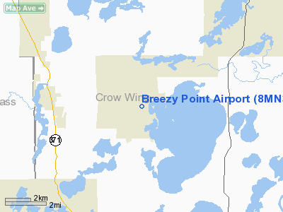
Location & QuickFacts
| FAA Information Effective: | 2008-09-25 |
| Airport Identifier: | 8MN3 |
| Airport Status: | Operational |
| Longitude/Latitude: | 094-13-12.0000W/46-35-45.0000N
-94.220000/46.595833 (Estimated) |
| Elevation: | 1255 ft / 382.52 m (Estimated) |
| Land: | 0 acres |
| From nearest city: | 3 nautical miles E of Pequot Lakes, MN |
| Location: | Crow Wing County, MN |
| Magnetic Variation: | 04E (1985) |
Owner & Manager
| Ownership: | Privately owned |
| Owner: | Breezy Point Airport Inc |
| Address: | 527 River Street
Minneapolis, MN 55401 |
| Phone number: | 612-386-3860 |
| Manager: | Richard Andolshek |
| Address: | 527 River Street
Minneapolis, MN 55401 |
| Phone number: | 612-386-3860 |
Airport Operations and Facilities
| Airport Use: | Private |
| Wind indicator: | Yes |
| Segmented Circle: | No |
| Control Tower: | No |
| Landing fee charge: | Yes |
| Sectional chart: | Twin Cities |
| Region: | AGL - Great Lakes |
| Boundary ARTCC: | ZMP - Minneapolis |
| Tie-in FSS: | PNM - Princeton |
| FSS on Airport: | No |
| FSS Toll Free: | 1-800-WX-BRIEF |
Airport Services
| Fuel available: | 100 |
| Airframe Repair: | MAJOR |
| Power Plant Repair: | MAJOR |
| Bottled Oxygen: | NONE |
| Bulk Oxygen: | NONE |
Runway Information
Runway 17/35
| Dimension: | 2300 x 50 ft / 701.0 x 15.2 m |
| Surface: | ASPH, |
| |
Runway 17 |
Runway 35 |
| Traffic Pattern: | Left | Left |
| Displaced threshold: | 0.00 ft | 246.00 ft |
| Runway End Identifier: | No | No |
| Centerline Lights: | No | No |
| Touchdown Lights: | No | No |
| Obstruction: | 58 ft trees, 812.0 ft from runway, 14:1 slope to clear | 14 ft trees, 221.0 ft from runway, 12:1 slope to clear
ACFT TIE-DOWN JUST OFF RWY. |
|
Radio Navigation Aids
| ID |
Type |
Name |
Ch |
Freq |
Var |
Dist |
| PWC | NDB | Pine River | | 330.00 | 03E | 10.4 nm |
| AIT | NDB | Aitkin | | 397.00 | 03E | 22.7 nm |
| XVG | NDB | Longville | | 392.00 | 04E | 24.0 nm |
| SAZ | NDB | Staples | | 257.00 | 04E | 27.4 nm |
| XCR | NDB | Ripley | | 404.00 | 03E | 31.5 nm |
| PK | NDB | Spida | | 269.00 | 04E | 34.3 nm |
| LXL | NDB | Little Falls | | 359.00 | 03E | 39.1 nm |
| RYM | TACAN | Camp Ripley | 048X | | 03E | 30.9 nm |
| PKD | VOR/DME | Park Rapids | 043X | 110.60 | 04E | 39.5 nm |
| GPZ | VOR/DME | Grand Rapids | 051X | 111.40 | 06E | 45.5 nm |
| BRD | VORTAC | Brainerd | 116X | 116.90 | 03E | 16.9 nm |
Remarks
- SNOW REMOVAL INTERMITTENTLY.
Images and information placed above are from
http://www.airport-data.com/airport/8MN3/
We thank them for the data!
| General Info
|
| Country |
United States
|
| State |
MINNESOTA
|
| FAA ID |
8MN3
|
| Latitude |
46-35-45.000N
|
| Longitude |
094-13-12.000W
|
| Elevation |
1255 feet
|
| Near City |
PEQUOT LAKES
|
We don't guarantee the information is fresh and accurate. The data may
be wrong or outdated.
For more up-to-date information please refer to other sources.
|
|


