 |
|
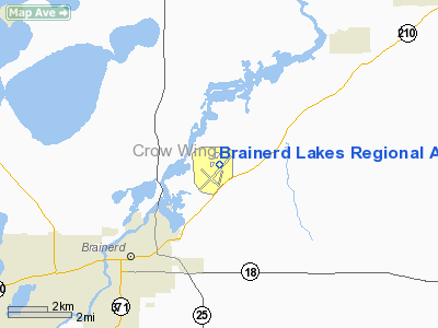
Brainerd Lakes Regional Airport |
| Brainerd Lakes Regional Airport |
| IATA: BRD – ICAO: KBRD |
| Summary |
| Airport type |
Public |
| Operator |
Brainerd / Crow Wing County |
| Location |
Brainerd, Minnesota |
| Elevation AMSL |
1,226 ft / 373.7 m |
| Coordinates |
46°23′54″N 94°08′17″W / 46.39833°N 94.13806°W / 46.39833; -94.13806Coordinates: 46°23′54″N 94°08′17″W / 46.39833°N 94.13806°W / 46.39833; -94.13806 |
| Runways |
| Direction |
Length |
Surface |
| ft |
m |
| 5/23 |
6,500 |
1,981 |
Asphalt/Treated |
| 16/34 |
6,500 |
1,981 |
Concrete |
| 12/30 |
4,080 |
1,244 |
Asphalt |
| Helipads |
| Number |
Length |
Surface |
| ft |
m |
| H1 |
60 |
18 |
Concrete |
Brainerd Lakes Regional Airport (IATA: BRD, ICAO: KBRD, FAA LID: BRD) is a public airport located three miles (5 km) northeast of the central business district (CBD) of Brainerd, a city in Crow Wing County, Minnesota, USA. The airport covers 1,560 acres (631 ha) and has three runways and one helipad. It is mostly used for general aviation but is also served by one commercial airline. Airlines and destinations
| Airlines |
Destinations |
| Delta Connection operated by Mesaba Airlines |
Minneapolis/St. Paul |
Cargo
| Airlines |
Destinations |
| Bemidji Airlines |
Minneapolis/St. Paul |
| FedEx Feeder operated by CSA Air |
Rochester (MN) |
The above content comes from Wikipedia and is published under free licenses – click here to read more.
Location & QuickFacts
| FAA Information Effective: | 2008-09-25 |
| Airport Identifier: | BRD |
| Airport Status: | Operational |
| Longitude/Latitude: | 094-08-08.0000W/46-24-06.3000N
-94.135556/46.401750 (Estimated) |
| Elevation: | 1232 ft / 375.51 m (Surveyed) |
| Land: | 1560 acres |
| From nearest city: | 3 nautical miles NE of Brainerd, MN |
| Location: | Crow Wing County, MN |
| Magnetic Variation: | 03E (1995) |
Owner & Manager
| Ownership: | Publicly owned |
| Owner: | Brainerd/crow Wing Cnty |
| Address: | 16384 Airport Rd, Suite 5
Brainerd, MN 56401 |
| Phone number: | 218-825-2166 |
| Manager: | Steve D. Sievek |
| Address: | Brainerd Lakes Regional Arpt, 16384 Airport Rd Suite 5
Brainerd, MN 56401 |
| Phone number: | 218-825-2166 |
Airport Operations and Facilities
| Airport Use: | Open to public |
| Wind indicator: | Yes |
| Segmented Circle: | Yes |
| Control Tower: | No |
| Lighting Schedule: | DUSK-DAWN
HIRL RY 05/23, 16/34 PRESET ON LOW INTST; TO INCR INTST & ACTVT MIRL RY 12/30 REIL RYS 05, 16, 30 & MALSR RY 23 & 34-CTAF. RY H1 PERIMETER LGT OPER DUSK-DAWN. |
| Beacon Color: | Clear-Green (lighted land airport) |
| Landing fee charge: | No |
| Sectional chart: | Twin Cities |
| Region: | AGL - Great Lakes |
| Traffic Pattern Alt: | 1000 ft |
| Boundary ARTCC: | ZMP - Minneapolis |
| Tie-in FSS: | PNM - Princeton |
| FSS on Airport: | No |
| FSS Toll Free: | 1-800-WX-BRIEF |
| NOTAMs Facility: | BRD (NOTAM-d service avaliable) |
| Certification type/date: | I A S 05/1973
PPR FOR UNSKED ACR OPNS WITH MORE THAN 30 PSGR SEATS CALL AMGR (218) 825-2166 BTN HRS 0800-1700. RWY12/30 NOT AVBL FOR ACR OPNS WITH MORE THAN 9 PSGR SEATS. |
| Federal Agreements: | NGY |
Airport Communications
| CTAF: | 122.700 |
| Unicom: | 122.700 |
Airport Services
| Fuel available: | 100LLA MOGAS |
| Airframe Repair: | MAJOR |
| Power Plant Repair: | MAJOR |
| Bottled Oxygen: | NONE |
| Bulk Oxygen: | NONE |
Runway Information
Runway 05/23
| Dimension: | 6514 x 150 ft / 1985.5 x 45.7 m |
| Surface: | ASPH-TRTD, Good Condition |
| Weight Limit: | Single wheel: 75000 lbs.
Dual wheel: 125000 lbs.
Dual tandem wheel: 220000 lbs. |
| Edge Lights: | High |
| |
Runway 05 |
Runway 23 |
| Longitude: | 094-08-46.7640W | 094-07-32.0153W |
| Latitude: | 46-23-40.6686N | 46-24-18.8794N |
| Elevation: | 1220.00 ft | 1222.00 ft |
| Alignment: | 54 | 127 |
| ILS Type: | | ILS
|
| Traffic Pattern: | Left | Left |
| Markings: | Precision instrument, Good Condition | Precision instrument, Good Condition |
| Crossing Height: | 46.00 ft | 50.00 ft |
| VASI: | 4-box on left side | 4-light PAPI on left side |
| Visual Glide Angle: | 3.00° | 3.00° |
| Approach lights: | | MALSR |
| Runway End Identifier: | Yes | No |
| Centerline Lights: | No | No |
| Touchdown Lights: | No | No |
| Obstruction: | 79 ft tree, 3174.0 ft from runway, 561 ft left of centerline, 37:1 slope to clear | 68 ft trees, 2803.0 ft from runway, 800 ft left of centerline, 38:1 slope to clear |
|
Runway 12/30
| Dimension: | 4080 x 75 ft / 1243.6 x 22.9 m |
| Surface: | ASPH, Fair Condition |
| Weight Limit: | Single wheel: 12000 lbs. |
| Edge Lights: | Medium |
| |
Runway 12 |
Runway 30 |
| Longitude: | 094-08-53.0571W | 094-08-05.7212W |
| Latitude: | 46-23-56.2821N | 46-23-32.8505N |
| Elevation: | 1227.00 ft | 1225.00 ft |
| Alignment: | 126 | 127 |
| Traffic Pattern: | Left | Left |
| Markings: | Non-precision instrument, Good Condition | Non-precision instrument, Good Condition |
| Crossing Height: | 27.00 ft | 26.00 ft |
| Displaced threshold: | 520.00 ft | 571.00 ft |
| VASI: | 4-box on left side | 4-box on left side |
| Visual Glide Angle: | 3.00° | 3.00° |
| Runway End Identifier: | No | Yes |
| Centerline Lights: | No | No |
| Touchdown Lights: | No | No |
| Obstruction: | 96 ft trees, 2301.0 ft from runway, 451 ft left of centerline, 21:1 slope to clear
APCH RATIO 28:1 AT DSPLCD THLD. | 17 ft road, 339.0 ft from runway, 241 ft left of centerline, 8:1 slope to clear
APCH RATIO 41:1 AT DSPLCD THR. |
|
Runway 16/34
| Dimension: | 6500 x 150 ft / 1981.2 x 45.7 m |
| Surface: | CONC, |
| Surface Treatment: | Saw-cut or plastic Grooved |
| Weight Limit: | Single wheel: 75000 lbs.
Dual wheel: 125000 lbs.
Dual tandem wheel: 220000 lbs. |
| Edge Lights: | High |
| |
Runway 16 |
Runway 34 |
| Longitude: | 094-08-07.1540W | 094-07-39.4975W |
| Latitude: | 46-24-57.1530N | 46-23-55.9114N |
| Elevation: | 1226.00 ft | 1232.00 ft |
| Alignment: | 127 | 127 |
| ILS Type: | | LOC/GS |
| Traffic Pattern: | Left | Left |
| Markings: | Precision instrument, Good Condition | Precision instrument, Good Condition |
| Crossing Height: | 45.00 ft | 57.00 ft |
| VASI: | 4-light PAPI on left side | 4-light PAPI on right side |
| Visual Glide Angle: | 3.00° | 3.00° |
| Approach lights: | | MALSR |
| Runway End Identifier: | Yes | |
| Touchdown Lights: | No | |
|
Helipad H1
| Dimension: | 60 x 60 ft / 18.3 x 18.3 m |
| Surface: | CONC, Good Condition |
| Edge Lights: | Medium |
| |
Runway H1 |
Runway |
| Traffic Pattern: | Left | Left |
| Markings: | Basic, Good Condition | , |
|
Radio Navigation Aids
| ID |
Type |
Name |
Ch |
Freq |
Var |
Dist |
| AIT | NDB | Aitkin | | 397.00 | 03E | 21.0 nm |
| XCR | NDB | Ripley | | 404.00 | 03E | 21.3 nm |
| PWC | NDB | Pine River | | 330.00 | 03E | 22.1 nm |
| SAZ | NDB | Staples | | 257.00 | 04E | 27.8 nm |
| LXL | NDB | Little Falls | | 359.00 | 03E | 28.5 nm |
| XVG | NDB | Longville | | 392.00 | 04E | 35.7 nm |
| PK | NDB | Spida | | 269.00 | 04E | 43.3 nm |
| JMR | NDB | Mora | | 327.00 | 03E | 47.4 nm |
| RYM | TACAN | Camp Ripley | 048X | | 03E | 20.8 nm |
| PKD | VOR/DME | Park Rapids | 043X | 110.60 | 04E | 48.8 nm |
| BRD | VORTAC | Brainerd | 116X | 116.90 | 03E | 5.6 nm |
Remarks
- DEER AND GULLS ON & INVOF ARPT.
- ACR OPNS INVOLVING ACFT WITH MORE THAN 30 PSGRS ARE NOT AUZD IN EXCESS OF 15 MINS BEFORE OR AFTER SKEDD ARR/DEP TIMES WITHOUT PRIOR COORDINATION WITH AMGR AND CFMN THAT ARFF IS AVBL PRIOR TO LANDING OR TAKEOFF.
Images and information placed above are from
http://www.airport-data.com/airport/BRD/
We thank them for the data!
| General Info
|
| Country |
United States
|
| State |
MINNESOTA
|
| FAA ID |
BRD
|
| Latitude |
46-23-52.289N
|
| Longitude |
094-08-14.019W
|
| Elevation |
1226 feet
|
| Near City |
BRAINERD
|
We don't guarantee the information is fresh and accurate. The data may
be wrong or outdated.
For more up-to-date information please refer to other sources.
|
|


