|
|
|
 |
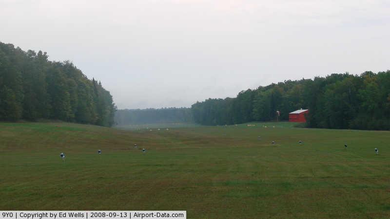
(Click on the photo to enlarge) |
|
 |
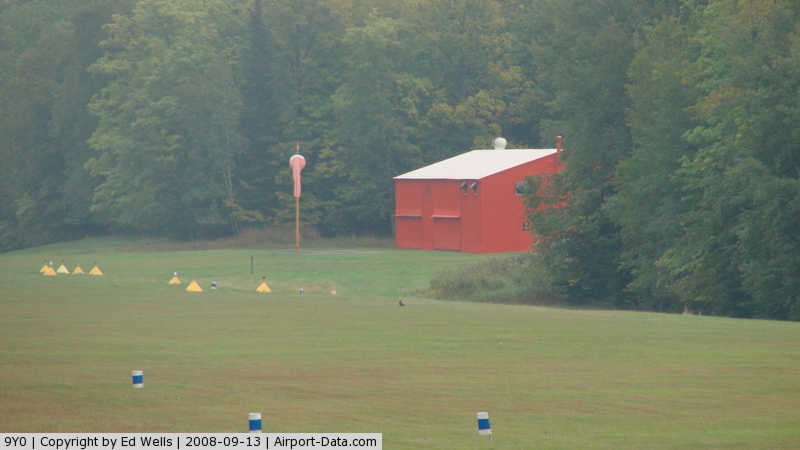
(Click on the photo to enlarge) |
|
 |
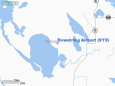
(Click on the photo to enlarge) |
|
 |
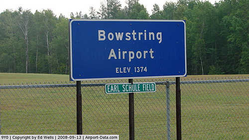
(Click on the photo to enlarge) |
Location & QuickFacts
| FAA Information Effective: | 2008-09-25 |
| Airport Identifier: | 9Y0 |
| Airport Status: | Operational |
| Longitude/Latitude: | 093-52-12.9000W/47-33-29.4000N
-93.870250/47.558167 (Estimated) |
| Elevation: | 1372 ft / 418.19 m (Estimated) |
| Land: | 80 acres |
| From nearest city: | 2 nautical miles NW of Bowstring, MN |
| Location: | Itasca County, MN |
| Magnetic Variation: | 03E (1985) |
Owner & Manager
| Ownership: | Publicly owned |
| Owner: | Itasca County |
| Address: | Po Box 4
Bowstring, MN 56631 |
| Phone number: | 218-832-3567
COUNTY ENGINEER LEE ENGSTROM. |
| Manager: | Jim Petersen |
| Address: | 42411 Little Turtle Road
Bigfork, MN 56628 |
| Phone number: | 218-832-3304 |
Airport Operations and Facilities
| Airport Use: | Open to public |
| Wind indicator: | Yes |
| Segmented Circle: | No |
| Control Tower: | No |
| Lighting Schedule: | DUSK-DAWN |
| Landing fee charge: | No |
| Sectional chart: | Twin Cities |
| Region: | AGL - Great Lakes |
| Boundary ARTCC: | ZMP - Minneapolis |
| Tie-in FSS: | PNM - Princeton |
| FSS on Airport: | No |
| FSS Toll Free: | 1-800-WX-BRIEF |
| NOTAMs Facility: | PNM (NOTAM-d service avaliable) |
| Federal Agreements: | S |
Airport Communications
Airport Services
| Airframe Repair: | NONE |
| Power Plant Repair: | NONE |
| Bottled Oxygen: | NONE |
| Bulk Oxygen: | NONE |
Runway Information
Runway 07/25
| Dimension: | 2700 x 150 ft / 823.0 x 45.7 m |
| Surface: | TURF, Good Condition |
| Edge Lights: | Low |
| |
Runway 07 |
Runway 25 |
| Longitude: | 093-52-32.3200W | 093-51-53.5000W |
| Latitude: | 47-33-27.1400N | 47-33-31.5900N |
| Traffic Pattern: | Left | Left |
| Runway End Identifier: | No | No |
| Centerline Lights: | No | No |
| Touchdown Lights: | No | No |
| Obstruction: | 106 ft trees, 1860.0 ft from runway, 50 ft right of centerline, 17:1 slope to clear | 17 ft trees, 240.0 ft from runway, 120 ft left of centerline, 14:1 slope to clear |
|
Radio Navigation Aids
| ID |
Type |
Name |
Ch |
Freq |
Var |
Dist |
| FOZ | NDB | Bigfork | | 345.00 | 02E | 16.1 nm |
| XVG | NDB | Longville | | 392.00 | 04E | 36.6 nm |
| ORB | NDB | Orr | | 341.00 | 02E | 49.2 nm |
| GPZ | VOR/DME | Grand Rapids | 051X | 111.40 | 06E | 28.4 nm |
| HIB | VOR/DME | Hibbing | 045X | 110.80 | 02E | 49.9 nm |
| BJI | VORTAC | Bemidji | 023X | 108.60 | 04E | 46.8 nm |
Remarks
- ARPT PLOWED WINTER MONTHS.
- DEER ON & INVOF RY.
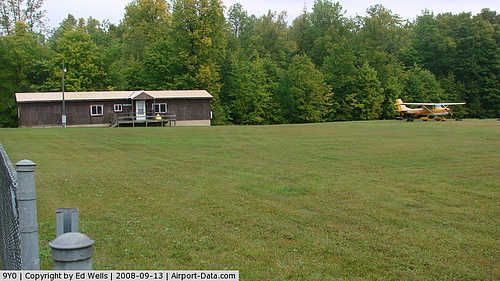
Images and information placed above are from
http://www.airport-data.com/airport/9Y0/
We thank them for the data!
| General Info
|
| Country |
United States
|
| State |
MINNESOTA
|
| FAA ID |
9Y0
|
| Latitude |
47-32-59.814N
|
| Longitude |
093-52-00.761W
|
| Elevation |
1372 feet
|
| Near City |
BOWSTRING
|
We don't guarantee the information is fresh and accurate. The data may
be wrong or outdated.
For more up-to-date information please refer to other sources.
|
|