 |
|
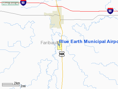
Blue Earth Municipal Airport |
Location & QuickFacts
| FAA Information Effective: | 2008-09-25 |
| Airport Identifier: | SBU |
| Airport Status: | Operational |
| Longitude/Latitude: | 094-05-34.2540W/43-35-43.2380N
-94.092848/43.595344 (Estimated) |
| Elevation: | 1107 ft / 337.41 m (Surveyed) |
| Land: | 257 acres |
| From nearest city: | 3 nautical miles S of Blue Earth, MN |
| Location: | Faribault County, MN |
| Magnetic Variation: | 04E (1985) |
Owner & Manager
| Ownership: | Publicly owned |
| Owner: | City Of Blue Earth |
| Address: | 125 W 6th St
Blue Earth, MN 56013 |
| Phone number: | 507-526-7336 |
| Manager: | Tim Steier |
| Address: | 7575 Hwy 169
Blue Earth, MN 56013 |
| Phone number: | 507-526-7264 |
Airport Operations and Facilities
| Airport Use: | Open to public |
| Wind indicator: | Yes |
| Segmented Circle: | No |
| Control Tower: | No |
| Lighting Schedule: | DUSK-DAWN
ACTVT MIRL RY 16/34 - CTAF. |
| Beacon Color: | Clear-Green (lighted land airport) |
| Landing fee charge: | No |
| Sectional chart: | Omaha |
| Region: | AGL - Great Lakes |
| Traffic Pattern Alt: | 1000 ft |
| Boundary ARTCC: | ZMP - Minneapolis |
| Tie-in FSS: | PNM - Princeton |
| FSS on Airport: | No |
| FSS Toll Free: | 1-800-WX-BRIEF |
| NOTAMs Facility: | PNM (NOTAM-d service avaliable) |
| Federal Agreements: | NGY |
Airport Communications
| CTAF: | 122.800 |
| Unicom: | 122.800 |
Airport Services
| Fuel available: | 100LLA |
| Airframe Repair: | MINOR |
| Power Plant Repair: | MINOR |
| Bottled Oxygen: | NONE |
| Bulk Oxygen: | NONE |
Runway Information
Runway 03/21
| Dimension: | 2280 x 200 ft / 694.9 x 61.0 m |
| Surface: | TURF, Good Condition |
| |
Runway 03 |
Runway 21 |
| Longitude: | 094-05-45.3600W | 094-05-26.7500W |
| Latitude: | 43-35-41.8400N | 43-35-59.8400N |
| Alignment: | 37 | 127 |
| Traffic Pattern: | Left | Left |
| Runway End Identifier: | No | No |
| Centerline Lights: | No | No |
| Touchdown Lights: | No | No |
| Obstruction: | 61 ft trees, 2100.0 ft from runway, 34:1 slope to clear | 19 ft road, 450.0 ft from runway, 23:1 slope to clear |
|
Runway 16/34
| Dimension: | 3399 x 75 ft / 1036.0 x 22.9 m |
| Surface: | ASPH, Fair Condition |
| Edge Lights: | Medium |
| |
Runway 16 |
Runway 34 |
| Longitude: | 094-05-40.5240W | 094-05-25.5630W |
| Latitude: | 43-35-53.9710N | 43-35-22.2140N |
| Elevation: | 1092.00 ft | 1107.00 ft |
| Alignment: | 127 | 127 |
| Traffic Pattern: | Left | Left |
| Markings: | Non-precision instrument, Good Condition | Non-precision instrument, Good Condition |
| Runway End Identifier: | No | No |
| Centerline Lights: | No | No |
| Touchdown Lights: | No | No |
| Obstruction: | 72 ft silo, 2914.0 ft from runway, 618 ft left of centerline, 37:1 slope to clear | 20 ft road, 900.0 ft from runway, 35:1 slope to clear |
|
Radio Navigation Aids
| ID |
Type |
Name |
Ch |
Freq |
Var |
Dist |
| SBU | NDB | Blue Earth | | 332.00 | 04E | 0.2 nm |
| FXY | NDB | Forest City | | 359.00 | 05E | 29.9 nm |
| JYG | NDB | St James | | 260.00 | 04E | 30.8 nm |
| PUF | NDB | Puff | | 345.00 | 04E | 31.7 nm |
| AXA | NDB | Algona | | 403.00 | 03E | 31.9 nm |
| ACQ | NDB | Waseca | | 371.00 | 02E | 36.9 nm |
| MJQ | NDB | Jackson | | 353.00 | 04E | 39.0 nm |
| EGQ | NDB | Emmetsburg | | 410.00 | 04E | 40.0 nm |
| MWM | NDB | Windom | | 203.00 | 03E | 48.0 nm |
| ULM | NDB/DME | New Ulm | 050X | 272.00 | 04E | 46.8 nm |
| EST | VOR | Estherville | | 110.40 | 07E | 30.5 nm |
| FRM | VOR/DME | Fairmont | 039X | 110.20 | 07E | 14.7 nm |
| AEL | VOR/DME | Albert Lea | 035X | 109.80 | 05E | 31.8 nm |
| MKT | VOR/DME | Mankato | 045X | 110.80 | 07E | 38.3 nm |
| FOW | VOR/DME | Halfway | 049X | 111.20 | 02E | 48.2 nm |
| MCW | VORTAC | Mason City | 096X | 114.90 | 06E | 44.9 nm |
Remarks
- RY 03/21 CLSD WINTER MONTHS
- DEER & WATERFOWL ON & INVOF ARPT.
Images and information placed above are from
http://www.airport-data.com/airport/SBU/
We thank them for the data!
| General Info
|
| Country |
United States
|
| State |
MINNESOTA
|
| FAA ID |
SBU
|
| Latitude |
43-35-43.238N
|
| Longitude |
094-05-34.254W
|
| Elevation |
1107 feet
|
| Near City |
BLUE EARTH
|
We don't guarantee the information is fresh and accurate. The data may
be wrong or outdated.
For more up-to-date information please refer to other sources.
|
|


