 |
|
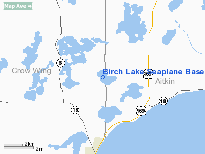
Location & QuickFacts
| FAA Information Effective: | 2008-09-25 |
| Airport Identifier: | M69 |
| Airport Status: | Operational |
| Longitude/Latitude: | 093-48-49.9200W/46-22-10.8500N
-93.813867/46.369681 (Estimated) |
| Elevation: | 1278 ft / 389.53 m (Estimated) |
| Land: | 500 acres |
| From nearest city: | 6 nautical miles NW of Deerwood, MN |
| Location: | Crow Wing County, MN |
| Magnetic Variation: | 03E (1985) |
Owner & Manager
| Ownership: | Privately owned |
| Owner: | Dave Ramsay |
| Address: | 4640 W. 77th St Suite 104
Edina, MN 55435 |
| Phone number: | 952-831-6622 |
| Manager: | Dave Ramsay |
| Address: | 4640 W. 77th St Suite 104
Edina, MN 55435 |
| Phone number: | 952-831-6622 |
Airport Operations and Facilities
| Airport Use: | Open to public |
| Wind indicator: | Yes |
| Segmented Circle: | No |
| Control Tower: | No |
| Landing fee charge: | No |
| Sectional chart: | Twin Cities |
| Region: | AGL - Great Lakes |
| Boundary ARTCC: | ZMP - Minneapolis |
| Tie-in FSS: | PNM - Princeton |
| FSS on Airport: | No |
| FSS Toll Free: | 1-800-WX-BRIEF |
| NOTAMs Facility: | PNM (NOTAM-d service avaliable) |
Airport Communications
Airport Services
Runway Information
Runway 13/31
| Dimension: | 6000 x 2000 ft / 1828.8 x 609.6 m |
| Surface: | WATER, |
| |
Runway 13 |
Runway 31 |
| Traffic Pattern: | Left | Left |
|
Radio Navigation Aids
| ID |
Type |
Name |
Ch |
Freq |
Var |
Dist |
| AIT | NDB | Aitkin | | 397.00 | 03E | 12.1 nm |
| XCR | NDB | Ripley | | 404.00 | 03E | 28.1 nm |
| PWC | NDB | Pine River | | 330.00 | 03E | 31.9 nm |
| LXL | NDB | Little Falls | | 359.00 | 03E | 33.5 nm |
| JMR | NDB | Mora | | 327.00 | 03E | 36.7 nm |
| XVG | NDB | Longville | | 392.00 | 04E | 40.9 nm |
| SAZ | NDB | Staples | | 257.00 | 04E | 41.1 nm |
| MZH | NDB | Moose Lake | | 362.00 | 02E | 41.9 nm |
| PNM | NDB | Princeton | | 368.00 | 03E | 49.1 nm |
| RYM | TACAN | Camp Ripley | 048X | | 03E | 28.0 nm |
| GPZ | VOR/DME | Grand Rapids | 051X | 111.40 | 06E | 49.6 nm |
| BRD | VORTAC | Brainerd | 116X | 116.90 | 03E | 8.9 nm |
Images and information placed above are from
http://www.airport-data.com/airport/M69/
We thank them for the data!
| General Info
|
| Country |
United States
|
| State |
MINNESOTA
|
| FAA ID |
M69
|
| Latitude |
46-22-10.850N
|
| Longitude |
093-48-49.920W
|
| Elevation |
1278 feet
|
| Near City |
DEERWOOD
|
We don't guarantee the information is fresh and accurate. The data may
be wrong or outdated.
For more up-to-date information please refer to other sources.
|
|


