 |
|
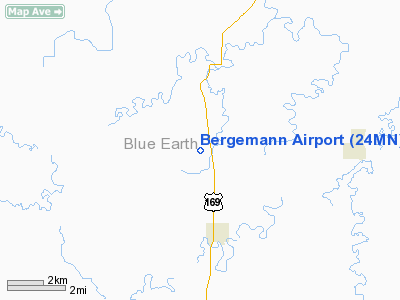
Location & QuickFacts
| FAA Information Effective: | 2008-09-25 |
| Airport Identifier: | 24MN |
| Airport Status: | Operational |
| Longitude/Latitude: | 094-10-40.8470W/44-00-14.8660N
-94.178013/44.004129 (Estimated) |
| Elevation: | 1001 ft / 305.10 m (Surveyed) |
| Land: | 0 acres |
| From nearest city: | 3 nautical miles S of Garden City, MN |
| Location: | Blue Earth County, MN |
| Magnetic Variation: | 04E (1985) |
Owner & Manager
| Ownership: | Privately owned |
| Owner: | Duane Bergemann |
| Address: | Box 132
Garden City, MN 56034 |
| Phone number: | 507-549-3037 |
| Manager: | Duane Bergemann |
| Address: | Box 132
Garden City, MN 56034 |
| Phone number: | 507-549-3037 |
Airport Operations and Facilities
| Airport Use: | Private |
| Wind indicator: | Yes |
| Segmented Circle: | No |
| Control Tower: | No |
| Landing fee charge: | No |
| Sectional chart: | Omaha |
| Region: | AGL - Great Lakes |
| Boundary ARTCC: | ZMP - Minneapolis |
| Tie-in FSS: | PNM - Princeton |
| FSS on Airport: | No |
| FSS Toll Free: | 1-800-WX-BRIEF |
Airport Services
| Fuel available: | 100 |
| Airframe Repair: | NONE |
| Power Plant Repair: | NONE |
Runway Information
Runway N/S
| Dimension: | 2500 x 75 ft / 762.0 x 22.9 m |
| Surface: | TURF, |
| |
Runway N |
Runway S |
| Traffic Pattern: | Left | Left |
|
Radio Navigation Aids
| ID |
Type |
Name |
Ch |
Freq |
Var |
Dist |
| JYG | NDB | St James | | 260.00 | 04E | 16.2 nm |
| SBU | NDB | Blue Earth | | 332.00 | 04E | 24.7 nm |
| ACQ | NDB | Waseca | | 371.00 | 02E | 27.3 nm |
| MWM | NDB | Windom | | 203.00 | 03E | 40.7 nm |
| MJQ | NDB | Jackson | | 353.00 | 04E | 41.1 nm |
| GYL | NDB | Glencoe | | 407.00 | 03E | 45.7 nm |
| PUF | NDB | Puff | | 345.00 | 04E | 46.2 nm |
| ULM | NDB/DME | New Ulm | 050X | 272.00 | 04E | 23.4 nm |
| EST | VOR | Estherville | | 110.40 | 07E | 43.4 nm |
| MKT | VOR/DME | Mankato | 045X | 110.80 | 07E | 17.3 nm |
| FRM | VOR/DME | Fairmont | 039X | 110.20 | 07E | 24.0 nm |
| FOW | VOR/DME | Halfway | 049X | 111.20 | 02E | 36.9 nm |
| AEL | VOR/DME | Albert Lea | 035X | 109.80 | 05E | 40.0 nm |
| RWF | VOR/DME | Redwood Falls | 080X | 113.30 | 07E | 49.5 nm |
Remarks
- LARGE WHITE TANK 1/2 MI NORTHEAST.
- STRIP USED EXTENSIVELY FOR AG SPRAYING APRIL-SEP.
Images and information placed above are from
http://www.airport-data.com/airport/24MN/
We thank them for the data!
| General Info
|
| Country |
United States
|
| State |
MINNESOTA
|
| FAA ID |
24MN
|
| Latitude |
44-00-14.866N
|
| Longitude |
094-10-40.847W
|
| Elevation |
1001 feet
|
| Near City |
GARDEN CITY
|
We don't guarantee the information is fresh and accurate. The data may
be wrong or outdated.
For more up-to-date information please refer to other sources.
|
|


