 |
|
| Bemidji Regional Airport |
 |
| IATA: BJI – ICAO: KBJI – FAA LID: BJI |
| Summary |
| Airport type |
Public |
| Owner |
City of Bemidji / Beltrami County |
| Serves |
Bemidji, Minnesota |
| Elevation AMSL |
1,391 ft / 424 m |
| Coordinates |
47°30′39″N 094°56′05″W / 47.51083°N 94.93472°W / 47.51083; -94.93472 |
| Website |
BemidjiAirport.org |
| Runways |
| Direction |
Length |
Surface |
| ft |
m |
| 13/31 |
7,002 |
2,134 |
Asphalt |
| 7/25 |
5,700 |
1,737 |
Asphalt |
| Statistics (2007) |
| Aircraft operations |
12,876 |
| Based aircraft |
36 |
| Source: Federal Aviation Administration |
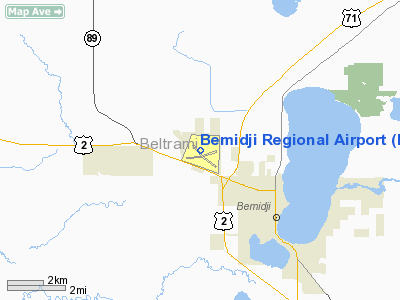
Bemidji Regional Airport (IATA: BJI, ICAO: KBJI, FAA LID: BJI) is a public use airport located three nautical miles (6 km) northwest of the central business district of Bemidji, a city in Beltrami County, Minnesota, United States. It is owned by the City of Bemidji and Beltrami County.
The airport is mostly used for general aviation. It is served by two commercial airlines, Mesaba, a wholly owned subsidiary of Delta Air Lines and SkyWest Airlines. Both airlines flights are operated under the name Delta Connection, for Delta Air Lines. In July 2010, work began on an $8.9 million airport terminal expansion and renovation project that would double the size of the terminal. Facilities and aircraft
Bemidji Regional Airport covers an area of 1,740 acres (704 ha) at an elevation of 1,391 feet (424 m) above mean sea level. It has two asphalt paved runways: 13/31 is 7,002 by 150 feet (2,134 x 46 m) and 7/25 is 5,700 by 150 feet (1,737 x 46 m).
For the 12-month period ending December 31, 2007, the airport had 12,876 aircraft operations, an average of 35 per day: 57% general aviation, 29% scheduled commercial, 10% air taxi, 4% military. At that time there were 36 aircraft based at this airport: 64% single-engine, 33% multi-engine and 3% helicopter.
Airlines and destinations
| Airlines |
Destinations |
| Delta Connection operated by Mesaba Airlines |
Minneapolis/St. Paul |
| Delta Connection operated by SkyWest Airlines |
Minneapolis/St. Paul |
Cargo
| Airlines |
Destinations |
| Bemidji Airlines |
Minneapolis/St. Paul |
| FedEx Feeder operated by Corporate Air |
Grand Forks |
Medivac
BJI is also the home to one of five medivac helicopter flight stations in the state for AirCare, operated by North Memorial Medical Center in Robbinsdale, MN, a Level 1 Trauma Center located in the Minneapolis/St. Paul area. This station covers the northern part of Minnesota and eastern North Dakota.
The above content comes from Wikipedia and is published under free licenses – click here to read more.
Location & QuickFacts
| FAA Information Effective: | 2008-09-25 |
| Airport Identifier: | BJI |
| Airport Status: | Operational |
| Longitude/Latitude: | 094-56-05.0000W/47-30-38.6000N
-94.934722/47.510722 (Estimated) |
| Elevation: | 1391 ft / 423.98 m (Surveyed) |
| Land: | 1740 acres |
| From nearest city: | 3 nautical miles NW of Bemidji, MN |
| Location: | Beltrami County, MN |
| Magnetic Variation: | 04E (1990) |
Owner & Manager
| Ownership: | Publicly owned |
| Owner: | City Of Bemidji / Beltrami Co |
| Address: | 3824 Moberg Drive, Ste. 101
Bemidji, MN 56601 |
| Phone number: | 218-444-2438 |
| Manager: | Harold Van Leeuwen
APT MAINT SUPVR, PHONE 218-444-2438. APRT MGR EMAIL BJIAPMGR@PAULBUNYAN.NET . |
| Address: | 3824 Moberg Drive, Ste 101
Bemidji, MN 56601 |
| Phone number: | 218-444-2438 |
Airport Operations and Facilities
| Airport Use: | Open to public |
| Wind indicator: | Yes |
| Segmented Circle: | No |
| Control Tower: | No |
| Lighting Schedule: | DUSK-DAWN
HIRL RY 13/31 PRESET ON LOW INTST; TO INCR INTST & ACTVT MIRL RY 07/25, REIL RYS 07; 13 & 25 & PAPI RYS 07; 25; 13 & 31; MALSR RYS 13 & 31 - CTAF. |
| Beacon Color: | Clear-Green (lighted land airport) |
| Landing fee charge: | No |
| Sectional chart: | Twin Cities |
| Region: | AGL - Great Lakes |
| Boundary ARTCC: | ZMP - Minneapolis |
| Tie-in FSS: | PNM - Princeton |
| FSS on Airport: | No |
| FSS Toll Free: | 1-800-WX-BRIEF |
| NOTAMs Facility: | BJI (NOTAM-d service avaliable) |
| Certification type/date: | I A S 05/1973
48 HR PPR FOR UNSKED ACR OPNS WITH MORE THAN 30 PSGR SEATS, CALL AMGR 218-444-2438. |
| Federal Agreements: | NGY3 |
Airport Communications
| CTAF: | 122.800 |
| Unicom: | 122.800 |
Airport Services
| Fuel available: | 100LLA |
| Airframe Repair: | MAJOR |
| Power Plant Repair: | MAJOR |
| Bottled Oxygen: | HIGH/LOW |
| Bulk Oxygen: | NONE |
Runway Information
Runway 07/25
| Dimension: | 5700 x 150 ft / 1737.4 x 45.7 m |
| Surface: | ASPH, |
| Surface Treatment: | Saw-cut or plastic Grooved |
| Weight Limit: | Single wheel: 75000 lbs.
Dual wheel: 200000 lbs. |
| Edge Lights: | Medium |
| |
Runway 07 |
Runway 25 |
| Longitude: | 094-56-36.6035W | 094-55-16.7974W |
| Latitude: | 47-30-26.0938N | 47-30-41.6001N |
| Elevation: | 1385.00 ft | 1378.00 ft |
| Alignment: | 74 | 127 |
| ILS Type: | | ILS/DME |
| Traffic Pattern: | Left | Left |
| Markings: | Non-precision instrument, Good Condition | Precision instrument, Good Condition |
| Crossing Height: | 43.00 ft | 47.00 ft |
| VASI: | 4-light PAPI on left side | 4-light PAPI on left side |
| Visual Glide Angle: | 3.00° | 3.00° |
| Runway End Identifier: | Yes | Yes |
| Obstruction: | 70 ft trees, 1188.0 ft from runway, 345 ft right of centerline, 14:1 slope to clear | , 50:1 slope to clear |
|
Runway 13/31
| Dimension: | 7002 x 150 ft / 2134.2 x 45.7 m |
| Surface: | ASPH, |
| Surface Treatment: | Saw-cut or plastic Grooved |
| Weight Limit: | Single wheel: 75000 lbs.
Dual wheel: 200000 lbs. |
| Edge Lights: | High |
| |
Runway 13 |
Runway 31 |
| Longitude: | 094-56-48.4815W | 094-55-35.1048W |
| Latitude: | 47-31-06.3997N | 47-30-18.3926N |
| Elevation: | 1391.00 ft | 1384.00 ft |
| Alignment: | 127 | 127 |
| ILS Type: | | ILS
|
| Traffic Pattern: | Left | Left |
| Markings: | Precision instrument, Good Condition | Precision instrument, Good Condition |
| Crossing Height: | 45.00 ft | 45.00 ft |
| VASI: | 4-light PAPI on left side | 4-light PAPI on left side |
| Visual Glide Angle: | 3.00° | 3.00° |
| Approach lights: | MALSR | MALSR |
| Runway End Identifier: | Yes | No |
|
Radio Navigation Aids
| ID |
Type |
Name |
Ch |
Freq |
Var |
Dist |
| FSE | NDB | Fosston | | 224.00 | 05E | 34.2 nm |
| PK | NDB | Spida | | 269.00 | 04E | 40.7 nm |
| XVG | NDB | Longville | | 392.00 | 04E | 43.0 nm |
| PKD | VOR/DME | Park Rapids | 043X | 110.60 | 04E | 37.2 nm |
| BJI | VORTAC | Bemidji | 023X | 108.60 | 04E | 5.4 nm |
Remarks
- DEER & BIRDS ON & INVOF ARPT.
- SNOW REMOVAL CREWS WILL BE MONITORING CTAF DURING ALL AIR CARRIER OPERATIONS FOR AIRFIELD CONDITION INFORMATION.
- ARFF CREWS WILL BE MONITORING CTAF DURING ALL AIR CARRIER OPERATIONS.
Images and information placed above are from
http://www.airport-data.com/airport/BJI/
We thank them for the data!
| General Info
|
| Country |
United States
|
| State |
MINNESOTA
|
| FAA ID |
BJI
|
| Latitude |
47-30-33.927N
|
| Longitude |
094-56-01.404W
|
| Elevation |
1390 feet
|
| Near City |
BEMIDJI
|
We don't guarantee the information is fresh and accurate. The data may
be wrong or outdated.
For more up-to-date information please refer to other sources.
|
|


