 |
|
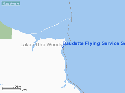
Baudette Flying Service Seaplane Base |
Location & QuickFacts
| FAA Information Effective: | 2008-09-25 |
| Airport Identifier: | 16MN |
| Airport Status: | Operational |
| Longitude/Latitude: | 094-42-15.7640W/48-49-54.9320N
-94.704379/48.831926 (Estimated) |
| Elevation: | 1060 ft / 323.09 m (Estimated) |
| Land: | 0 acres |
| From nearest city: | 9 nautical miles NW of Baudette, MN |
| Location: | Lake Of The Woods County, MN |
| Magnetic Variation: | 04E (1985) |
Owner & Manager
| Ownership: | Privately owned |
| Owner: | T&s Enterprises |
| Address: | P.o.box 17
Stillwater, MN 55082 |
| Phone number: | 612-439-0558 |
| Manager: | Stephen Cooper |
| Address: | Rr 1 Box 171
Baudette, MN 56623 |
| Phone number: | 218-634-1040 |
Airport Operations and Facilities
| Airport Use: | Private |
| Wind indicator: | Yes |
| Segmented Circle: | No |
| Control Tower: | No |
| Landing fee charge: | No |
| Sectional chart: | Twin Cities |
| Region: | AGL - Great Lakes |
| Boundary ARTCC: | ZMP - Minneapolis |
| Tie-in FSS: | PNM - Princeton |
| FSS on Airport: | No |
| FSS Toll Free: | 1-800-WX-BRIEF |
Airport Services
| Airframe Repair: | NONE |
| Power Plant Repair: | NONE |
| Bottled Oxygen: | NONE |
| Bulk Oxygen: | NONE |
Runway Information
Runway 02/20
| Dimension: | 4000 x 400 ft / 1219.2 x 121.9 m |
| Surface: | WATER, |
| |
Runway 02 |
Runway 20 |
| Traffic Pattern: | Left | Left |
|
Runway 15/33
| Dimension: | 4000 x 400 ft / 1219.2 x 121.9 m |
| Surface: | WATER, |
| |
Runway 15 |
Runway 33 |
| Traffic Pattern: | Left | Left |
|
Radio Navigation Aids
| ID |
Type |
Name |
Ch |
Freq |
Var |
Dist |
| YAG | NDB | Fort Frances | | 376.00 | 02E | 47.0 nm |
| BDE | VOR/DME | Baudette | 053X | 111.60 | 04E | 7.6 nm |
| ROX | VOR/DME | Roseau | 025X | 108.80 | 05E | 39.2 nm |
| VBI | VORTAC | Sioux Narrows | 099X | 115.20 | 04E | 46.6 nm |
Images and information placed above are from
http://www.airport-data.com/airport/16MN/
We thank them for the data!
| General Info
|
| Country |
United States
|
| State |
MINNESOTA
|
| FAA ID |
16MN
|
| Latitude |
48-49-54.932N
|
| Longitude |
094-42-15.764W
|
| Elevation |
1060 feet
|
| Near City |
BAUDETTE
|
We don't guarantee the information is fresh and accurate. The data may
be wrong or outdated.
For more up-to-date information please refer to other sources.
|
|


