 |
|
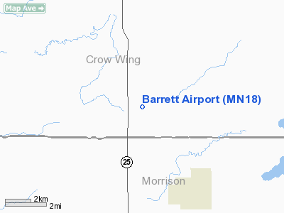
Location & QuickFacts
| FAA Information Effective: | 2008-09-25 |
| Airport Identifier: | MN18 |
| Airport Status: | Operational |
| Longitude/Latitude: | 094-05-18.9660W/46-10-41.3720N
-94.088602/46.178159 (Estimated) |
| Elevation: | 1275 ft / 388.62 m (Estimated) |
| Land: | 0 acres |
| From nearest city: | 15 nautical miles S of Brainerd, MN |
| Location: | Crow Wing County, MN |
| Magnetic Variation: | 04E (1990) |
Owner & Manager
| Ownership: | Privately owned |
| Owner: | Michael Barrett |
| Address: | 1417 S. Hwy 25
Brainerd, MN 56401 |
| Phone number: | 320-277-3555 |
| Address: |
|
Airport Operations and Facilities
| Airport Use: | Private |
| Wind indicator: | Yes |
| Segmented Circle: | No |
| Control Tower: | No |
| Sectional chart: | Twin Cities |
| Region: | AGL - Great Lakes |
| Boundary ARTCC: | ZMP - Minneapolis |
| Tie-in FSS: | PNM - Princeton |
| FSS Toll Free: | 1-800-WX-BRIEF |
Runway Information
Runway 09/27
| Dimension: | 2600 x 100 ft / 792.5 x 30.5 m |
| Surface: | TURF, |
| |
Runway 09 |
Runway 27 |
| Traffic Pattern: | Left | Left |
| Obstruction: | 30 ft trees, 500.0 ft from runway | 15 ft road |
|
Radio Navigation Aids
| ID |
Type |
Name |
Ch |
Freq |
Var |
Dist |
| XCR | NDB | Ripley | | 404.00 | 03E | 12.2 nm |
| LXL | NDB | Little Falls | | 359.00 | 03E | 17.3 nm |
| AIT | NDB | Aitkin | | 397.00 | 03E | 28.0 nm |
| SAZ | NDB | Staples | | 257.00 | 04E | 32.2 nm |
| PWC | NDB | Pine River | | 330.00 | 03E | 35.2 nm |
| JMR | NDB | Mora | | 327.00 | 03E | 38.4 nm |
| PNM | NDB | Princeton | | 368.00 | 03E | 42.0 nm |
| XVG | NDB | Longville | | 392.00 | 04E | 49.3 nm |
| RYM | TACAN | Camp Ripley | 048X | | 03E | 12.3 nm |
| STC | VOR/DME | St Cloud | 058X | 112.10 | 03E | 37.8 nm |
| AXN | VOR/DME | Alexandria | 075X | 112.80 | 07E | 49.5 nm |
| BRD | VORTAC | Brainerd | 116X | 116.90 | 03E | 10.6 nm |
Remarks
- OBS REMOVED/LOWERED OR THRS DSPLCD TO PRVD 20:1 SLOPES; 200' EITHER END & 125' EITHER SIDE OF CNTRLN BE CLEAR OF OBS.
Images and information placed above are from
http://www.airport-data.com/airport/MN18/
We thank them for the data!
| General Info
|
| Country |
United States
|
| State |
MINNESOTA
|
| FAA ID |
MN18
|
| Latitude |
46-10-41.372N
|
| Longitude |
094-05-18.966W
|
| Elevation |
1275 feet
|
| Near City |
BRAINERD
|
We don't guarantee the information is fresh and accurate. The data may
be wrong or outdated.
For more up-to-date information please refer to other sources.
|
|


