 |
|
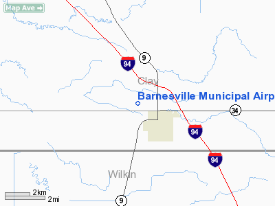
Barnesville Municipal Airport |
Location & QuickFacts
| FAA Information Effective: | 2008-09-25 |
| Airport Identifier: | 9MN3 |
| Airport Status: | Operational |
| Longitude/Latitude: | 096-26-28.2460W/46-39-54.8560N
-96.441179/46.665238 (Estimated) |
| Elevation: | 980 ft / 298.70 m (Estimated) |
| Land: | 15 acres |
| From nearest city: | 1 nautical miles NW of Barnesville, MN |
| Location: | Clay County, MN |
| Magnetic Variation: | 06E (1985) |
Owner & Manager
| Ownership: | Publicly owned |
| Owner: | City Of Barnesville |
| Address: | 102 Front Street N
Barnesville, MN 56514 |
| Phone number: | 218-354-2292 |
| Manager: | John Chattin
MICHAEL BETHORST |
| Address: | Po Box 550
Barnesville, MN 56514 |
| Phone number: | 218-354-2292 |
Airport Operations and Facilities
| Airport Use: | Private |
| Wind indicator: | Yes |
| Segmented Circle: | No |
| Control Tower: | No |
| Sectional chart: | Twin Cities |
| Region: | AGL - Great Lakes |
| Boundary ARTCC: | ZMP - Minneapolis |
| Tie-in FSS: | PNM - Princeton |
| FSS on Airport: | No |
| FSS Toll Free: | 1-800-WX-BRIEF |
Airport Services
Runway Information
Runway 17/35
| Dimension: | 2780 x 50 ft / 847.3 x 15.2 m |
| Surface: | TURF, Good Condition |
| |
Runway 17 |
Runway 35 |
| Traffic Pattern: | Left | Left |
| Obstruction: | 33 ft rr, 880.0 ft from runway, 125 ft left of centerline, 26:1 slope to clear | 45 ft trees, 870.0 ft from runway, 100 ft right of centerline, 19:1 slope to clear |
|
Radio Navigation Aids
| ID |
Type |
Name |
Ch |
Freq |
Var |
Dist |
| AA | NDB | Kenie | | 365.00 | 06E | 25.8 nm |
| BWP | NDB | Breckenridge-wahpeton | | 233.00 | 05E | 26.1 nm |
| DTL | VOR/DME | Detroit Lakes | 049X | 111.20 | 05E | 24.8 nm |
| FFM | VOR/DME | Fergus Falls | 041X | 110.40 | 05E | 25.5 nm |
| FAR | VORTAC | Fargo | 109X | 116.20 | 09E | 17.7 nm |
Remarks
Images and information placed above are from
http://www.airport-data.com/airport/9MN3/
We thank them for the data!
| General Info
|
| Country |
United States
|
| State |
MINNESOTA
|
| FAA ID |
9MN3
|
| Latitude |
46-39-54.856N
|
| Longitude |
096-26-28.246W
|
| Elevation |
980 feet
|
| Near City |
BARNESVILLE
|
We don't guarantee the information is fresh and accurate. The data may
be wrong or outdated.
For more up-to-date information please refer to other sources.
|
|


