 |
|
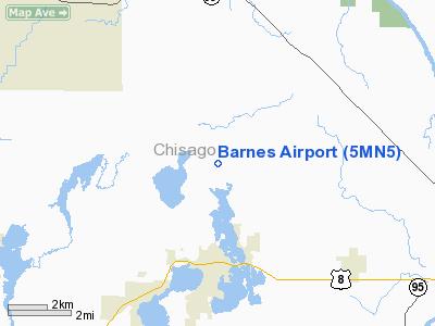
Location & QuickFacts
| FAA Information Effective: | 2008-09-25 |
| Airport Identifier: | 5MN5 |
| Airport Status: | Operational |
| Longitude/Latitude: | 092-50-05.7710W/45-26-10.8660N
-92.834936/45.436352 (Estimated) |
| Elevation: | 945 ft / 288.04 m (Estimated) |
| Land: | 0 acres |
| From nearest city: | 3 nautical miles N of Lindstrom, MN |
| Location: | Chisago County, MN |
| Magnetic Variation: | 03E (1985) |
Owner & Manager
| Ownership: | Privately owned |
| Owner: | Michael H. Barnes |
| Address: | P.o. Box 511
Lindstrom, MN 55045 |
| Phone number: | 612-257-2022 |
| Manager: | Michael H. Barnes |
| Address: | P.o. Box 511
Lindstrom, MN 55045 |
| Phone number: | 612-257-2022 |
Airport Operations and Facilities
| Airport Use: | Private |
| Wind indicator: | Yes |
| Segmented Circle: | No |
| Control Tower: | No |
| Landing fee charge: | No |
| Sectional chart: | Green Bay |
| Region: | AGL - Great Lakes |
| Boundary ARTCC: | ZMP - Minneapolis |
| Tie-in FSS: | PNM - Princeton |
| FSS on Airport: | No |
| FSS Toll Free: | 1-800-WX-BRIEF |
Runway Information
Runway 16/34
| Dimension: | 1650 x 50 ft / 502.9 x 15.2 m |
| Surface: | TURF, |
| |
Runway 16 |
Runway 34 |
| Traffic Pattern: | Left | Left |
|
Radio Navigation Aids
| ID |
Type |
Name |
Ch |
Freq |
Var |
Dist |
| OEO | NDB | Osceola | | 233.00 | 01E | 9.8 nm |
| ROS | NDB | Rush City | | 282.00 | 02E | 16.5 nm |
| CBG | NDB | Cambridge | | 350.00 | 03E | 19.4 nm |
| RNH | NDB | New Richmond | | 257.00 | 02E | 21.6 nm |
| AHH | NDB | Ameron | | 278.00 | 01E | 21.7 nm |
| BXR | NDB | Big Doctor | | 203.00 | 02E | 30.4 nm |
| JMR | NDB | Mora | | 327.00 | 03E | 32.8 nm |
| PNM | NDB | Princeton | | 368.00 | 03E | 33.5 nm |
| PPI | NDB | Hopey | | 400.00 | 03E | 34.2 nm |
| UBE | NDB | Cumberland | | 375.00 | 01E | 36.4 nm |
| MS | NDB | Narco | | 266.00 | 02E | 38.3 nm |
| SSQ | NDB | Shell Lake | | 212.00 | 01E | 42.3 nm |
| RZN | VOR/DME | Siren | 031X | 109.40 | 02E | 30.1 nm |
| MSP | VOR/DME | Minneapolis | 100X | 115.30 | 02E | 36.6 nm |
| RPD | VOR/DME | Rice Lake | 037X | 110.00 | 01E | 44.6 nm |
| FCM | VOR/DME | Flying Cloud | 055X | 111.80 | 06E | 45.2 nm |
| GEP | VORTAC | Gopher | 120X | 117.30 | 06E | 28.7 nm |
| STP | VOT | St Paul | | 114.40 | | 31.3 nm |
| MSP | VOT | Minneapolis St Paul | | 111.00 | | 36.9 nm |
Images and information placed above are from
http://www.airport-data.com/airport/5MN5/
We thank them for the data!
| General Info
|
| Country |
United States
|
| State |
MINNESOTA
|
| FAA ID |
5MN5
|
| Latitude |
45-26-10.866N
|
| Longitude |
092-50-05.771W
|
| Elevation |
945 feet
|
| Near City |
LINDSTROM
|
We don't guarantee the information is fresh and accurate. The data may
be wrong or outdated.
For more up-to-date information please refer to other sources.
|
|


