 |
|
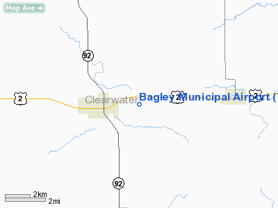
Location & QuickFacts
| FAA Information Effective: | 2008-09-25 |
| Airport Identifier: | 7Y4 |
| Airport Status: | Operational |
| Longitude/Latitude: | 095-21-39.0530W/47-31-29.8420N
-95.360848/47.524956 (Estimated) |
| Elevation: | 1500 ft / 457.20 m (Estimated) |
| Land: | 249 acres |
| From nearest city: | 1 nautical miles E of Bagley, MN |
| Location: | Clearwater County, MN |
| Magnetic Variation: | 05E (1985) |
Owner & Manager
| Ownership: | Publicly owned |
| Owner: | City Of Bagley |
| Address: | Po Box 178
Bagley, MN 56621 |
| Phone number: | 218-694-2865 |
| Manager: | Arvin Teige |
| Address: | 18 Main Ave S, Box 178
Bagley, MN 56621 |
| Phone number: | 218-694-6532 |
Airport Operations and Facilities
| Airport Use: | Open to public |
| Wind indicator: | Yes |
| Segmented Circle: | No |
| Control Tower: | No |
| Lighting Schedule: | DUSK-DAWN
RWY 14/32 PRESET LOW INTST, CHNG INTST AND ACTIVT REIL 14, 32 AND PAPI 14, 32 - CTAF |
| Beacon Color: | Clear-Green (lighted land airport) |
| Landing fee charge: | No |
| Sectional chart: | Twin Cities |
| Region: | AGL - Great Lakes |
| Boundary ARTCC: | ZMP - Minneapolis |
| Tie-in FSS: | PNM - Princeton |
| FSS on Airport: | No |
| FSS Toll Free: | 1-800-WX-BRIEF |
| NOTAMs Facility: | PNM (NOTAM-d service avaliable) |
Airport Communications
Airport Services
Runway Information
Runway 14/32
| Dimension: | 3800 x 75 ft / 1158.2 x 22.9 m
RWY 14/32 PAVED AND EXTENDED ON SE END. |
| Surface: | ASPH, Good Condition
BARE SPOTS AND PLOW DAMAGE ON RY.
RWY 14/32 1-2" DROPOFF AT EDGE OF PAVEMENT. |
| Edge Lights: | Medium |
| |
Runway 14 |
Runway 32 |
| Longitude: | 095-21-52.9500W | 095-21-25.0700W |
| Latitude: | 47-31-43.7400N | 47-31-15.8600N |
| Elevation: | 1494.00 ft | 1500.00 ft |
| Traffic Pattern: | Left | Left |
| Markings: | Non-precision instrument, Good Condition | Non-precision instrument, Good Condition |
| VASI: | 4-light PAPI on left side | 4-light PAPI on left side |
| Runway End Identifier: | Yes | Yes |
| Obstruction: | 11 ft trees, 480.0 ft from runway, 80 ft left of centerline, 25:1 slope to clear | 26 ft trees, 1060.0 ft from runway, 125 ft left of centerline, 33:1 slope to clear |
|
Radio Navigation Aids
| ID |
Type |
Name |
Ch |
Freq |
Var |
Dist |
| FSE | NDB | Fosston | | 224.00 | 05E | 17.0 nm |
| PK | NDB | Spida | | 269.00 | 04E | 44.4 nm |
| PKD | VOR/DME | Park Rapids | 043X | 110.60 | 04E | 39.5 nm |
| TVF | VOR/DME | Thief River Falls | 021X | 108.40 | 08E | 46.7 nm |
| DTL | VOR/DME | Detroit Lakes | 049X | 111.20 | 05E | 47.2 nm |
| BJI | VORTAC | Bemidji | 023X | 108.60 | 04E | 14.0 nm |
Remarks
- OCNL FARM TFC CROSSING RY.
- BIRDS ON AND INVOF ARPT.
Images and information placed above are from
http://www.airport-data.com/airport/7Y4/
We thank them for the data!
| General Info
|
| Country |
United States
|
| State |
MINNESOTA
|
| FAA ID |
7Y4
|
| Latitude |
47-31-29.842N
|
| Longitude |
095-21-39.053W
|
| Elevation |
1500 feet
|
| Near City |
BAGLEY
|
We don't guarantee the information is fresh and accurate. The data may
be wrong or outdated.
For more up-to-date information please refer to other sources.
|
|


