 |
|
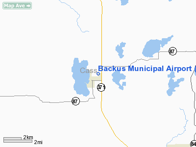
Location & QuickFacts
| FAA Information Effective: | 2008-09-25 |
| Airport Identifier: | 7Y3 |
| Airport Status: | Operational |
| Longitude/Latitude: | 094-30-25.9930W/46-49-36.8530N
-94.507220/46.826904 (Estimated) |
| Elevation: | 1355 ft / 413.00 m (Surveyed) |
| Land: | 0 acres |
| From nearest city: | 1 nautical miles NE of Backus, MN |
| Location: | Cass County, MN |
| Magnetic Variation: | 04E (1985) |
Owner & Manager
| Ownership: | Publicly owned |
| Owner: | City Of Backus |
| Address: | Po Box 44
Backus, MN 56435 |
| Phone number: | 218-947-3221 |
| Manager: | Denny Williams |
| Address: | Po Box 187
Backus, MN 56435 |
| Phone number: | 218-947-3100 |
Airport Operations and Facilities
| Airport Use: | Open to public |
| Wind indicator: | Yes |
| Segmented Circle: | No |
| Control Tower: | No |
| Lighting Schedule: | DUSK-DAWN |
| Beacon Color: | Clear-Green (lighted land airport) |
| Landing fee charge: | No |
| Sectional chart: | Twin Cities |
| Region: | AGL - Great Lakes |
| Boundary ARTCC: | ZMP - Minneapolis |
| Tie-in FSS: | PNM - Princeton |
| FSS on Airport: | No |
| FSS Toll Free: | 1-800-WX-BRIEF |
| NOTAMs Facility: | PNM (NOTAM-d service avaliable) |
Airport Communications
Airport Services
| Fuel available: | 100LLMOGAS
FOR FUEL CALL 218-947-3211 OR 218-947-3100. |
Runway Information
Runway 15/33
| Dimension: | 3588 x 145 ft / 1093.6 x 44.2 m |
| Surface: | TURF, Fair Condition
RWY 15/33 SAND SHOWING THROUGH TURF. |
| Edge Lights: | Non-standard lighting system
NSTD LIRL DUE TO SPACING. |
| |
Runway 15 |
Runway 33 |
| Longitude: | 094-30-33.0100W | 094-30-18.9800W |
| Latitude: | 46-49-53.8900N | 46-49-19.8100N |
| Elevation: | 1353.00 ft | 1346.00 ft |
| Traffic Pattern: | Left | Left |
| Runway End Identifier: | No | No |
| Obstruction: | 44 ft trees, 1115.0 ft from runway, 25:1 slope to clear | 54 ft trees, 1270.0 ft from runway, 23:1 slope to clear |
|
Radio Navigation Aids
| ID |
Type |
Name |
Ch |
Freq |
Var |
Dist |
| PWC | NDB | Pine River | | 330.00 | 03E | 7.8 nm |
| XVG | NDB | Longville | | 392.00 | 04E | 15.9 nm |
| PK | NDB | Spida | | 269.00 | 04E | 19.3 nm |
| SAZ | NDB | Staples | | 257.00 | 04E | 29.4 nm |
| AIT | NDB | Aitkin | | 397.00 | 03E | 38.2 nm |
| XCR | NDB | Ripley | | 404.00 | 03E | 45.5 nm |
| RYM | TACAN | Camp Ripley | 048X | | 03E | 44.7 nm |
| PKD | VOR/DME | Park Rapids | 043X | 110.60 | 04E | 23.6 nm |
| GPZ | VOR/DME | Grand Rapids | 051X | 111.40 | 06E | 46.4 nm |
| BRD | VORTAC | Brainerd | 116X | 116.90 | 03E | 35.0 nm |
| BJI | VORTAC | Bemidji | 023X | 108.60 | 04E | 49.7 nm |
Remarks
- ULTRALIGHT ACTIVITY ON & INVOF ARPT.
Images and information placed above are from
http://www.airport-data.com/airport/7Y3/
We thank them for the data!
| General Info
|
| Country |
United States
|
| State |
MINNESOTA
|
| FAA ID |
7Y3
|
| Latitude |
46-49-36.853N
|
| Longitude |
094-30-25.993W
|
| Elevation |
1355 feet
|
| Near City |
BACKUS
|
We don't guarantee the information is fresh and accurate. The data may
be wrong or outdated.
For more up-to-date information please refer to other sources.
|
|


