 |
|
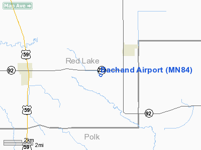
Location & QuickFacts
| FAA Information Effective: | 2008-09-25 |
| Airport Identifier: | MN84 |
| Airport Status: | Operational |
| Longitude/Latitude: | 095-53-31.1010W/47-48-49.8590N
-95.891973/47.813850 (Estimated) |
| Elevation: | 1100 ft / 335.28 m (Estimated) |
| Land: | 0 acres |
| From nearest city: | 3 nautical miles SW of Oklee, MN |
| Location: | Red Lake County, MN |
| Magnetic Variation: | 05E (1985) |
Owner & Manager
| Ownership: | Privately owned |
| Owner: | David Bachand |
| Address: | Route 1, Box 191a
Oklee, MN 56742 |
| Phone number: | 218-796-5765 |
| Address: |
|
Airport Operations and Facilities
| Airport Use: | Private |
| Wind indicator: | No |
| Segmented Circle: | No |
| Control Tower: | No |
| Landing fee charge: | No |
| Sectional chart: | Twin Cities |
| Region: | AGL - Great Lakes |
| Boundary ARTCC: | ZMP - Minneapolis |
| Tie-in FSS: | PNM - Princeton |
| FSS on Airport: | No |
| FSS Toll Free: | 1-800-WX-BRIEF |
Airport Services
| Airframe Repair: | NONE |
| Power Plant Repair: | NONE |
Runway Information
Runway E/W
| Dimension: | 2000 x 40 ft / 609.6 x 12.2 m |
| Surface: | TURF, |
| |
Runway E |
Runway W |
| Traffic Pattern: | Right | Right |
| Obstruction: | | 25 ft bldgs |
|
Radio Navigation Aids
| ID |
Type |
Name |
Ch |
Freq |
Var |
Dist |
| FSE | NDB | Fosston | | 224.00 | 05E | 14.4 nm |
| CKN | NDB | Crookston | | 400.00 | 07E | 29.3 nm |
| TVF | VOR/DME | Thief River Falls | 021X | 108.40 | 08E | 19.4 nm |
| BJI | VORTAC | Bemidji | 023X | 108.60 | 04E | 37.9 nm |
Images and information placed above are from
http://www.airport-data.com/airport/MN84/
We thank them for the data!
| General Info
|
| Country |
United States
|
| State |
MINNESOTA
|
| FAA ID |
MN84
|
| Latitude |
47-48-49.859N
|
| Longitude |
095-53-31.101W
|
| Elevation |
1100 feet
|
| Near City |
OKLEE
|
We don't guarantee the information is fresh and accurate. The data may
be wrong or outdated.
For more up-to-date information please refer to other sources.
|
|


