 |
|
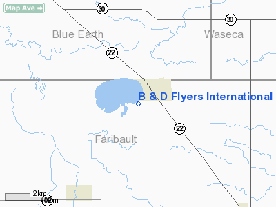
B & D Flyers International Airport |
Location & QuickFacts
| FAA Information Effective: | 2008-09-25 |
| Airport Identifier: | MN74 |
| Airport Status: | Operational |
| Longitude/Latitude: | 093-50-25.8220W/43-49-49.8500N
-93.840506/43.830514 (Estimated) |
| Elevation: | 1055 ft / 321.56 m (Estimated) |
| Land: | 0 acres |
| From nearest city: | 1 nautical miles S of Minnesota Lake, MN |
| Location: | Faribault County, MN |
| Magnetic Variation: | 04E (1985) |
Owner & Manager
| Ownership: | Privately owned |
| Owner: | William J. Daly |
| Address: | 23595 510th Ave
Minnesota Lake, MN 56068 |
| Phone number: | 507-462-3635 |
| Manager: | William J. Daly |
| Address: | 23595 510th Ave
Minnesota Lake, MN 56068 |
| Phone number: | 507-462-3635 |
Airport Operations and Facilities
| Airport Use: | Private |
| Wind indicator: | Yes |
| Segmented Circle: | No |
| Control Tower: | No |
| Landing fee charge: | No |
| Sectional chart: | Omaha |
| Region: | AGL - Great Lakes |
| Boundary ARTCC: | ZMP - Minneapolis |
| Tie-in FSS: | PNM - Princeton |
| FSS on Airport: | No |
| FSS Toll Free: | 1-800-WX-BRIEF |
Runway Information
Runway E/W
| Dimension: | 2300 x 75 ft / 701.0 x 22.9 m |
| Surface: | TURF, |
| |
Runway E |
Runway W |
| Traffic Pattern: | Left | Left |
|
Radio Navigation Aids
| ID |
Type |
Name |
Ch |
Freq |
Var |
Dist |
| SBU | NDB | Blue Earth | | 332.00 | 04E | 17.9 nm |
| ACQ | NDB | Waseca | | 371.00 | 02E | 19.1 nm |
| JYG | NDB | St James | | 260.00 | 04E | 32.2 nm |
| FXY | NDB | Forest City | | 359.00 | 05E | 37.0 nm |
| PUF | NDB | Puff | | 345.00 | 04E | 48.5 nm |
| AXA | NDB | Algona | | 403.00 | 03E | 48.8 nm |
| ULM | NDB/DME | New Ulm | 050X | 272.00 | 04E | 40.8 nm |
| EST | VOR | Estherville | | 110.40 | 07E | 46.8 nm |
| AEL | VOR/DME | Albert Lea | 035X | 109.80 | 05E | 22.3 nm |
| MKT | VOR/DME | Mankato | 045X | 110.80 | 07E | 23.6 nm |
| FRM | VOR/DME | Fairmont | 039X | 110.20 | 07E | 27.6 nm |
| FOW | VOR/DME | Halfway | 049X | 111.20 | 02E | 30.3 nm |
| JAY | VOR/DME | Austin | 019X | 108.20 | 03E | 42.8 nm |
| MCW | VORTAC | Mason City | 096X | 114.90 | 06E | 49.5 nm |
Images and information placed above are from
http://www.airport-data.com/airport/MN74/
We thank them for the data!
| General Info
|
| Country |
United States
|
| State |
MINNESOTA
|
| FAA ID |
MN74
|
| Latitude |
43-49-49.850N
|
| Longitude |
093-50-25.822W
|
| Elevation |
1055 feet
|
| Near City |
MINNESOTA LAKE
|
We don't guarantee the information is fresh and accurate. The data may
be wrong or outdated.
For more up-to-date information please refer to other sources.
|
|


