 |
|
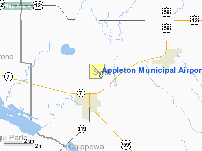
Appleton Municipal Airport |
Location & QuickFacts
| FAA Information Effective: | 2008-09-25 |
| Airport Identifier: | AQP |
| Airport Status: | Operational |
| Longitude/Latitude: | 096-00-15.6000W/45-13-39.1000N
-96.004333/45.227528 (Estimated) |
| Elevation: | 1020 ft / 310.90 m (Surveyed) |
| Land: | 220 acres |
| From nearest city: | 2 nautical miles NE of Appleton, MN |
| Location: | Swift County, MN |
| Magnetic Variation: | 05E (1995) |
Owner & Manager
| Ownership: | Publicly owned |
| Owner: | City Of Appleton |
| Address: | 323 W. Schlieman Ave.
Appleton, MN 56208 |
| Phone number: | 320-289-1363 |
| Manager: | Greg Ruether |
| Address: | 149 S Munsterman
Appleton, MN 56208 |
| Phone number: | 320-289-2193 |
Airport Operations and Facilities
| Airport Use: | Open to public |
| Wind indicator: | Yes |
| Segmented Circle: | No |
| Control Tower: | No |
| Lighting Schedule: | DUSK DAWN
ACTVT MIRL RY 13/31 - CTAF. |
| Beacon Color: | Clear-Green (lighted land airport) |
| Landing fee charge: | No |
| Sectional chart: | Twin Cities |
| Region: | AGL - Great Lakes |
| Traffic Pattern Alt: | 800 ft |
| Boundary ARTCC: | ZMP - Minneapolis |
| Tie-in FSS: | PNM - Princeton |
| FSS on Airport: | No |
| FSS Toll Free: | 1-800-WX-BRIEF |
| NOTAMs Facility: | AQP (NOTAM-d service avaliable) |
Airport Communications
Airport Services
| Airframe Repair: | NONE |
| Power Plant Repair: | NONE |
| Bottled Oxygen: | NONE |
| Bulk Oxygen: | NONE |
Runway Information
Runway 04/22
| Dimension: | 2725 x 157 ft / 830.6 x 47.9 m |
| Surface: | TURF, Good Condition |
| |
Runway 04 |
Runway 22 |
| Longitude: | 096-00-32.1600W | 096-00-05.7000W |
| Latitude: | 45-13-30.9800N | 45-13-50.3200N |
| Elevation: | 1019.00 ft | 1021.00 ft |
| Alignment: | 44 | 127 |
| Traffic Pattern: | Left | Left |
| Obstruction: | 16 ft road, 372.0 ft from runway, 125 ft right of centerline, 23:1 slope to clear | 15 ft road, 300.0 ft from runway, 125 ft left of centerline, 20:1 slope to clear |
|
Runway 13/31
| Dimension: | 3500 x 75 ft / 1066.8 x 22.9 m |
| Surface: | ASPH, Good Condition |
| Edge Lights: | Medium
RY 13 VISUAL LIGHTING ON INSTRUMENT RY. |
| |
Runway 13 |
Runway 31 |
| Longitude: | 096-00-30.8400W | 095-59-56.5100W |
| Latitude: | 45-13-49.0400N | 45-13-24.4200N |
| Elevation: | 1020.00 ft | 1019.00 ft |
| Alignment: | 127 | 127 |
| Traffic Pattern: | Left | Left |
| Markings: | Non-precision instrument, Good Condition
RY 13 BASIC MARKING ON NPI RY. | Non-precision instrument, Good Condition |
| Obstruction: | , 50:1 slope to clear | 53 ft trees, 1010.0 ft from runway, 300 ft left of centerline, 15:1 slope to clear |
|
Radio Navigation Aids
| ID |
Type |
Name |
Ch |
Freq |
Var |
Dist |
| AQP | NDB | Appleton | | 356.00 | 05E | 0.2 nm |
| BBB | NDB | Benson | | 239.00 | 05E | 16.1 nm |
| DXX | NDB | Dawson/madison | | 341.00 | 06E | 16.4 nm |
| VVV | NDB | Ortonville | | 332.00 | 05E | 18.2 nm |
| GHW | NDB | Glenwood | | 346.00 | 03E | 38.3 nm |
| ETH | NDB | Wheaton | | 326.00 | 05E | 40.5 nm |
| EE | NDB | Tamie | | 374.00 | 04E | 44.9 nm |
| MVE | VOR/DME | Montevideo | 053X | 111.60 | 05E | 19.7 nm |
| MOX | VOR/DME | Morris | 033X | 109.60 | 05E | 20.4 nm |
| BDH | VOR/DME | Willmar | 84X | 113.70 | 04E | 37.8 nm |
| ILL | VOR/DME | Willmar | 084X | 113.70 | 04E | 39.3 nm |
| MML | VOR/DME | Marshall | 047X | 111.00 | 05E | 47.5 nm |
Remarks
- ULTRALIGHTS ON & INVOF ARPT.
- EXISTED PRIOR TO 1959.
Images and information placed above are from
http://www.airport-data.com/airport/AQP/
We thank them for the data!
| General Info
|
| Country |
United States
|
| State |
MINNESOTA
|
| FAA ID |
AQP
|
| Latitude |
45-13-39.100N
|
| Longitude |
096-00-15.600W
|
| Elevation |
1020 feet
|
| Near City |
APPLETON
|
We don't guarantee the information is fresh and accurate. The data may
be wrong or outdated.
For more up-to-date information please refer to other sources.
|
|


