 |
|
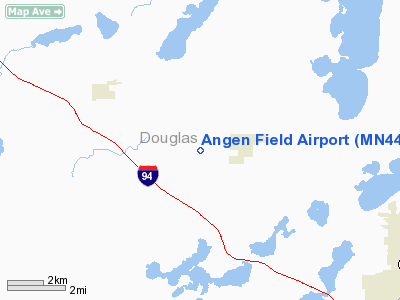
Location & QuickFacts
| FAA Information Effective: | 2008-09-25 |
| Airport Identifier: | MN44 |
| Airport Status: | Operational |
| Longitude/Latitude: | 095-31-34.1540W/45-56-10.8590N
-95.526154/45.936350 (Estimated) |
| Elevation: | 1450 ft / 441.96 m (Estimated) |
| Land: | 4 acres |
| From nearest city: | 2 nautical miles SW of Garfield, MN |
| Location: | Douglas County, MN |
| Magnetic Variation: | 05E (1995) |
Owner & Manager
| Ownership: | Privately owned |
| Owner: | Steve Angen |
| Address: | 4422 Utopia Dr Nw
Garfield, MN 56332 |
| Phone number: | 320-834-2153 |
| Manager: | Steve Angen |
| Address: | 4422 Utopia Dr Nw
Garfield, MN 56332 |
| Phone number: | 320-834-2153 |
Airport Operations and Facilities
| Airport Use: | Private |
| Segmented Circle: | No |
| Control Tower: | No |
| Sectional chart: | Twin Cities |
| Region: | AGL - Great Lakes |
| Boundary ARTCC: | ZMP - Minneapolis |
| Tie-in FSS: | PNM - Princeton |
| FSS on Airport: | No |
| FSS Toll Free: | 1-800-WX-BRIEF |
Runway Information
Runway 11/29
| Dimension: | 2800 x 75 ft / 853.4 x 22.9 m |
| Surface: | TURF, |
| |
Runway 11 |
Runway 29 |
| Longitude: | 095-31-50.7700W | 095-31-17.5400W |
| Latitude: | 45-56-15.0800N | 45-56-06.6400N |
| Elevation: | 1450.00 ft | 1450.00 ft |
| Traffic Pattern: | Left | Left |
| Obstruction: | | 60 ft pline, 2000.0 ft from runway |
|
Radio Navigation Aids
| ID |
Type |
Name |
Ch |
Freq |
Var |
Dist |
| EE | NDB | Tamie | | 374.00 | 04E | 12.7 nm |
| GHW | NDB | Glenwood | | 346.00 | 03E | 19.6 nm |
| BBB | NDB | Benson | | 239.00 | 05E | 37.0 nm |
| SAZ | NDB | Staples | | 257.00 | 04E | 40.2 nm |
| ETH | NDB | Wheaton | | 326.00 | 05E | 43.7 nm |
| AQP | NDB | Appleton | | 356.00 | 05E | 47.2 nm |
| BWP | NDB | Breckenridge-wahpeton | | 233.00 | 05E | 48.6 nm |
| LXL | NDB | Little Falls | | 359.00 | 03E | 49.5 nm |
| RYM | TACAN | Camp Ripley | 048X | | 03E | 49.8 nm |
| AXN | VOR/DME | Alexandria | 075X | 112.80 | 07E | 12.3 nm |
| MOX | VOR/DME | Morris | 033X | 109.60 | 05E | 29.0 nm |
| FFM | VOR/DME | Fergus Falls | 041X | 110.40 | 05E | 33.8 nm |
Remarks
Images and information placed above are from
http://www.airport-data.com/airport/MN44/
We thank them for the data!
| General Info
|
| Country |
United States
|
| State |
MINNESOTA
|
| FAA ID |
MN44
|
| Latitude |
45-56-10.859N
|
| Longitude |
095-31-34.154W
|
| Elevation |
1450 feet
|
| Near City |
GARFIELD
|
We don't guarantee the information is fresh and accurate. The data may
be wrong or outdated.
For more up-to-date information please refer to other sources.
|
|


