 |
|
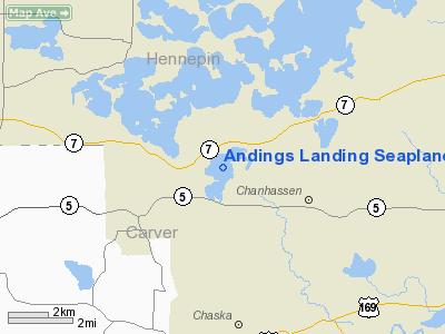
Andings Landing Seaplane Base |
Location & QuickFacts
| FAA Information Effective: | 2008-09-25 |
| Airport Identifier: | MY23 |
| Airport Status: | Operational |
| Longitude/Latitude: | 093-36-30.8480W/44-52-49.8660N
-93.608569/44.880518 (Estimated) |
| Elevation: | 942 ft / 287.12 m (Estimated) |
| Land: | 0 acres |
| From nearest city: | 3 nautical miles W of Chanhassen, MN |
| Location: | Carver County, MN |
| Magnetic Variation: | 03E (1985) |
Owner & Manager
| Ownership: | Privately owned |
| Owner: | Richard B Anding |
| Address: | 3715 So Cedar Dr
Excelsior, MN 55331 |
| Phone number: | 612-474-4211 |
| Manager: | Richard B Anding |
| Address: | 3715 So Cedar Dr
Excelsior, MN 55331 |
| Phone number: | 612-474-4211 |
Airport Operations and Facilities
| Airport Use: | Private |
| Wind indicator: | No |
| Segmented Circle: | No |
| Control Tower: | No |
| Landing fee charge: | No |
| Sectional chart: | Twin Cities |
| Region: | AGL - Great Lakes |
| Boundary ARTCC: | ZMP - Minneapolis |
| Tie-in FSS: | PNM - Princeton |
| FSS on Airport: | No |
| FSS Toll Free: | 1-800-WX-BRIEF |
Runway Information
Runway ENE/WSW
| Dimension: | 5000 x 1000 ft / 1524.0 x 304.8 m |
| Surface: | WATER, |
| |
Runway ENE |
Runway WSW |
| Traffic Pattern: | Left | Left |
|
Runway NNW/SSE
| Dimension: | 5000 x 1000 ft / 1524.0 x 304.8 m |
| Surface: | WATER, |
| |
Runway NNW |
Runway SSE |
| Traffic Pattern: | Left | Left |
|
Runway NW/SE
| Dimension: | 3000 x 1000 ft / 914.4 x 304.8 m |
| Surface: | WATER, |
| |
Runway NW |
Runway SE |
| Traffic Pattern: | Left | Left |
|
Radio Navigation Aids
| ID |
Type |
Name |
Ch |
Freq |
Var |
Dist |
| GYL | NDB | Glencoe | | 407.00 | 03E | 21.6 nm |
| MS | NDB | Narco | | 266.00 | 02E | 22.3 nm |
| PPI | NDB | Hopey | | 400.00 | 03E | 28.4 nm |
| HCD | NDB | Hutchinson | | 209.00 | 04E | 33.0 nm |
| PNM | NDB | Princeton | | 368.00 | 03E | 41.1 nm |
| CBG | NDB | Cambridge | | 350.00 | 03E | 43.3 nm |
| OEO | NDB | Osceola | | 233.00 | 01E | 46.8 nm |
| RNH | NDB | New Richmond | | 257.00 | 02E | 48.4 nm |
| ACQ | NDB | Waseca | | 371.00 | 02E | 48.8 nm |
| FCM | VOR/DME | Flying Cloud | 055X | 111.80 | 06E | 7.3 nm |
| MSP | VOR/DME | Minneapolis | 100X | 115.30 | 02E | 15.9 nm |
| MKT | VOR/DME | Mankato | 045X | 110.80 | 07E | 41.8 nm |
| FOW | VOR/DME | Halfway | 049X | 111.20 | 02E | 41.9 nm |
| STC | VOR/DME | St Cloud | 058X | 112.10 | 03E | 44.5 nm |
| GEP | VORTAC | Gopher | 120X | 117.30 | 06E | 18.8 nm |
| FGT | VORTAC | Farmington | 104X | 115.70 | 06E | 23.6 nm |
| DWN | VORTAC | Darwin | 027X | 109.00 | 07E | 38.0 nm |
| MSP | VOT | Minneapolis St Paul | | 111.00 | | 16.8 nm |
| STP | VOT | St Paul | | 114.40 | | 23.7 nm |
Remarks
- INCOMPATIBLITY OF ARPT TRAFFIC PATTERN AIRSPACE AREAS ASSOCIATED WITH ANDING'S LANDING SEAPLANE BASE AND FLOBACK SEAPLANE BASE. TO THE NORTHWEST, LAKE MINNETONKA SEAPLANE BASE TO THE NORTH AND FUDPUCKER SEAPLANE BASE TO THE NOTRHEAST.
Images and information placed above are from
http://www.airport-data.com/airport/MY23/
We thank them for the data!
| General Info
|
| Country |
United States
|
| State |
MINNESOTA
|
| FAA ID |
MY23
|
| Latitude |
44-52-49.866N
|
| Longitude |
093-36-30.848W
|
| Elevation |
942 feet
|
| Near City |
CHANHASSEN
|
We don't guarantee the information is fresh and accurate. The data may
be wrong or outdated.
For more up-to-date information please refer to other sources.
|
|


