 |
|
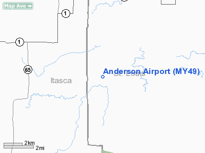
Location & QuickFacts
| FAA Information Effective: | 2008-09-25 |
| Airport Identifier: | MY49 |
| Airport Status: | Operational |
| Longitude/Latitude: | 093-03-37.6480W/47-47-14.7390N
-93.060458/47.787427 (Estimated) |
| Elevation: | 1310 ft / 399.29 m (Estimated) |
| Land: | 0 acres |
| From nearest city: | 1 nautical miles NE of Bear River, MN |
| Location: | St Louis County, MN |
| Magnetic Variation: | 02E (1985) |
Owner & Manager
| Ownership: | Privately owned |
| Owner: | Bert L. Anderson |
| Address: | N. Airport Road
Cook, MN 55723 |
| Phone number: | 218-376-4644 |
| Manager: | Bert L. Anderson |
| Address: | N. Airport Road
Cook, MN 55723 |
| Phone number: | 218-376-4644 |
Airport Operations and Facilities
| Airport Use: | Private |
| Wind indicator: | Yes |
| Segmented Circle: | No |
| Control Tower: | No |
| Sectional chart: | Twin Cities |
| Region: | AGL - Great Lakes |
| Boundary ARTCC: | ZMP - Minneapolis |
| Tie-in FSS: | PNM - Princeton |
| FSS on Airport: | No |
| FSS Toll Free: | 1-800-WX-BRIEF |
Runway Information
Runway 17/35
| Dimension: | 2150 x 80 ft / 655.3 x 24.4 m |
| Surface: | TURF, |
| |
Runway 17 |
Runway 35 |
| Traffic Pattern: | Left | Left |
|
Radio Navigation Aids
| ID |
Type |
Name |
Ch |
Freq |
Var |
Dist |
| CQM | NDB | Cook | | 233.00 | 01E | 15.0 nm |
| ORB | NDB | Orr | | 341.00 | 02E | 16.0 nm |
| FOZ | NDB | Bigfork | | 345.00 | 02E | 24.0 nm |
| SCG | NDB | Scott | | 385.00 | 02E | 36.9 nm |
| IN | NDB | Raize | | 353.00 | 06E | 42.6 nm |
| EVM | VOR/DME | Eveleth | 019X | 108.20 | 01E | 31.6 nm |
| HIB | VOR/DME | Hibbing | 045X | 110.80 | 02E | 32.6 nm |
| GPZ | VOR/DME | Grand Rapids | 051X | 111.40 | 06E | 41.3 nm |
| ELO | VOR/DME | Ely | 033X | 109.60 | 00E | 49.7 nm |
| INL | VORTAC | International Falls | 047X | 111.00 | 06E | 48.8 nm |
Remarks
- FILED FOR RECORD PURPOSES.
Images and information placed above are from
http://www.airport-data.com/airport/MY49/
We thank them for the data!
| General Info
|
| Country |
United States
|
| State |
MINNESOTA
|
| FAA ID |
MY49
|
| Latitude |
47-47-14.739N
|
| Longitude |
093-03-37.648W
|
| Elevation |
1310 feet
|
| Near City |
BEAR RIVER
|
We don't guarantee the information is fresh and accurate. The data may
be wrong or outdated.
For more up-to-date information please refer to other sources.
|
|


