 |
|
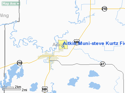
Aitkin Muni - Steve Kurtz Field Airport |
Aitkin Municipal Airport
Steve Kurtz Field |
| IATA: none – ICAO: KAIT – FAA LID: AIT |
| Summary |
| Airport type |
Public |
| Owner |
County & City of Aitkin |
| Serves |
Aitkin, Minnesota |
| Elevation AMSL |
1,205 ft / 367 m |
| Coordinates |
46°32′54″N 093°40′36″W / 46.54833°N 93.67667°W / 46.54833; -93.67667 |
| Runways |
| Direction |
Length |
Surface |
| ft |
m |
| 16/34 |
4,018 |
1,225 |
Asphalt |
| 8/26 |
3,335 |
1,017 |
Turf |
| Statistics (2007) |
| Aircraft operations |
16,000 |
| Based aircraft |
47 |
| Source: Federal Aviation Administration |
Aitkin Municipal Airport (ICAO: KAIT, FAA LID: AIT), also known as Steve Kurtz Field, is a public use airport located two nautical miles (4 km) northeast of the central business district of Aitkin, a city in Aitkin County, Minnesota, United States. It is owned by the County & City of Aitkin.
Although most U.S. airports use the same three-letter location identifier for the FAA and IATA, this airport is assigned AIT by the FAA but has no designation from the IATA (which assigned AIT to Aitutaki, Cook Islands).
Facilities and aircraft
Aitkin Municipal Airport covers an area of 299 acres (121 ha) at an elevation of 1,205 feet (367 m) above mean sea level. It has two runways: 16/34 with a 4,018 x 75 ft (1,225 x 23 m) asphalt pavement and 8/26 with a 3,335 x 150 ft (1,017 x 46 m) turf surface.
For the 12-month period ending June 30, 2007, the airport had 16,000 general aviation aircraft operations, an average of 43 per day. At that time there were 47 aircraft based at this airport: 94% single-engine, 4% multi-engine and 2% glider.
The above content comes from Wikipedia and is published under free licenses – click here to read more.
Location & QuickFacts
| FAA Information Effective: | 2008-09-25 |
| Airport Identifier: | AIT |
| Airport Status: | Operational |
| Longitude/Latitude: | 093-40-36.4800W/46-32-54.3210N
-93.676800/46.548423 (Estimated) |
| Elevation: | 1205 ft / 367.28 m (Surveyed) |
| Land: | 299 acres |
| From nearest city: | 2 nautical miles NE of Aitkin, MN |
| Location: | Aitkin County, MN |
| Magnetic Variation: | 03E (1995) |
Owner & Manager
| Ownership: | Publicly owned |
| Owner: | County & City Of Aitkin |
| Address: | 109 1st Ave. Nw
Aitkin, MN 56431 |
| Phone number: | 218-927-2527 |
| Manager: | Kathy Brophy |
| Address: | 109 1st Ave. Nw
Aitkin, MN 56431 |
| Phone number: | 218-927-2527 |
Airport Operations and Facilities
| Airport Use: | Open to public |
| Wind indicator: | Yes |
| Segmented Circle: | Yes |
| Control Tower: | No |
| Lighting Schedule: | DUSK-DAWN
ACTVT MIRL RY 16/34, VASI & REIL RYS 16 & RY 34 - CTAF. |
| Beacon Color: | Clear-Green (lighted land airport) |
| Landing fee charge: | No |
| Sectional chart: | Twin Cities |
| Region: | AGL - Great Lakes |
| Traffic Pattern Alt: | 800 ft |
| Boundary ARTCC: | ZMP - Minneapolis |
| Tie-in FSS: | PNM - Princeton |
| FSS on Airport: | No |
| FSS Toll Free: | 1-800-WX-BRIEF |
| NOTAMs Facility: | AIT (NOTAM-d service avaliable) |
| Federal Agreements: | NGY |
Airport Communications
| CTAF: | 123.050 |
| Unicom: | 123.050 |
Airport Services
| Fuel available: | 100LLA |
| Airframe Repair: | MINOR |
| Power Plant Repair: | MINOR |
| Bottled Oxygen: | NONE |
| Bulk Oxygen: | NONE |
Runway Information
Runway 08/26
| Dimension: | 3335 x 150 ft / 1016.5 x 45.7 m |
| Surface: | TURF, Good Condition |
| |
Runway 08 |
Runway 26 |
| Longitude: | 093-41-09.8930W | 093-40-26.8920W |
| Latitude: | 46-32-42.8450N | 46-32-43.8440N |
| Alignment: | 88 | 127 |
| Traffic Pattern: | Left | Left |
| Markings: | None,
08/26 MKD WITH YELLOW CONES. | None, |
| Runway End Identifier: | No | No |
| Centerline Lights: | No | No |
| Touchdown Lights: | No | No |
| Obstruction: | 57 ft trees, 850.0 ft from runway, 30 ft left of centerline, 14:1 slope to clear | 76 ft trees, 1215.0 ft from runway, 240 ft right of centerline, 15:1 slope to clear |
|
Runway 16/34
| Dimension: | 4018 x 75 ft / 1224.7 x 22.9 m |
| Surface: | ASPH, Good Condition |
| Weight Limit: | Single wheel: 12500 lbs. |
| Edge Lights: | Medium |
| |
Runway 16 |
Runway 34 |
| Longitude: | 093-40-35.2740W | 093-40-19.8520W |
| Latitude: | 46-33-21.6410N | 46-32-43.4330N |
| Elevation: | 1205.00 ft | 1205.00 ft |
| Alignment: | 127 | 127 |
| Traffic Pattern: | Left | Left |
| Markings: | Non-precision instrument, Good Condition | Non-precision instrument, Good Condition |
| Crossing Height: | 26.00 ft | 39.00 ft |
| VASI: | 2-box on left side | 2-box on left side |
| Visual Glide Angle: | 3.00° | 3.00° |
| Runway End Identifier: | Yes | Yes |
| Centerline Lights: | No | No |
| Touchdown Lights: | No | No |
| Obstruction: | 67 ft trees, 2500.0 ft from runway, 34:1 slope to clear | 40 ft trees, 1100.0 ft from runway, 260 ft left of centerline, 22:1 slope to clear |
|
Radio Navigation Aids
| ID |
Type |
Name |
Ch |
Freq |
Var |
Dist |
| PWC | NDB | Pine River | | 330.00 | 03E | 31.1 nm |
| XVG | NDB | Longville | | 392.00 | 04E | 34.6 nm |
| MZH | NDB | Moose Lake | | 362.00 | 02E | 37.0 nm |
| XCR | NDB | Ripley | | 404.00 | 03E | 39.5 nm |
| JMR | NDB | Mora | | 327.00 | 03E | 43.1 nm |
| LXL | NDB | Little Falls | | 359.00 | 03E | 45.4 nm |
| SAZ | NDB | Staples | | 257.00 | 04E | 47.8 nm |
| COQ | NDB | Cloquet | | 335.00 | 03E | 49.3 nm |
| RYM | TACAN | Camp Ripley | 048X | | 03E | 39.3 nm |
| GPZ | VOR/DME | Grand Rapids | 051X | 111.40 | 06E | 37.8 nm |
| BRD | VORTAC | Brainerd | 116X | 116.90 | 03E | 18.8 nm |
Remarks
- ULTRALIGHTS & GLIDERS ON & INVOF ARPT.
Images and information placed above are from
http://www.airport-data.com/airport/AIT/
We thank them for the data!
| General Info
|
| Country |
United States
|
| State |
MINNESOTA
|
| FAA ID |
AIT
|
| Latitude |
46-32-54.321N
|
| Longitude |
093-40-36.480W
|
| Elevation |
1205 feet
|
| Near City |
AITKIN
|
We don't guarantee the information is fresh and accurate. The data may
be wrong or outdated.
For more up-to-date information please refer to other sources.
|
|


